[Note: This story was originally published with an outdated bridge graphic. The one below is more current.]
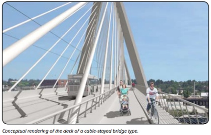
At a board meeting this morning, TriMet voted to approve $127 million in contracts to construct a new bridge over the Willamette River as part of their Portland to Milwaukie Light Rail project. The bridge will be carfree, carrying only light rail, walking and biking traffic.
The width of the bike/walkway and just exactly how that space is “programmed” (to use planning-speak) has been subject of discussion for well over a year now.
(Photos © J. Maus)
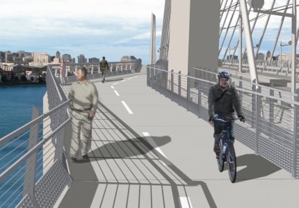
According to TriMet bike planner Colin Maher, the current design calls for 14 feet of bike/walkway on each side of the bridge and the space will be divided up like this: 6′ 4″ for walking, then an 8″ buffer stripe, then 7′ for biking. Also planned is additional width at each of the two towers (“belvederes”), which will bump the pathway out to 22′.
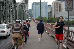
As a comparison, the Hawthorne Bridge is about 10.5 feet wide.
yet to be decided.
Much of the discussion about how to program the bike/walk space had to do with how to best separate the two modes. Initially there was talk of creating a vertical difference, or grade separation, between the bikeway and the walkway. Given the sometimes dangerous mix of modes that can occur on the Hawthorne Bridge, some sort of curb to physical delineate where people should bike and walk had some appeal. However, concerns about added cost of a curb and complications with maintaining it, disabled persons access, and other issues put that idea on the shelf.
Another interesting design issue this bridge will have for bike traffic is its 5 percent grade. That’s pretty steep for a mixed-use facility (similar to biking up SW 5th Avenue to Portland State University). Given the tremendous amount of complaints the City of Portland already fields about interactions on busy and flat multi-paths, I expect lots of debate about how best to mitigate downhill biking speeds once the project enters final design.
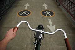
At this point, no final decisions have been made in terms of striping, signage, or other methods of marking the bike/walk way. With a separated grade no longer an option, the talk will turn to how best to demarcate the biking and walking zones. Possible solutions might be different colored pavement, creative striping, and/or signage.
TriMet expects construction of the new bridge to start next year, with an opening in 2015. Learn more here.