In an effort to showcase some of the best bike rides in the region, the Washington County Visitor’s Association (WCVA) is working on an update of their bike map; and they want your feedback and suggestions to make it even better.
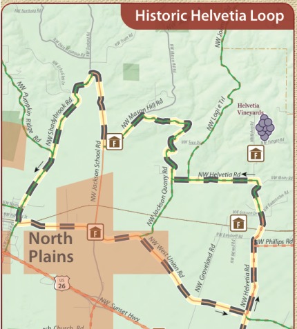
The map covers Washington County and is intended for both visitors and locals. Allison George with the WCVA says the map is scheduled to be released later this fall. The format and coding of the new map will be consistent with those used on Metro’s Bike There! map. From what I’ve seen of the draft PDFs, the map is very impressive. There are several featured rides — including the “Historic Helvetia Loop” and the “Fern Hill Loop” — that include a description of the route, GPS coordinates, an elevation profile and so on. And, since this is a WCVA publication, there’s a complete listing of nearby wineries.
Here’s a detail shot from the draft version of the map:

If you ride in Washington County and would like to offer input on the maps before they are printed, go to the WCVA’s FTP site. The two files to review are PDFs named “WaCoBikeMap_Back_Draft4_080810.pdf” and “WaCoBikeMap_Front_Draft4_080810.pdf.” To access the FTP site use username “wcvaFTP” and password “ftp4wcva”.
In order to get feedback from BikePortland readers, the WCVA has extended their suggestion submision deadline to Friday, October 8th. All feedback should be sent to Gerald Kubiak at gkubiak13(at)yahoo.com.

