“Culturally, there’s a shift going on in Beaverton. A lot of people around metro Portland might think of Beaverton as the place where you go to Walmart or Target. But that old Beaverton is dead. We’re trying to build a new Beaverton where people can walk and bike. We’re building infrastructure for decades-long change.”
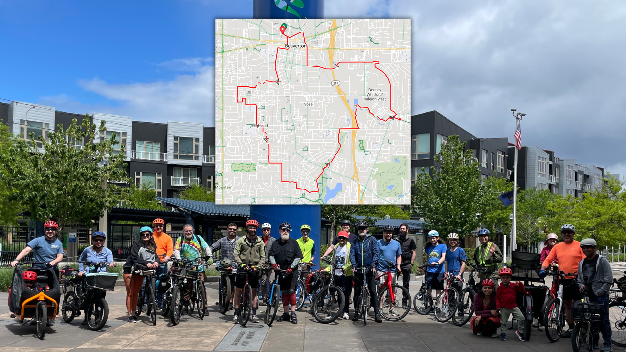
That was Beaverton City Councilor John Dugger on May 18th at Ride Westside’s Beaverton Policy Ride on May 18th. Dugger and Beaverton City Councilor Kevin Teater led a ten-mile loop around the city and its neighborhoods, looking at the good, the bad, the ugly, and the improving not-so-ugly bike infrastructure in the city. Also on the ride were Tigard City Councilor Yi-Kang Hu and members of Ride Westside.
I was there (as one of the founding members of Ride Westside) and as we rode along I pondered a question that I hope was also on the councilors’ minds: What would it take to make Beaverton into a place where kids, families, and riders who don’t want to jockey with traffic could feel safe on bikes?


My neighbors in Beaverton want to bike. A few ride regularly, but most keep their bikes in the garage — behind the lawnmower, covered in dust. Sometimes they strap their bikes onto cars and drive to the Banks-Vernonia Trail or the Providence Bridge Pedal where they feel safe riding. When they come home, the bikes go back in the garage.
Let’s call them the Dusty Bike Constituency. And there are a lot of them. They like the idea of biking, but they don’t want to die on a 45 mph road with a stripe of paint for a bike lane.
So let’s go on a ride and see if we can find any keys to unlock cycling for these reluctant riders and everyone else who wants to go by bike in Washington County.
We started at the Beaverton Central MAX station outside City Hall.

First Stop: Evelyn Schiffler Park near Central Beaverton
We rode through downtown Beaverton, past Beaverton High School, to our first stop in Evelyn Schiffler Park. Like a lot of Beaverton parks, it’s criss-crossed with bike paths built and maintained by Tualatin Hills Park and Recreation District (THPRD).
Dugger sees the THPRD’s 70-mile path network as transportation. “The paths are critically important for the ten, twelve, and fifteen-year-olds who want to bike. We want to create a culture of cycling so it’s safe to go everywhere.”
It’s not just about ten-year-olds, it’s also about their parents. “We have to build trust with their parents through safety,” Dugger said. “I can go anywhere I want, mix in with cars, it doesn’t bother me. But for a lot of people, that’s terrifying. Creating safety for younger riders expands the pool of people of all ages who are willing to ride.”
Would the Dusty Bike Constituency ride this first stretch, from Beaverton Central MAX to Evelyn Schiffler Park? Probably. It’s mostly quiet streets, some off-street paths, and decent bike lanes.
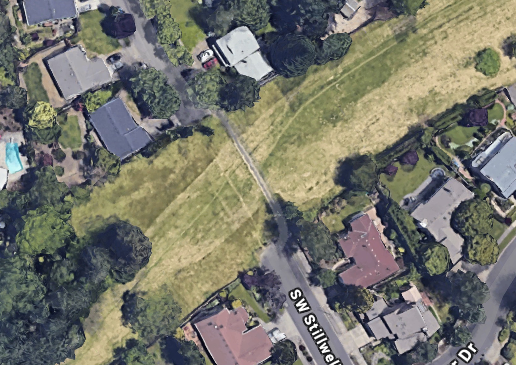
Second Stop: The Missing 125th Street at SW Stillwell Lane
We continued on through suburban streets, and took a paved path at SW Stillwell Lane across a long narrow strip of wild land, right in the middle of Beaverton. It’s full of trees and shrubs, and an unexpected home for wildlife. “You can ride a bike through this, but only if you have a mountain bike or a gravel bike,” said Councilor Teater.
As we pedaled past, Dugger called out, “This space belongs to the city, and was never developed into a road. We don’t have any plans to do it, and the neighbors would flip their lids if we did.” (A neighbor called from his porch: “I hope they never do!”)
Dugger would love to see trails or park infrastructure in this undeveloped area, but it would take coordinating with THPRD. “Having these pockets of land will help a lot for our bike and pedestrian transportation vision,” he said.
Would the Dusty Bike Constituency ride from Evelyn Schiffler Park to SW Stillwell Lane? More than likely. Most of our way was on quiet streets with little traffic. If the 125th Street wild land became a bike corridor with paved paths, absolutely.
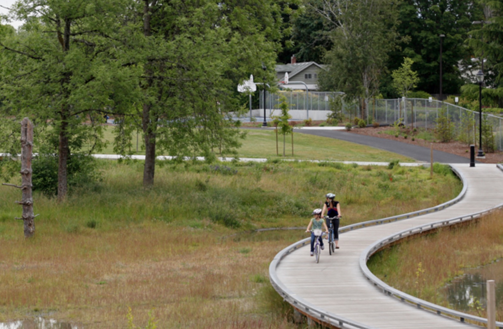
Third Stop: Fanno Creek Trail at Greenway Park
We carried on through neighborhood streets to catch the Fanno Creek Trail at Greenway Park. This trail is a major connector (some of it is on the former Red Electric rail line) but it’s also known for flooding. Parts of the trail are seasonal, but the uptime when the trail is passable is in the high 90% these days. Teater said that’s been a priority for THRPD: “They’ve done a lot of work lately to make this happen.”
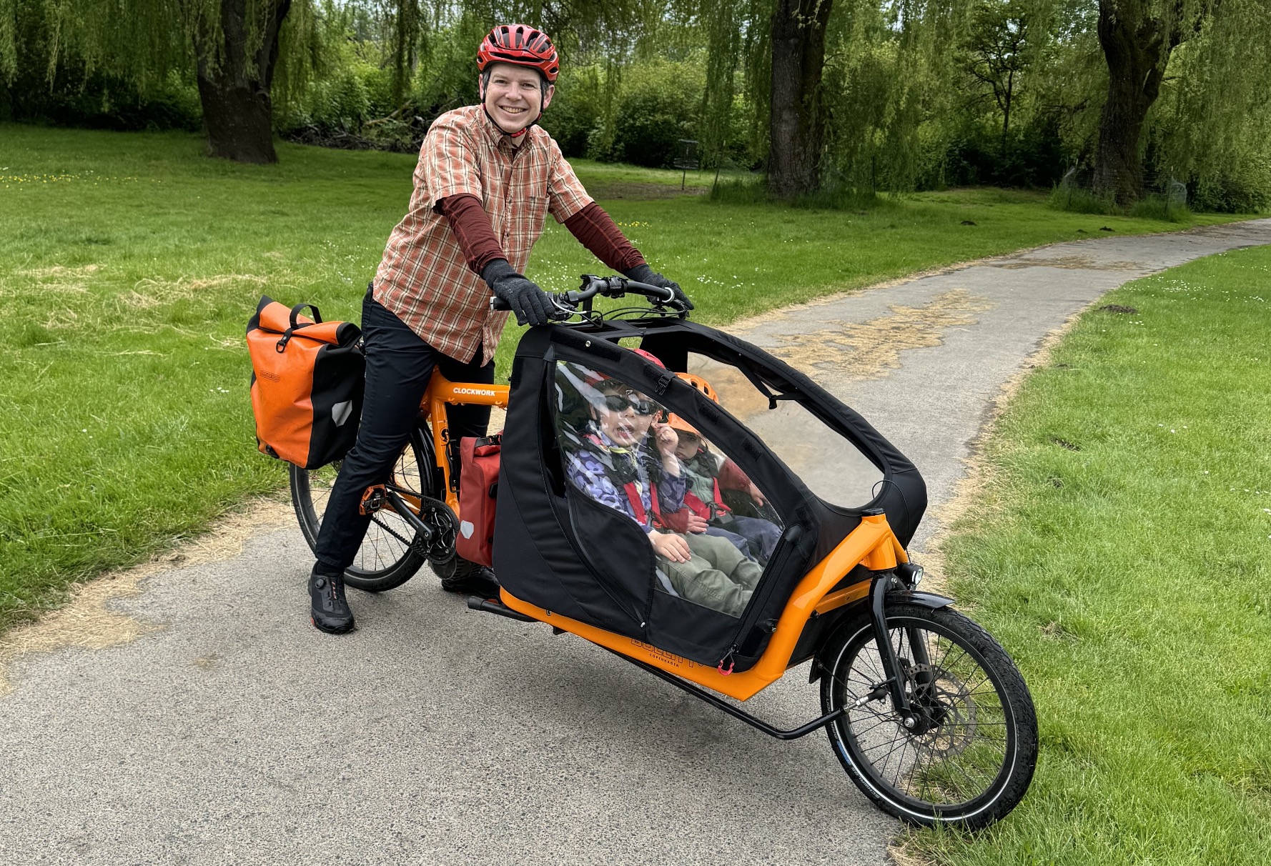
Along the way, I chatted with one of the riders, Thom Drane. Thom has a Bullitt cargo bike that he modified himself, and lives in Central Beaverton, which he and his wife chose for its central location and bikeability. He regularly bikes one of his kids to preschool, about three miles each way.
Drane chose his route to preschool that doubles his time from ten minutes to twenty because it’s safer and has less traffic. “Beaverton and THPRD does a decent job of taking care of debris on roads and paths. If the community puts in this infrastructure, I want to make sure it gets used,” he shared.
How would the Dusty Bike Constituency feel about the Fanno Creek Trail? Great, when the trail isn’t under water. When the trail is flooded, the Dusty Bike Constituency would drive.
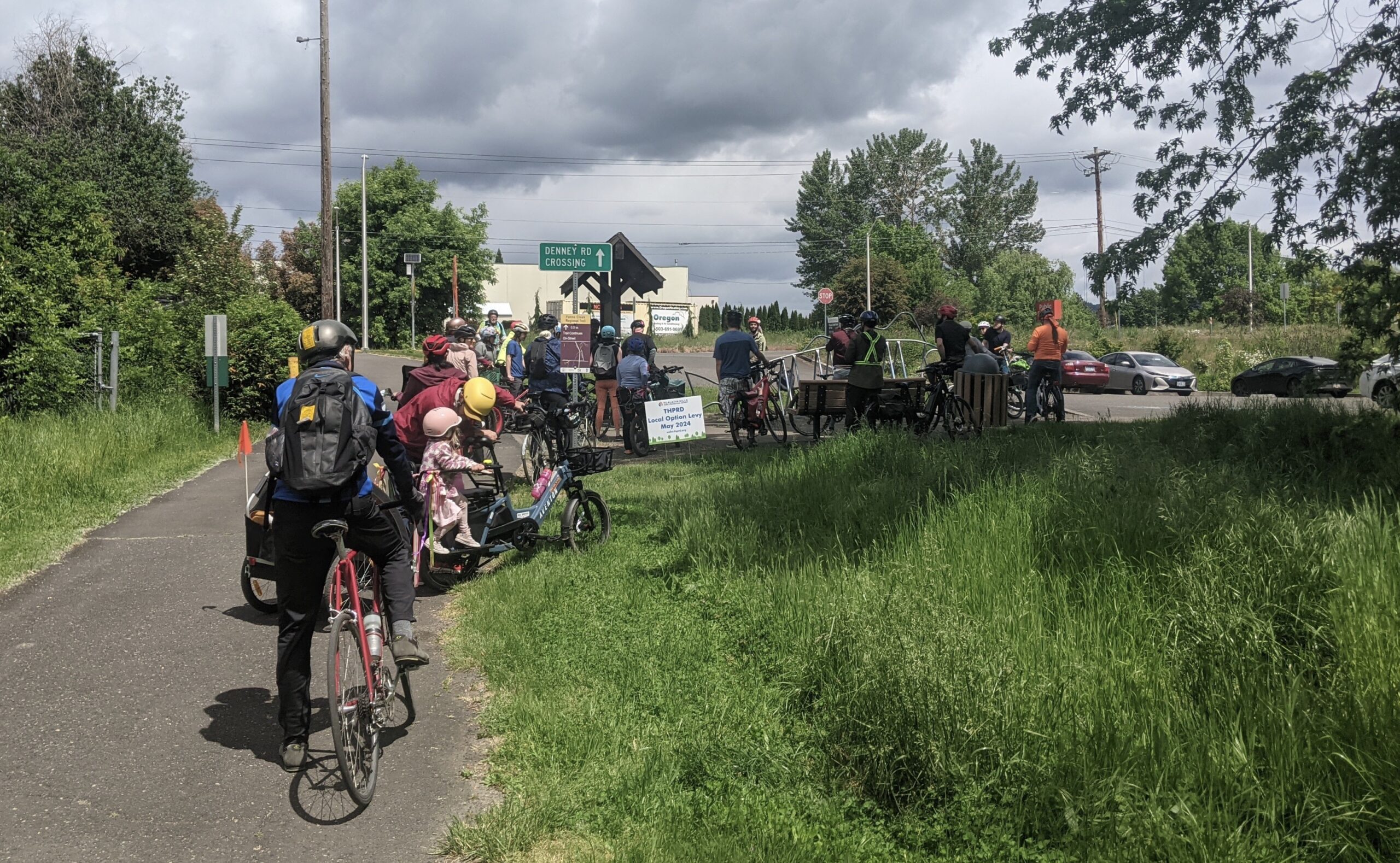
Fourth Stop: Fanno Creek Trail Crossing Hwy 217 at Denney Road
After our next stop, we rode through some seriously hairy road construction on the Denney Road bridge over 217. We only had a narrow twisty space to cross, but in the future it will be a wide multi-use path.
Before we crossed 217, Teater mentioned that the engineering is complete to add a 12-foot shared bike and pedestrian path on the north side of Denney Road to Scholls Ferry Road where there currently are no bike lanes (or they are spotty). That will be a key connection and will close a gap in the Fanno Creek Trail.
Would the Dusty Bike Constituency ride across the Highway 217 crossing? When the bridge and sidewalk construction is finished, maybe, if these new lanes connect to where they want to go in a safe and protected way. Would they ride the protected Fanno Creek Trail? Absolutely.
Fifth Stop: Beaverton’s Industrial Area at SW Western and SW Fifth
Southwest Fifth Avenue is Beaverton’s industrial area, as well as a protected, slow, low-traffic street that is a major bike thoroughfare cyclists use to avoid Beaverton-Hillsdale Highway. According to Dugger, the city worked with the businesses on Fifth to give them wider turn lanes for trucks and a slow-speed road that doesn’t attract more cars.
Would the Dusty Bike Constituency ride on Fifth Avenue? Maybe, if they knew about it. The street felt wide and slow. Although the bike lanes are only paint, there’s just not that much traffic.
Sixth Stop: SW Millikan Way
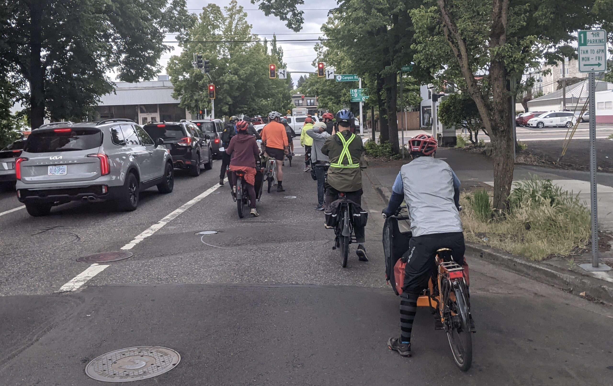
The last part of our ride took us into the heart of Central Beaverton, where we crossed train tracks and two ODOT highways (Hwy 8/Canyon Road/Tualatin-Valley Highway, and Hwy 10/Farmington Road). These roads are, as Dugger calls them, “gashes across the heart of Beaverton.” They feel perilous and are wide, noisy, and full of cars.
We stopped behind the Royal Manor apartments near SW Lombard where there’s a cycling connector from SW Lombard Avenue and the Beaverton Transit Center onto Millikan Way. The city is currently designing the SW Millikan Way Extension Project. The eventual plan for Millikan Way is to be a route into Central Beaverton, from the Tualatin Hills Nature Park all the way through Central Beaverton to Highway 217.
Dugger said the Millikan Way project will allow people to walk to the MAX station and make good on billions of regional light rail investments.
Would the Dusty Bike Constituency ride across two highways and train tracks to get to the Beaverton Transit Center? No. It was stressful even with a large group. But the future Beaverton Downtown Loop Project will help with this.
Last Stop: Beaverton Central MAX Station
We continued down the existing Millikan Way back to our start at Beaverton Central MAX station. In its current state, it’s narrow and twisty, with only sharrows for bikes. But it’s also an extremely low-traffic street, so it works.
Would the Dusty Bike Constituency ride on the new redesigned Millikan Way? If it’s anything like the designs in the plans, absolutely. But only if Millikan connects to where they want to go, and doesn’t become another stop-and-start series of disconnected bikeways.
Dugger and Teater have high hopes for the future of Beaverton, based in part on the ride itself. “The fact that we had two Beaverton City Councilors and a Tigard City Councilor doing a policy ride on bikes is a small earthquake,” Dugger said, as he shared that even more local elected officials wanted to come but couldn’t make it.
Teater wants to shift local transportation dialogues away from talking about car parking and toward accessibility. “How are people accessing the places they want to go? These conversations are not just about riding bikes. How is our community connecting with itself?,” is how he put it.
I hope Dugger and Teater are right. I want to live in that Beaverton that they’re building. And maybe some of those bikes in my neighbors’ garages will get dusted off more often.