One of the most underdeveloped parts of Portland has taken a big step toward catching up to the rest of the city.
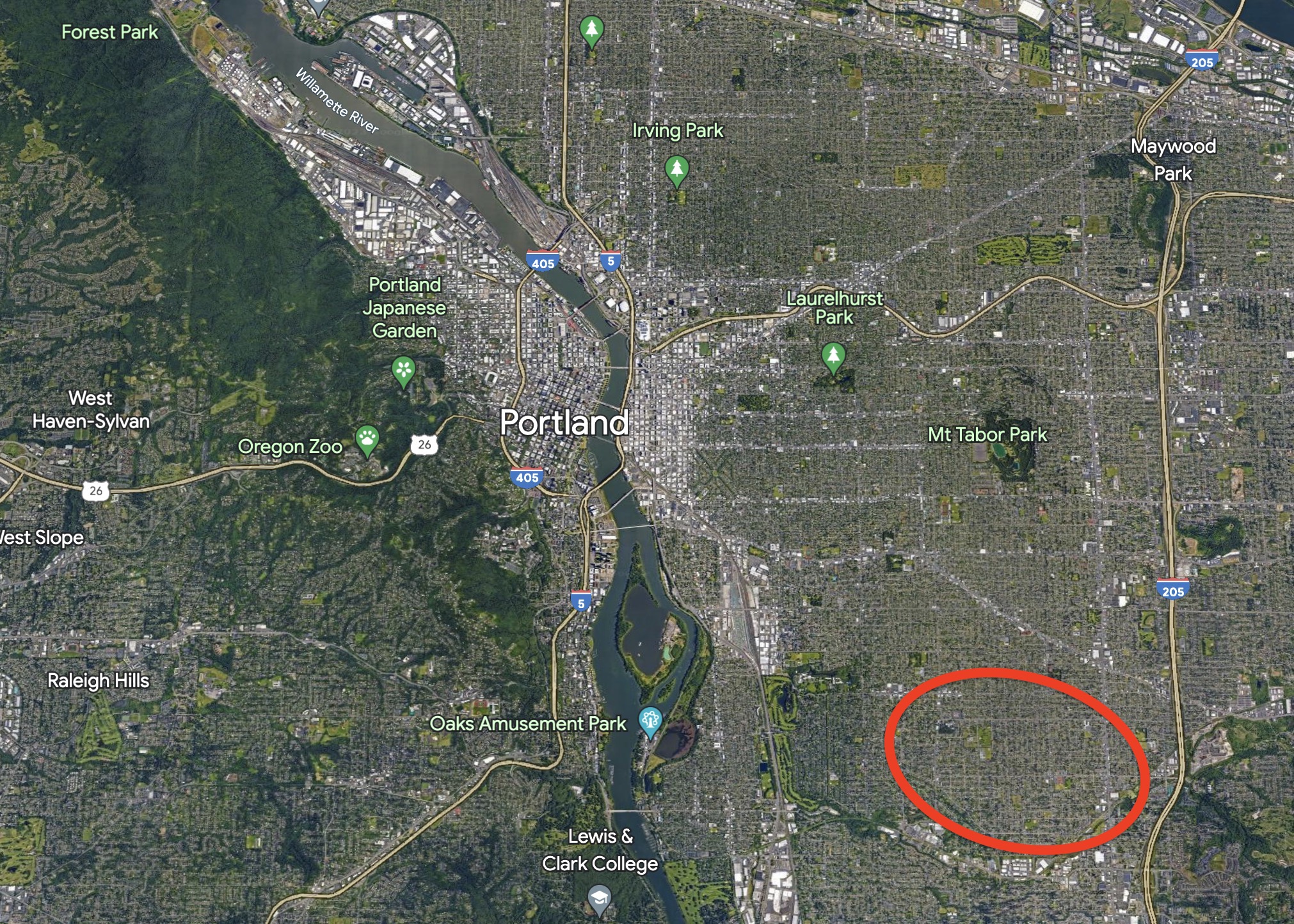
After two years of planning and public outreach, the City of Portland has released a draft plan for how they’d like to hasten development of the lower southeast — an area that includes the Brentwood-Darlington, Lents, Ardenwald-Johnson Creek, Mt Scott-Arleta, and Woodstock neighborhoods.
With a mix of land use and transportation changes, the idea behind the Lower SE Rising Area Plan is to boost neighborhood businesses, create more — and more affordable — housing, and make it easier to walk, bike and take transit. The ultimate goal is to give people the opportunity to meet daily needs without having to drive. Last week the Bureau of Planning and Sustainability (BPS) and the Bureau of Transportation (PBOT) released a draft version of the plan and it’s our first look at what city planners recommend for helping this part of the city catch up to the rest of Portland.

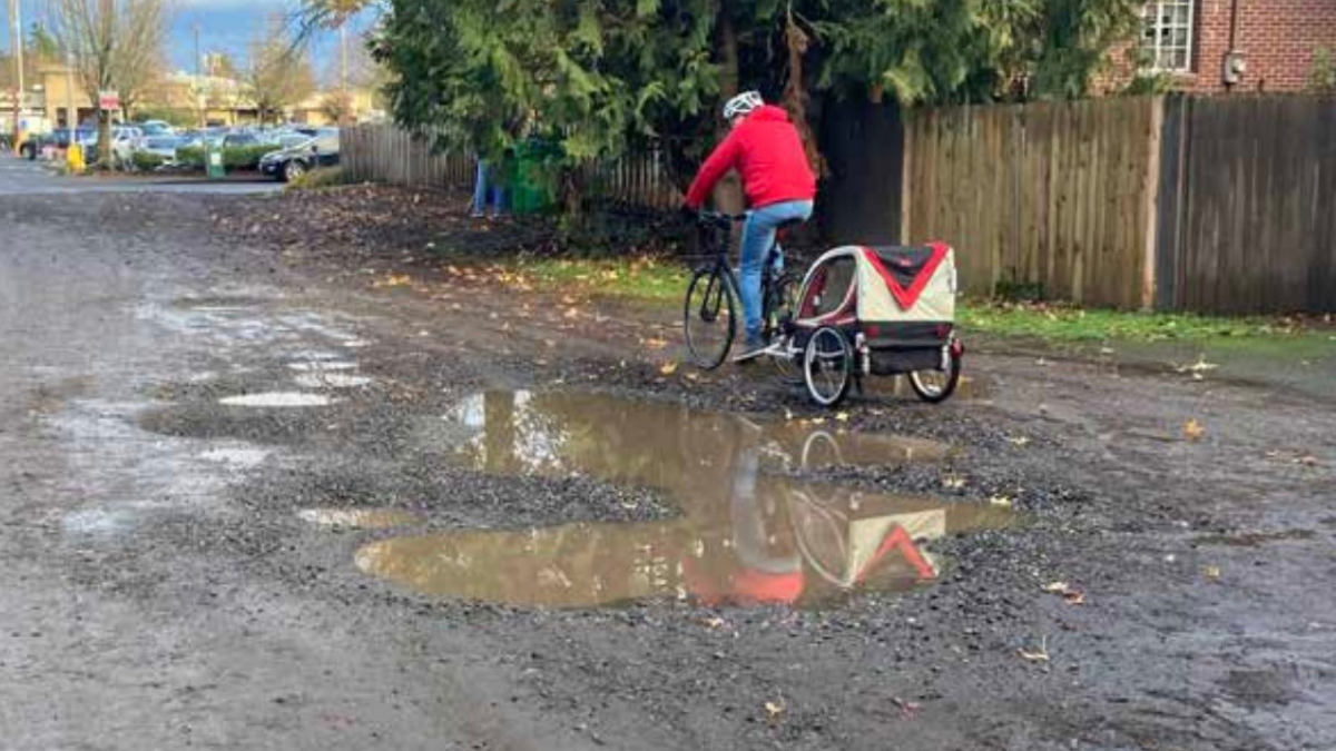
Portland’s lower southeast wasn’t annexed into Portland until 1986 and prior to that it was “yellowlined” — a federal designation on loan maps right above “redlined” that made it hard to get home loans. There are some good bones from historic rail service (both urban streetcar and proximity to the former train that ran on the Springwater Corridor), but for the most part lower southeast remains behind other parts of Portland when it comes to business access and active transportation infrastructure.
“Lower SE Portland shares many physical characteristics with East Portland: gravel streets and missing sidewalks; a disconnected street network and limited bus service; and few neighborhood stores, restaurants, and other conveniences, so that residents must drive to meet their daily needs,” reads the draft plan.
To lift up the area, BPS and PBOT recommend a two-part strategy of zoning code changes and transportation projects.
Land use and zoning
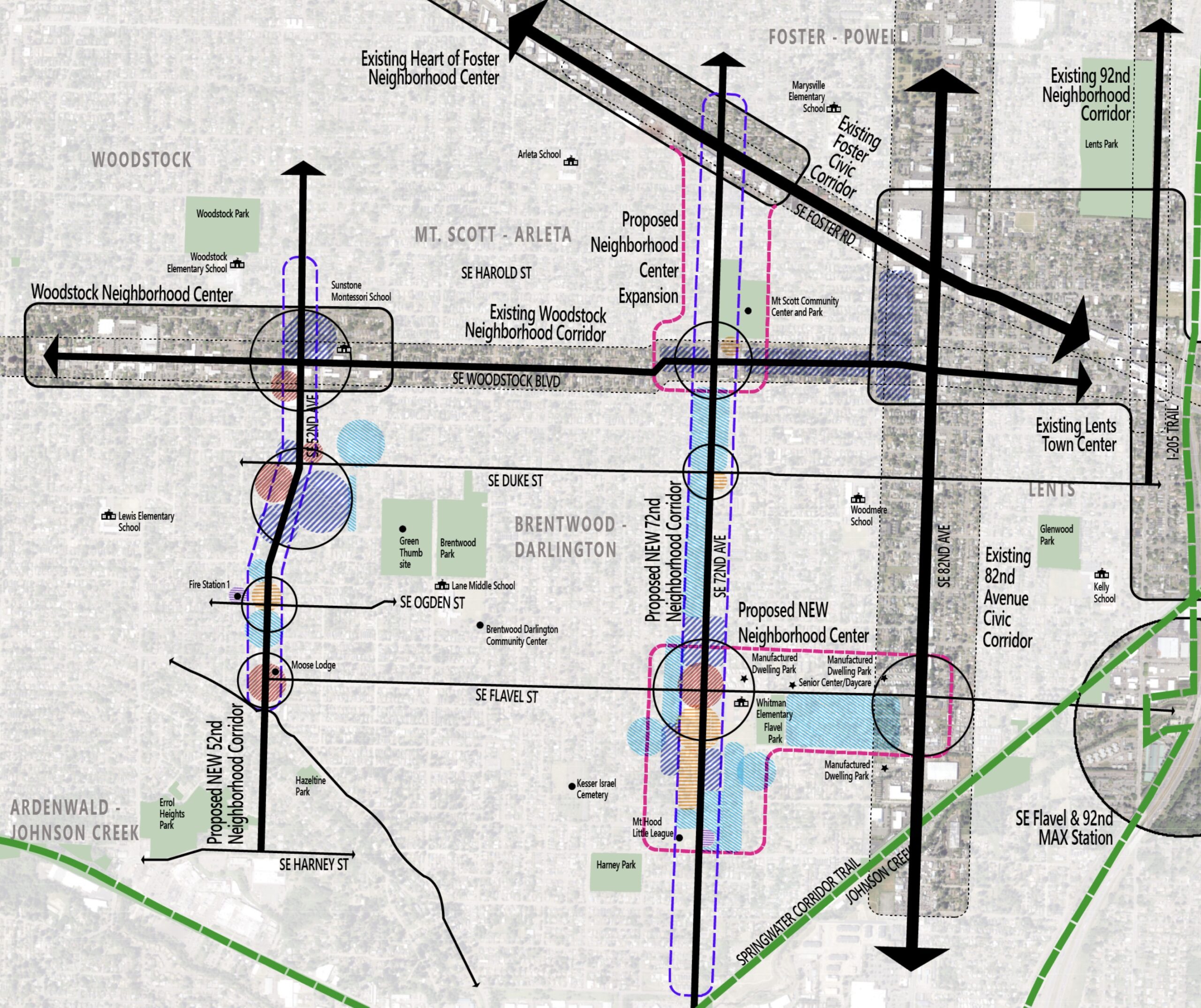
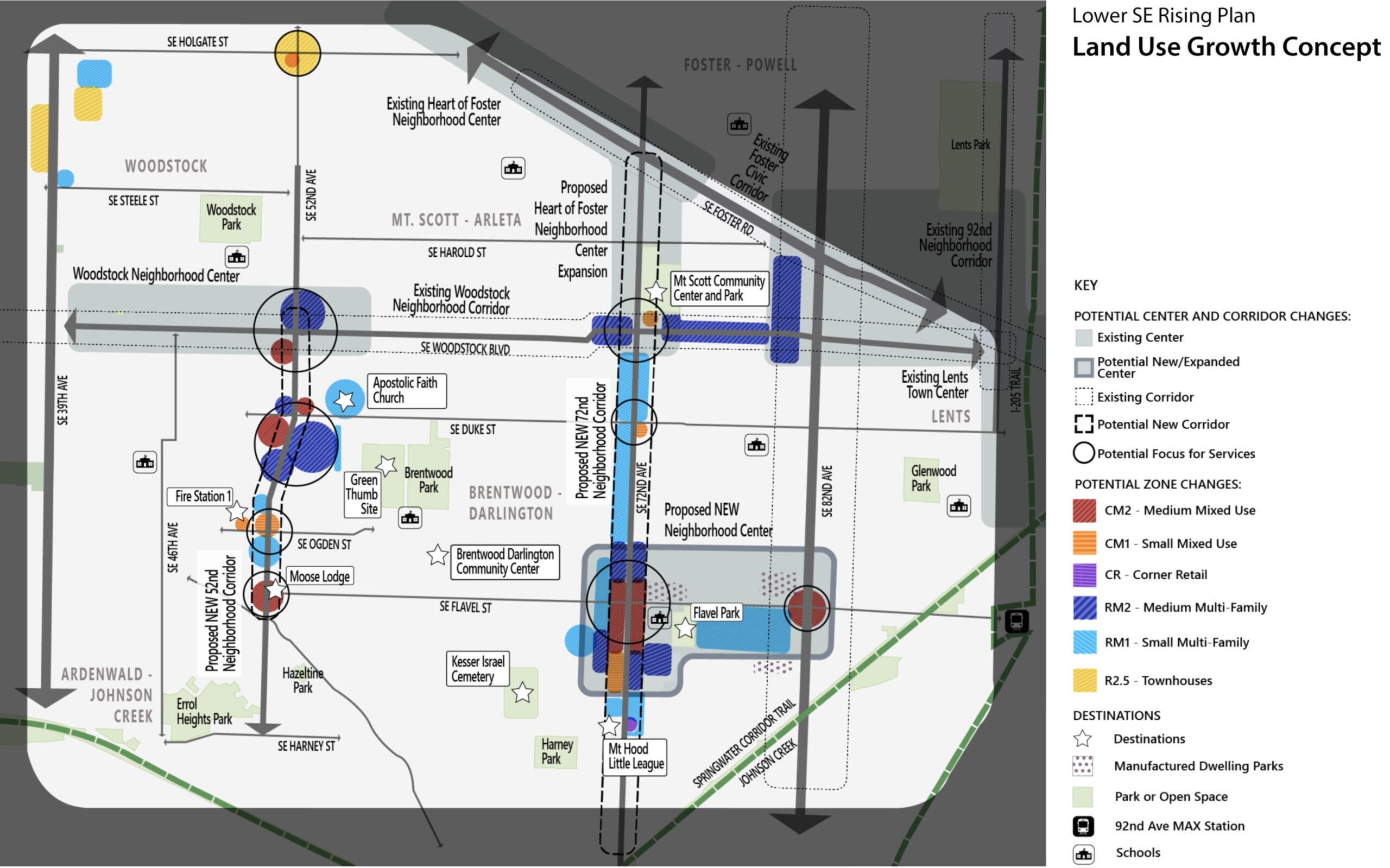
On the land use side, BPS proposes a new business district around SE 72nd and Flavel that would, “serve as a hub for commercial services with additional housing options” and “fill in a substantial gap in access to services in this area of Portland.” That district would be part of a new neighborhood center that would extend east along Flavel to 82nd. This would help give the Brentwood-Darlington neighborhood something on par with how 72nd feels just to the north at Woodstock and at Foster. Currently the Flavel/72nd intersection is bordered by parking lots and/or car-related businesses and low-density housing.
The city also proposes zoning code changes to the area around 82nd and Flavel that would allow for mixed-use instead of the commercial and light-industrial uses it has today in order to, “encourage a small commercial hub that is more pedestrian oriented and allows businesses in mixed-use buildings with housing on upper floors.”
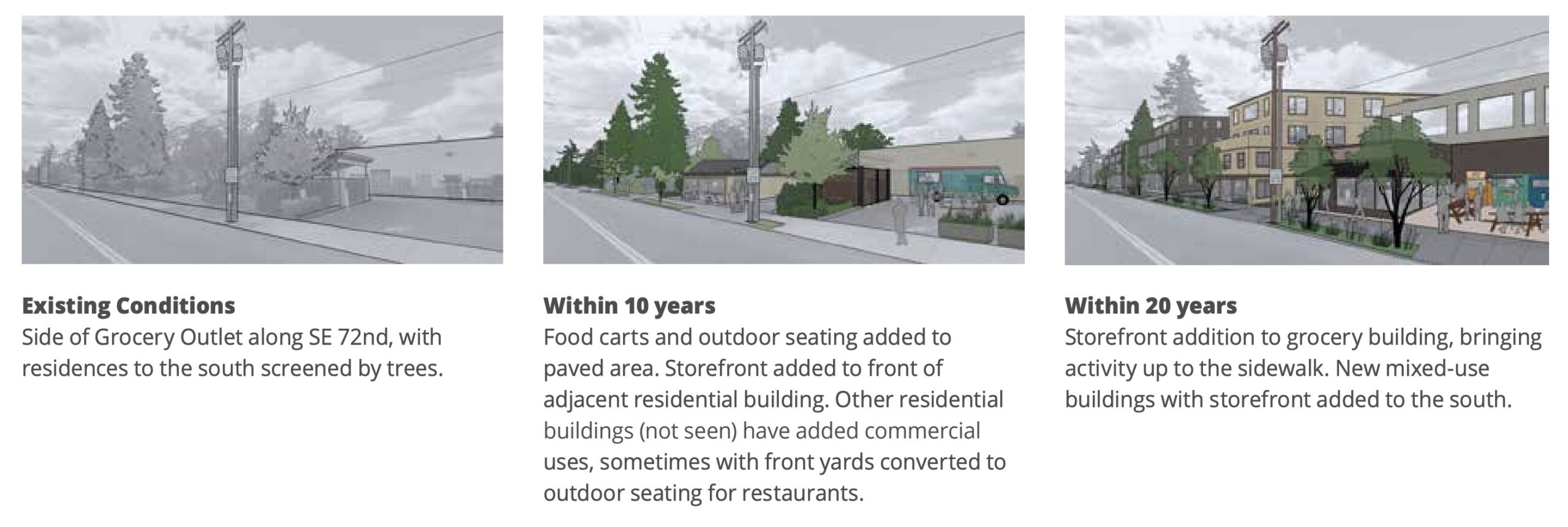
72nd would become a much more prominent and pedestrian-oriented street as part of this plan. The current “neighborhood center” and “pedestrian district” that exists on the street at Foster would be extended south to include the Mt. Scott Community Center and Arleta Triangle (which not boasts a public plaza). The city is also proposing to allow 3-4 story buildings along SE Woodstock instead of the 2-3 stories allowed today. And around the new public plaza at the Arleta Triangle, the plan recommends a zoning change that would allow for commercial and mixed-use developments to, “support its emerging role as a community hub.”
52nd would also see changes if the proposals in the plan are adopted. It would become a “neighborhood corridor” (along with 72nd), which opens it up to zoning changes that would allow more housing, neighborhood businesses and small, 2-3 story multi-family developments.
Transportation
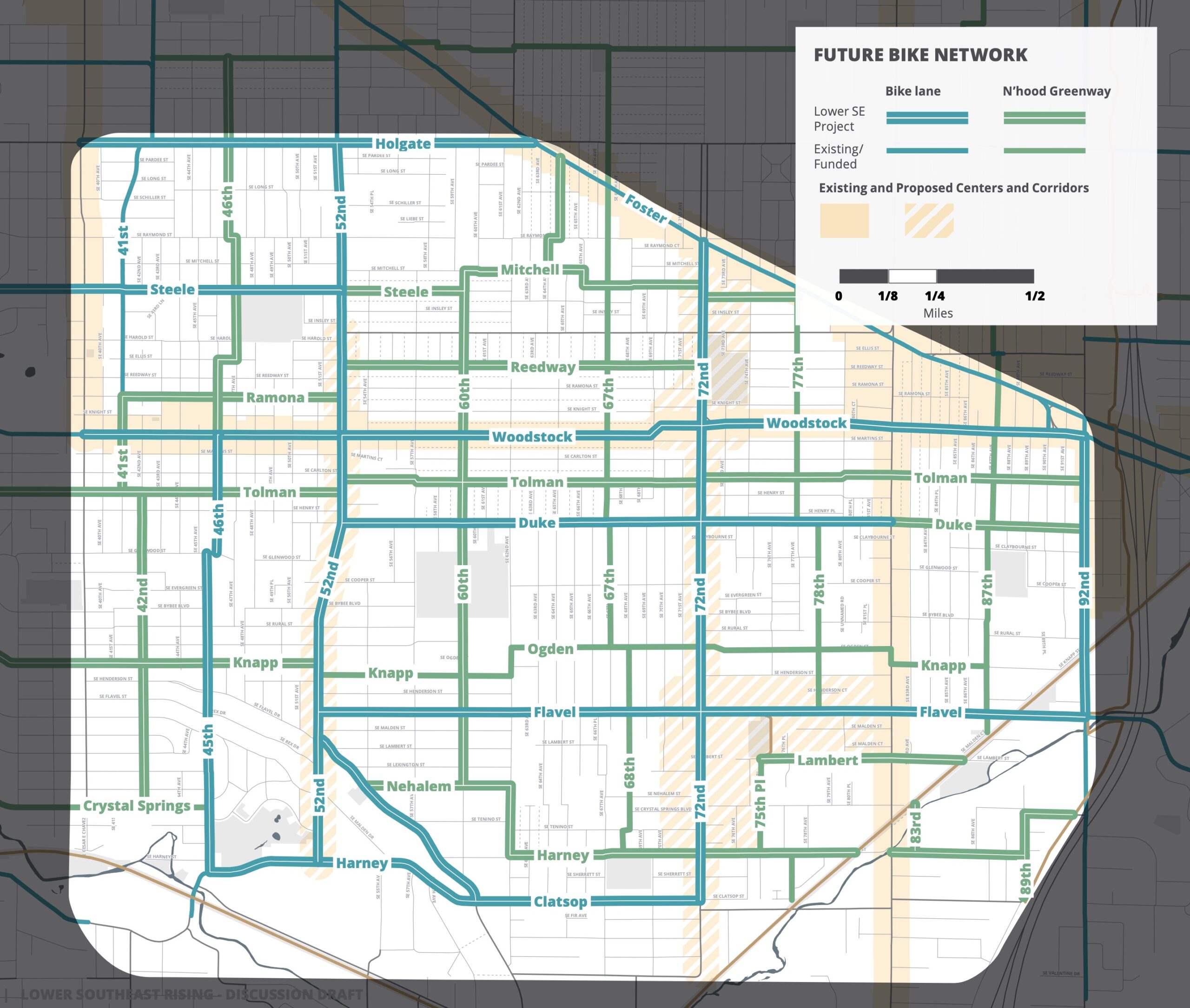
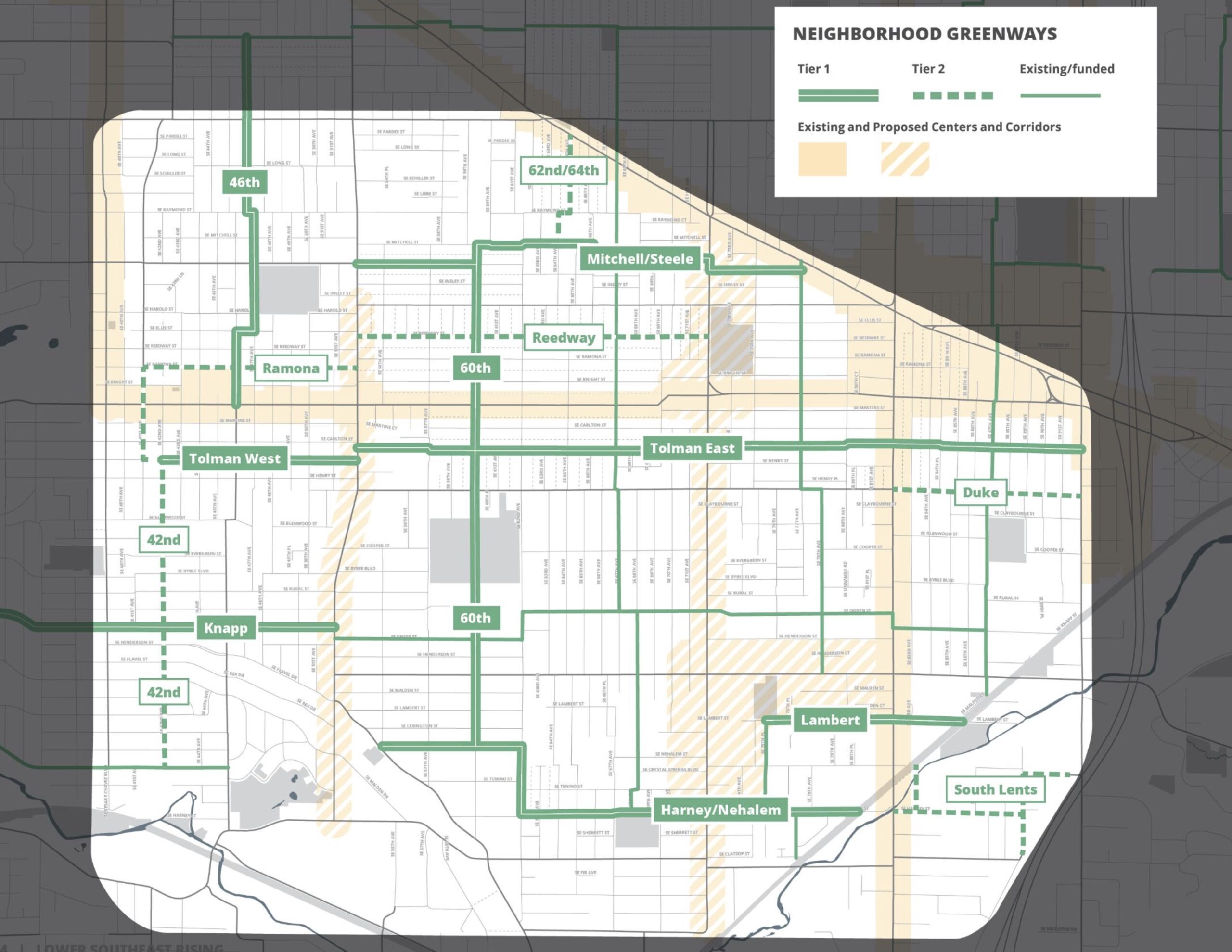
To support the land use changes, the city is also proposing transportation improvements to make it more attractive to walk, bike and take the bus. Since the area was annexed so late and historically underinvested in, then went from being dominated by streetcars in the early 20th century to being car-centric by the 1950s, it still lacks sidewalks and bike lanes on many streets. The plan uses a combination of changes to busy streets (52nd, 72nd, and Woodstock) and neighborhood greenways to, “bring every corner of the Plan Area within a few blocks of a safe and low-stress walking and biking route, focusing on the Brentwood-Darlington neighborhood.”
Using a standard approach used elsewhere in the city, PBOT would build more neighborhood greenways to act as alternate routes to busy streets, then create safer crossings when the streets intersect.
PBOT is also leaving the possibility of bike lanes on the busy streets open. “Given the narrow busy streets in this district, where a Corridor Improvement project calls for enhanced bike lanes, parking removal on one or both sides of the street will often be necessary,” the plan states. The plan recommends which streets should have new or enhanced bike lanes, though in most cases no cross sections for these streets are included.
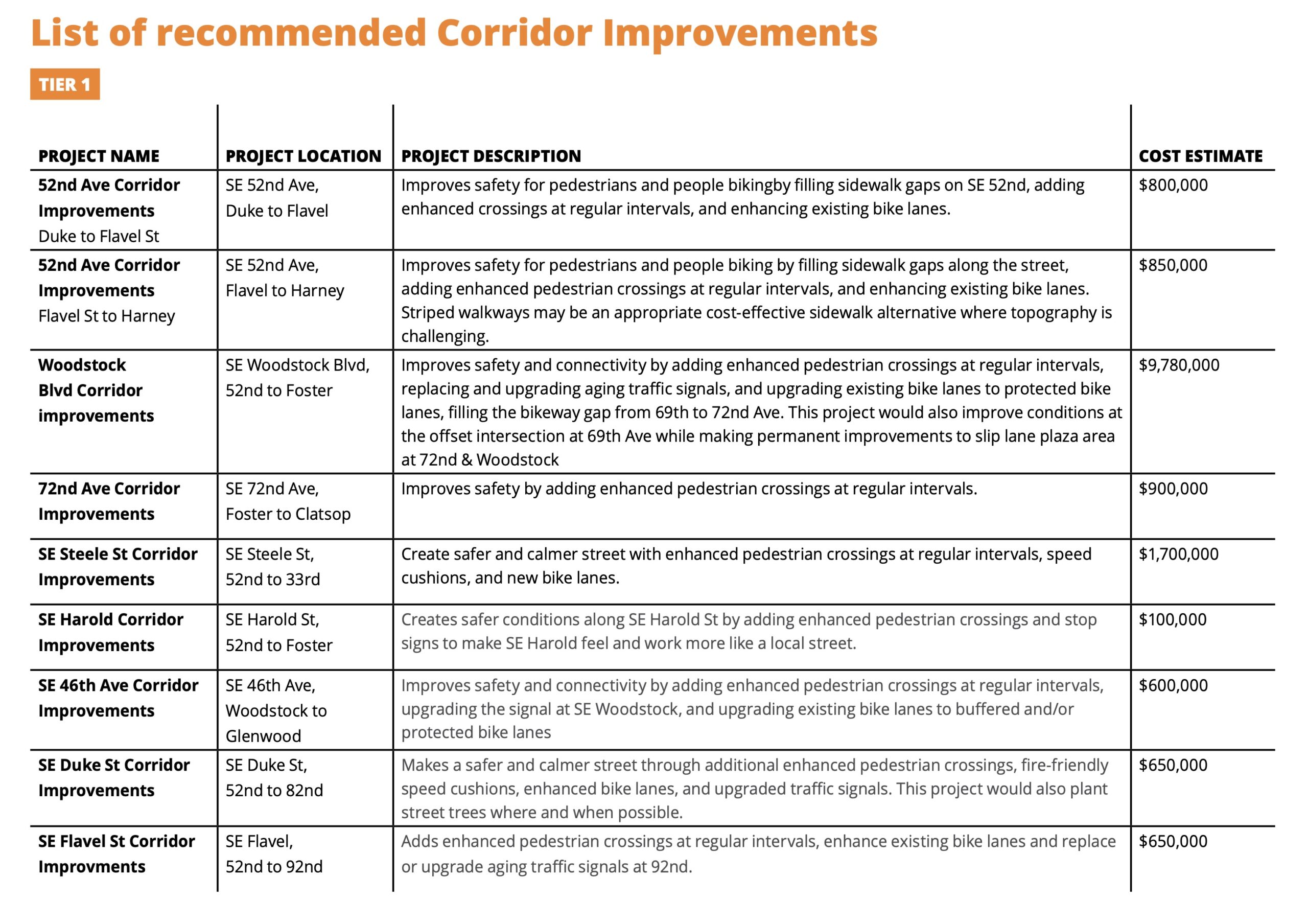
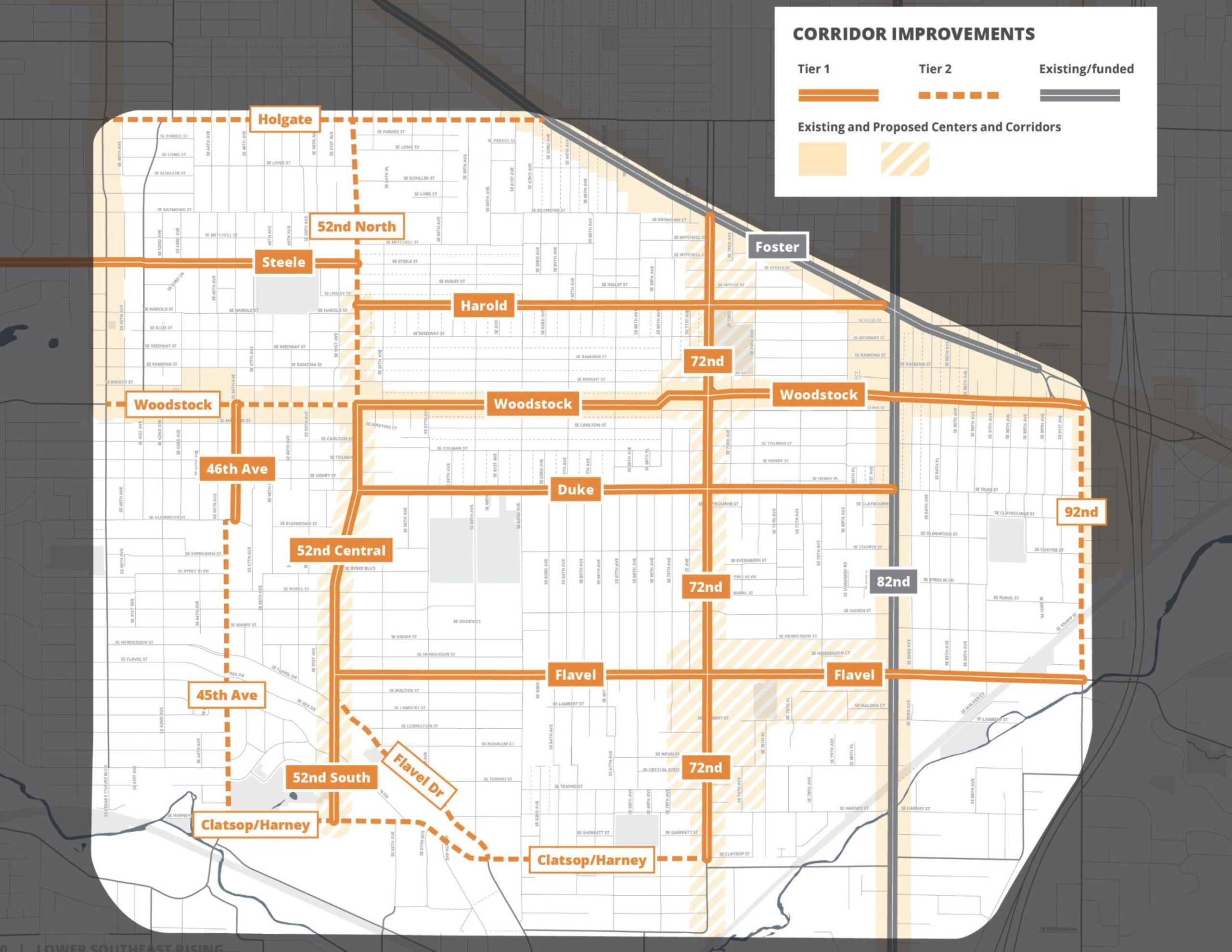
Like similar “In Motion” plans in other parts of the city, PBOT has recommended a set of transportation projects split into Tier 1 and Tier 2. One of the Tier 1 projects (estimated cost $800,000) would fill sidewalk gaps, improve crossings, and “enhance” existing bike lanes on 52nd Ave between Flavel and Duke. This section of 52nd is slated for repaving in 2025 — a project that “will be the key near-term opportunity” to make these changes a reality.
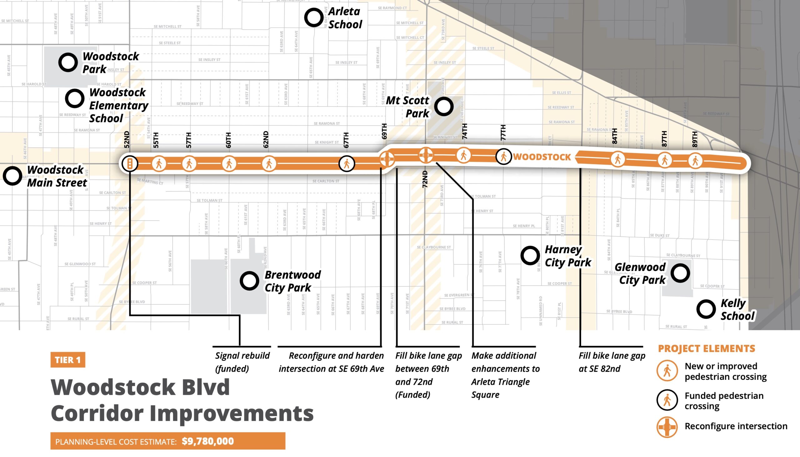
Another Tier 1 project is a $9.7 million upgrade to SE Woodstock between 52nd and I-205 that would tackle the dangerous off-set intersection at 69th, add protected bike lanes, and more.
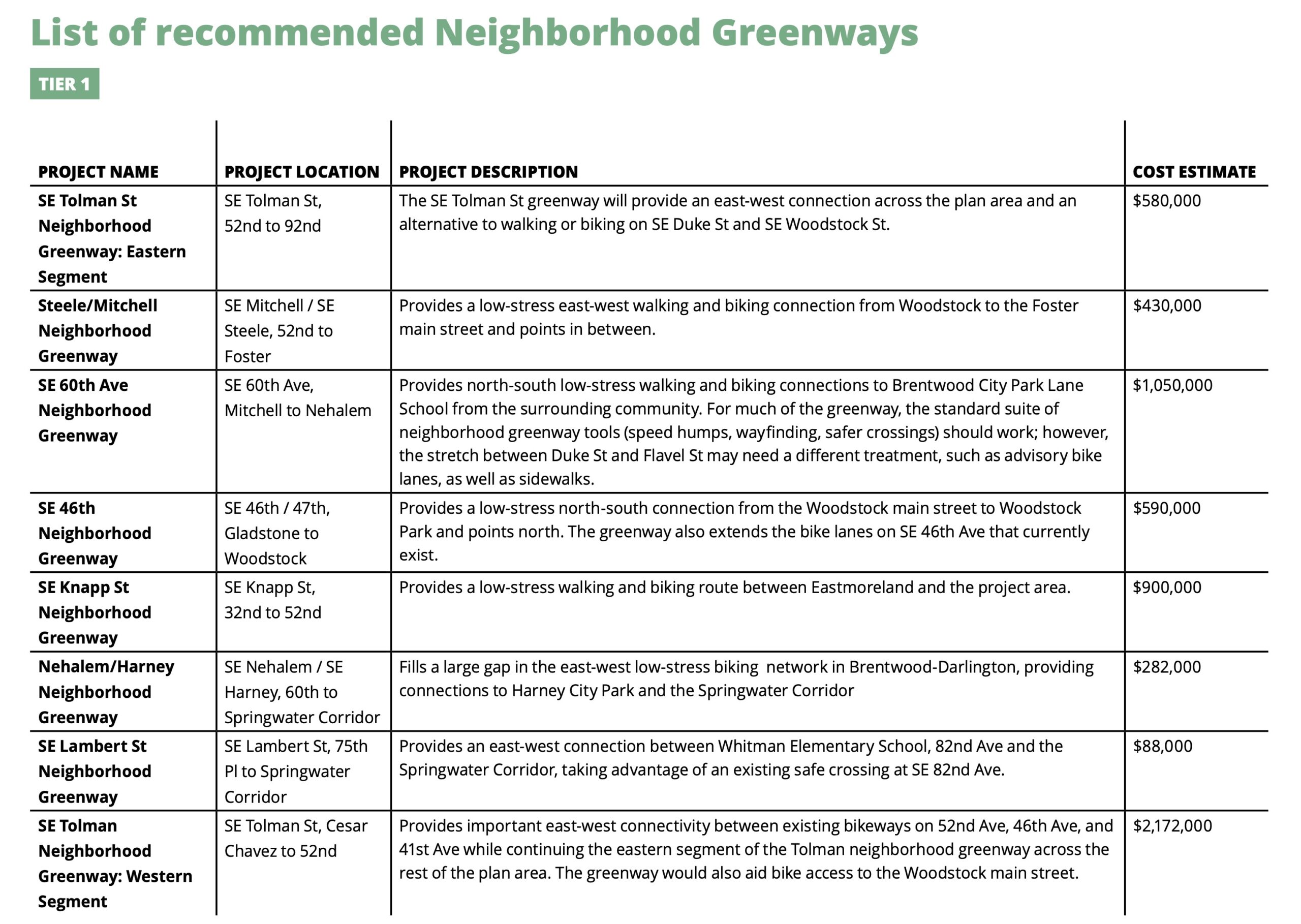
The list of nine Tier 1 corridor improvement projects have an estimated cost of over $22 million. The seven recommended Tier 1 neighborhood greenway projects — with new greenways on Tolman and on 60th playing starring roles — have a total estimated cost of $6.1 million.
The plan also makes recommendations for bus service expansions and includes details on how to fund and implement all the projects.
What’s next
The plan is currently in “discussion draft” form which is a final step to garner public feedback before the “proposed draft is released.” That’s expected to happen in August when there will also be a public hearing at the Planning Commission before a final adoption by Portland City Council. Comments on the current draft are being accepted through June 23rd.
This is a thorough and (thoroughly) exciting plan for a part of town that has been left behind for too long! Take time to check out the plan and share your comments. Get all the links you need to learn more and comment here.