Josh Ross writes about products and adventure rides. His last piece for us was a u-lock announcement.
As much as I’d like to be traveling the world and spending every day riding all day, that’s just not my life. I can only do that a few times a year. The rest of the time I ride near Portland, where there’s no shortage of rides worth sharing. And they’re more accessible and educational! Hopefully it means I’ll see some of you out there on my rides and you’ll say hello.
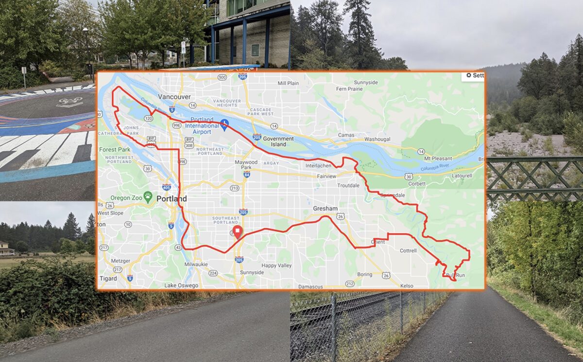
The first route I wanted to talk about is something I’m calling the Classic Tour of East Portland. It’s a route I’ve done so many times over the years I almost didn’t want to share it. It’s a showcase of what Portland has to offer. It uses some of our amazing bike infrastructure and it gets the rider out of the city into beauty that’s close by. You can ride just under 100 miles long without every going too far away.
The route is a loop, but I’m a SE Portlander so that’s where I’ll start. It works to start from wherever you are but I got onto the Springwater and headed west. It’s flat, it’s wide, and there are quite a few road crossings that require a careful eye toward anyone making a left. There is also quite a bit of beauty in this area. Close to 82nd there’s even an area with a few short dirt trails and views of Johnson Creek.
Advertisement
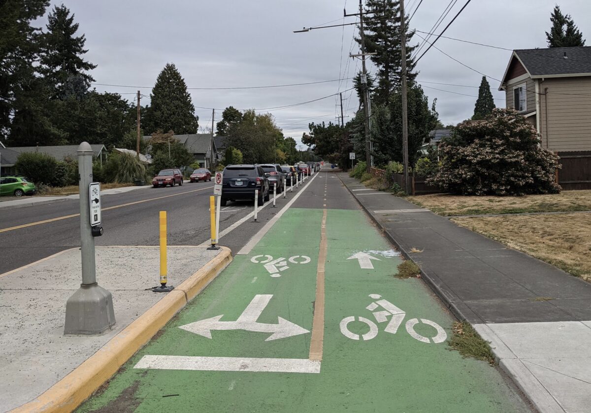
This part of the path ends in the Sellwood area. As the Springwater ends there’s an awkward right hand turn around some barriers and you drop onto a greenway street. In the past I always continued up to Umatilla, but in the course of writing this article I discovered a better route. Ride with GPS (which I hope you’re using) suggested taking Linn Street until it connects with the next section of the path. There’s less traffic and it’s more direct.
Once back on the path you’ll head north past Oaks Bottom. This area is well trafficked by runners and bikes of all speeds. Take your time and enjoy the views. There are sometimes herons off to the right and the river on the left is always beautiful. In about three miles you’ll reach the Tilikum Crossing bridge and a turn just before it puts you on the waterfront behind OMSI.
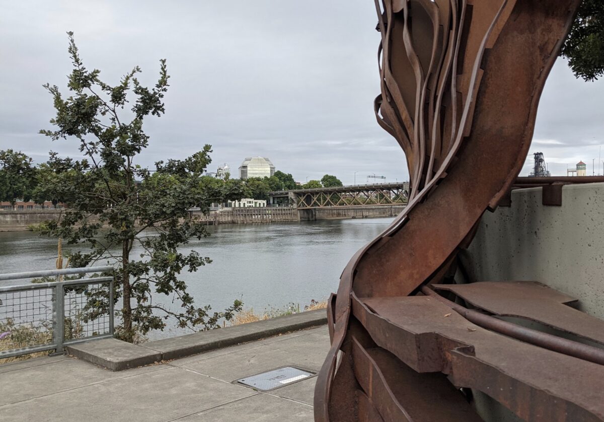
This is still a heavily trafficked section and requires some care. The Eastbank Esplanade puts you right above the water but can be slippery when it’s wet and cold. I’ve also had friends take a dip off the dock at the end of a long ride in the summer so it’s a great place to start or end the ride.
Coming up off the Esplanade brings you to a section that requires a bit of negotiation. Between the convention center and Broadway, the bike lane changes sides of the street a few times. It’s also always important to cross the tracks as perpendicular as possible. Once you pass Broadway though, everything is pretty smooth along one of the busier bike lanes in Portland.
Your next turn is going to be onto Rosa Parks Way. Take Rosa Parks to Willamette and you find a section of road with very few traffic lights. For years I worked this into my mid-week rides because the bike lane is rarely busy, it’s flat, and there’s only one traffic light. It also passes Cathedral Coffee which is another popular start for rides and a great place to start this one.
After making your way through St. Johns you’ll turn onto Lombard Street. This begins a section of the riding that is best done on a weekend. There’s excellent bike infrastructure and on the weekend there’s very little traffic. As you curve around the Smith and Bybee Wetlands take the path to the right instead of sticking to Marine Drive. Instead of needing to share space with traffic you’ll find yourself crossing North Portland Road. There’s a short section of bike path before getting on the path next to Marine Drive.
After following the path around, I like to go through the housing and pop out next to Subway. Cross Marine Drive again and you’ll find something that’s a cross between a shoulder and a bike lane. This section is also better on the weekends.
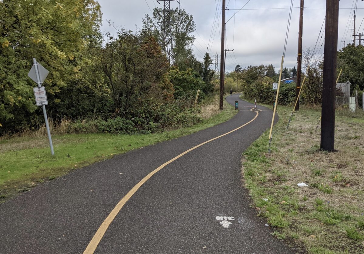
Two miles later you face a choice: At 33rd a lovely path begins that’s entirely separate from Marine Drive. Over the years I have taken to making the right then left to join the path for the first section. I then tend to cross Marine drive and stick to the path until it crosses Marine Drive again after I-205.
Riding the shoulder on Marine Drive can feel scary sometimes. It’s not always super pleasant but it’s fast and straight with very few times that cars cross the direction you are heading. In the past I’ve always chosen this option instead of crossing back and forth across Marine Drive to stay on the pieces of paved path. Right now, there’s the added danger of heavy automotive traffic on the bike path. If you encounter a car on the bike path there’s no room to get out of the way. The option is there, so make the choice that feels best to you.
Whatever choice you make, the route takes you to Troutdale. Here my preference is to turn left and head around the airport. There’s a bike path and it’s pretty and it allows you up to skip the freeway frontage road and main street traffic through Troutdale. You also get to cross the Sandy River on a carfree bridge!
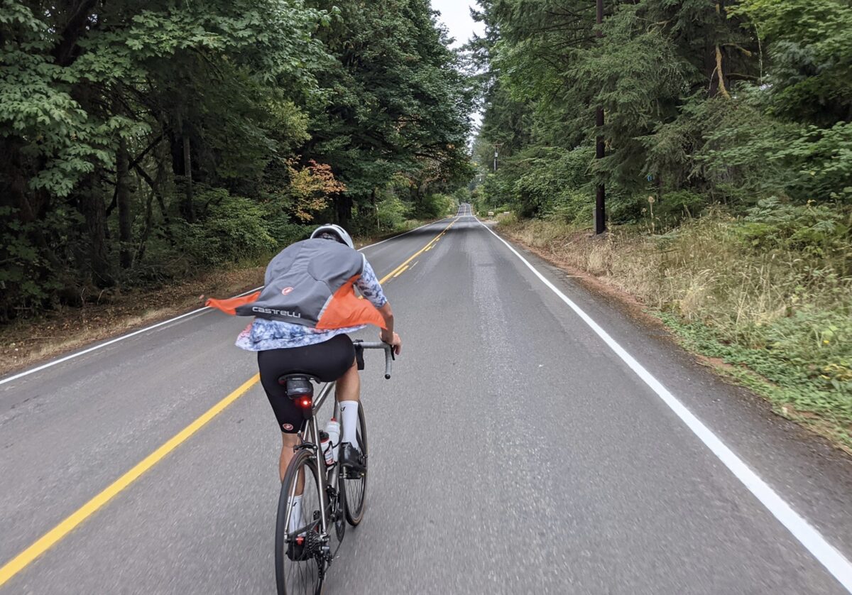
It’s at this point the ride drastically changes. There’s no more bike infrastructure, but there also no more city. My route takes you off of the Columbia River Highway as quickly as possible. Instead, you spend your time climbing on low-traffic country roads. The scenery is gorgeous and only gets better after passing through Springdale.
The ride roughly follows the Sandy River before passing through the Bull Run area. It’s defined by a series of ups and downs as you descend towards the river then climb away from it. The environment is classic Pacific Northwest forests and the eventual goal is to get back to the Springwater in Boring. The only obstacle is Highway 26 and this route minimizes traffic interactions.
Once you find yourself back on the Springwater, the loop is complete. You’ve got a gentle downhill back to the start if you hopped on in southeast Portland. The section of the Springwater north of Boring is much quieter than what you might be used to and it’s a real gem.
I followed this route twice recently. Each time making small changes and adjusting it for better flow. You can take it in small sections or do it in one ride. If you want more distance, and climbing, head to the top of Larch Mountain before rejoining the route. If you want less, head south from Troutdale to catch the Springwater.
Not everything about Portland is perfect, but there’s beauty all around us and if you want an amazing ride, you don’t have to go far.
See the route details below. After you’ve ridden this, let us know how it went!
— Josh Ross, @josh_ross on Twitter
— Get our headlines delivered to your inbox.
— Support this independent community media outlet with a one-time contribution or monthly subscription.

