
(Image: Tryon Creek Cove Trail Master Plan, Metro)
An ordinance in front of Portland City Council this week will hasten implementation of a plan that will improve the biking and walking connection between Tryon Creek State Park and Foothills Park in Lake Oswego and build a new bridge over Tryon Creek adjacent to the Willamette River.

The City of Portland Bureau of Environmental Services is set to formally adopt the Tryon Creek Cove Trail Master Plan which was completed in March and formally adopted by Lake Oswego City Council last month.
The plan (PDF) considered two options for how to get people across Highway 43 near the intersection with Terwilliger Blvd: a full traffic signal or a tunnel. A third option, which would keep path users on the highway and direct them a half-mile south to cross using an existing traffic signal at Foothills Road, was kept on the table, as a “possible interim solution if other options were found to be infeasible or were long delayed.”
The project advisory committee chose the third option.

Advertisement

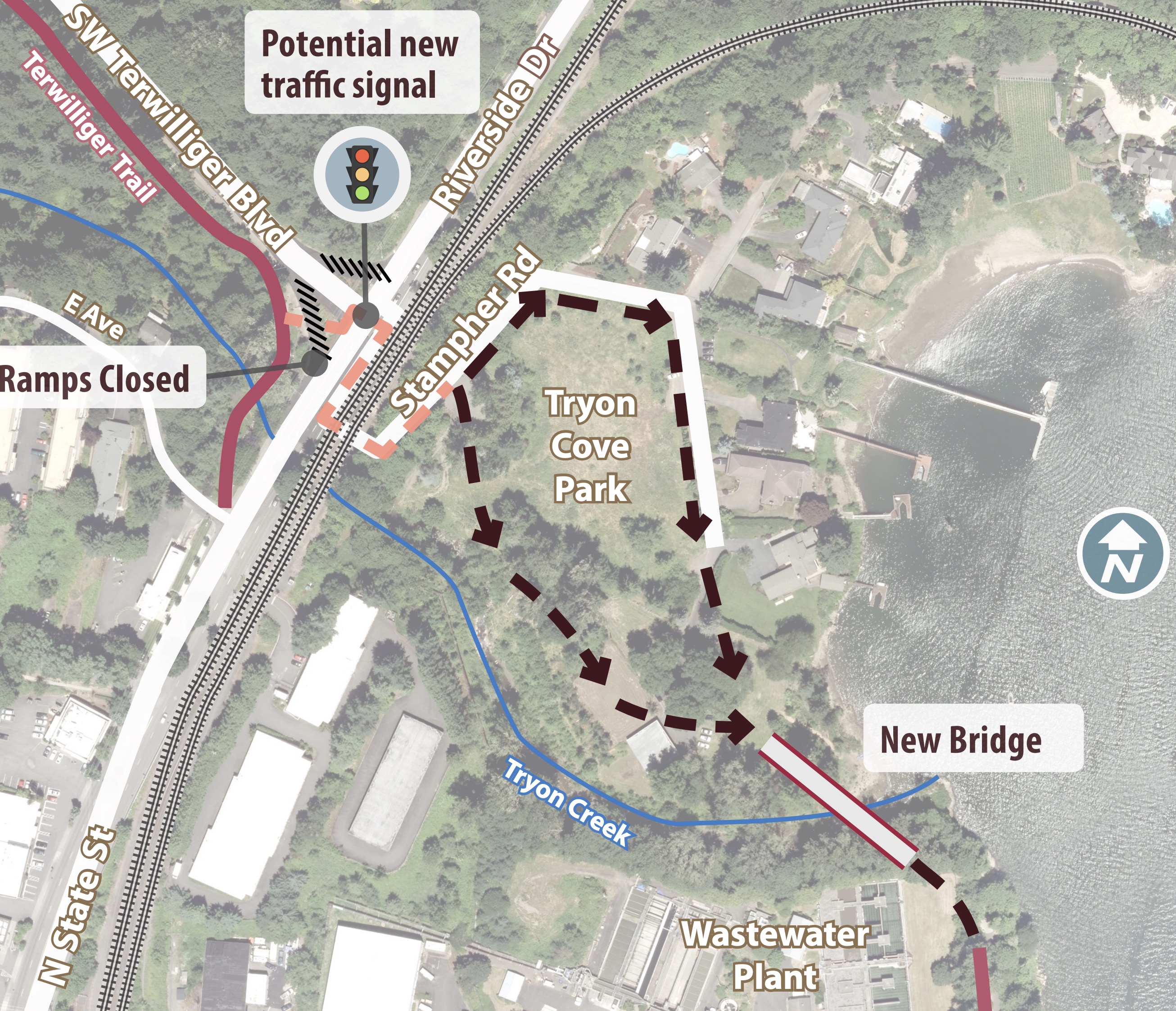

In their recommendation later dated March 26th, 2019 (PDF), the committee wrote, “At this time, the recommendation is to not cross Hwy. 43 with the trail due to approval by Oregon Department of Transportation and Union Pacific Railroad, potential right-of-way acquisition needs, complexity of permits, the need to widen the highway on the north side of Terwilliger Blvd., and high costs ($8-$13 million).”
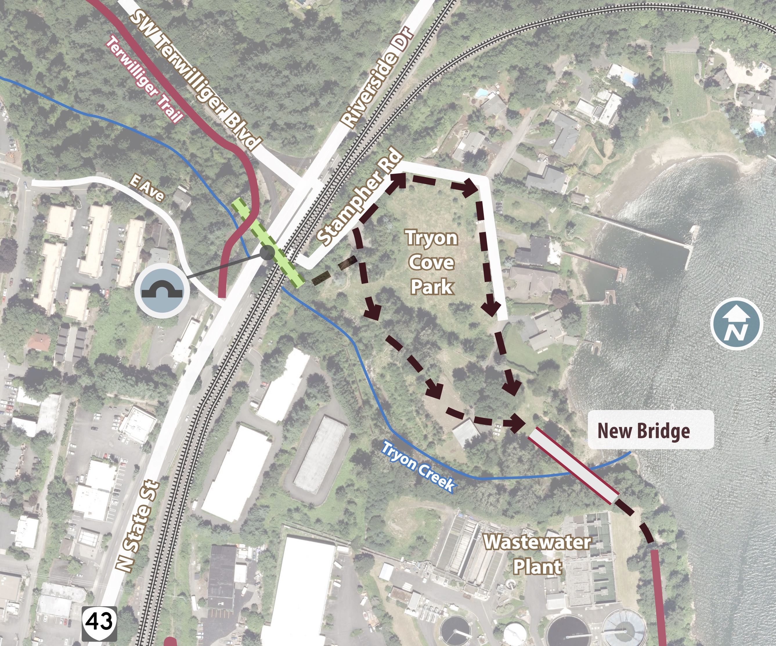
Instead of a new signal or tunnel that would make a direct connection between the two existing parks and paths, the committee recommended a phased approach (see below). The cost estimate of this recommended approach is about $1.5 million which includes a prefabricated steel bridge over the creek and a 3-4 foot wide soft surface trail (“nature pathway”) in the cove. The narrow trail is considered an interim step. If/when the tunnel or signal option is implemented, a 10-12 foot multi-use path would be installed in its place.
Here’s the recommended alternative showing the on-highway route:

This project takes on added significance given the Oak Grove-Lake Oswego Bridge project. This planned bridge (which we covered in February 2018) would create a carfree connection between the two cities and would likely connect directly to new paths in Tryon Cove Park. Clackamas County is currently leading a a Metro-funded, $306,000 planning study to further develop the project. The study is expected to be completed by November of this year.
— Jonathan Maus: (503) 706-8804, @jonathan_maus on Twitter and jonathan@bikeportland.org
Never miss a story. Sign-up for the daily BP Headlines email.
BikePortland needs your support.