
(Photos: J. Maus/BikePortland)
Portland’s 16th State Scenic Bikeway rolls through river canyons, sacred tribal fishing grounds and the small-town splendor that rural Oregon is known for. Travel Oregon and the Oregon Parks and Recreation Department announced the Sherar’s Falls Scenic Bikeway today.
Here’s the official map and route description:
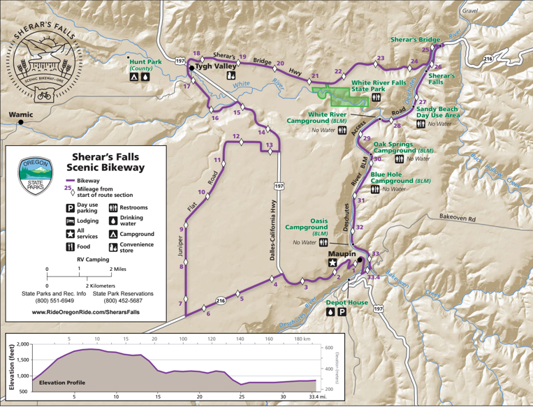
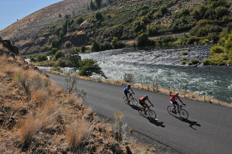
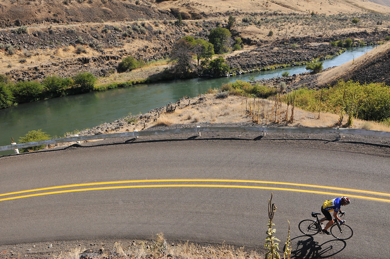
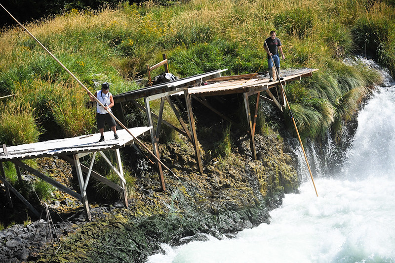
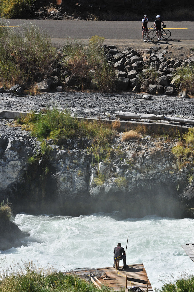
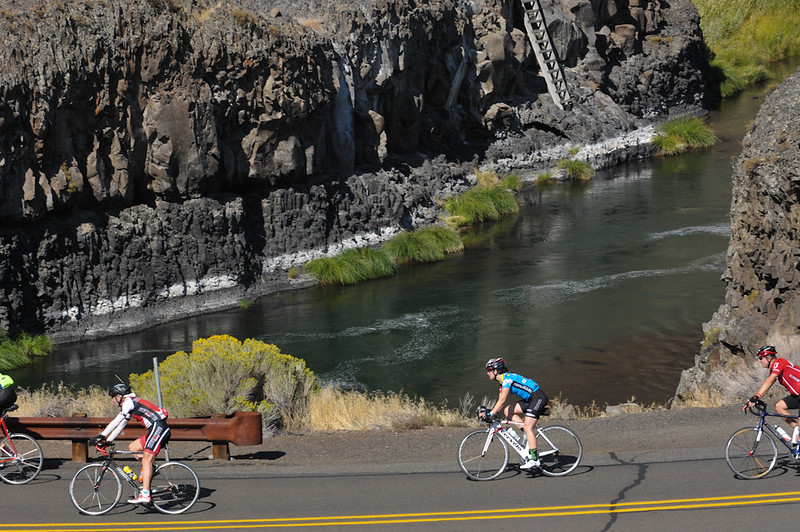
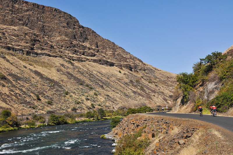
Sherar’s Falls Scenic Bikeway traverses the strikingly scenic high desert canyon of northern Central Oregon, known as River Canyon Country. This 33-mile loop (with 1,700 feet of climbing) winds along the Deschutes River en route to the bikeway’s namesake, Sherar’s Falls, where the Confederated Tribes of Warm Springs fish for salmon just as they have for thousands of years — from wooden scaffolds using traditional dip nets and set nets.
Riders will follow a section of White River and pass White River Falls State Park, one of Oregon’s secret hideaways, where a short walk leads to views of the river’s 90-foot plunge over a basalt shelf.
The small, vibrant town of Maupin — and its walkable downtown, friendly locals, restaurants, lodging and camping — serves as the bikeway’s start and finish.
Advertisement
This ride is best enjoyed in spring and fall, as well as some mild winter days. In springtime, wildflowers dot the hillsides, including lupine bearing purple sprays and arrowleaf balsamroot with its pops of yellow. Come winter, Central Oregon can be a dry, temperate reprieve while the rest of the state shelters from rain. Tucked in the protective shadow of the Cascade Mountains, the region boasts 300 days of sunshine and less than six inches of rain per year.

And yes, it’s as good as it sounds. I had the pleasure of riding part of this loop (from Maupin to Tygh Valley) on day six of the 2014 Cycle Oregon ride. Riding along the Deschutes on the low-traffic BLM access road north of Maupin and stopping at Sherar’s Falls to watch the fishermen work on the scaffolds was a big highlight.
Oregon’s Scenic Bikeway program was created in 2008. Routes can be proposed by anyone and are then vetted by the State Parks Commission and judged for scenic quality and roadway conditions. Once a route is selected it receives special directional signage and marketing. The routes spur tourism-related economic activity for nearby towns and businesses. Browse maps, GPS files, hotel and services listings and much more at RideOregonRide.com or learn more about the scenic bikeway program on the State of Oregon website.
— Jonathan Maus: (503) 706-8804, @jonathan_maus on Twitter and jonathan@bikeportland.org
BikePortland is supported by the community (that means you!). Please become a subscriber or make a donation today.