(Images: PDC)
Portland’s proposals for redeveloping its downtown post office include what would be a huge biking upgrade for the north side of downtown.
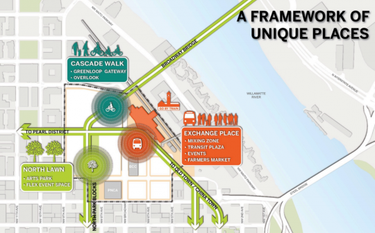
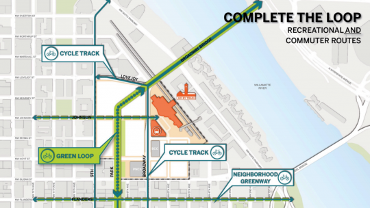
The “preferred alternative” plan (PDF) currently being circulated by the Portland Development Commission includes not only some sort of new descent from the Broadway Bridge directly to the North Park Blocks, but also protected bike lanes extending south on Broadway and west on Lovejoy Street.
On Johnson and Flanders streets, meanwhile, the city transportation bureau has been angling for diverters, speed bumps or other measures that would make them comfortable as neighborhood greenways: traffic volumes below 1,500 cars per day and speeds of 20 mph or below.
“We want to make sure that traffic accessing the site is not using Johnson to get to and from I-405 in particular,” city transportation planner Zef Wagner wrote in an email. “We have also asked that parking garage access be from the edges of the site or short accessways, but not from Johnson or Park.”
These changes are all theoretical until a big and very specific event takes place: the actual sale of the post office site, which would let the U.S. Postal Service move its trucking-intense operation to a less traffic-congested area. As we wrote back in April, a sale is looking as likely as it ever has, but the USPS has backed out of similar plans before.
In April, the PDC (which is the city’s main economic development agency) put up $500,000 for exclusive negotiations to buy the site. Its goal is to sell the property to real estate developers who’ll build a combination of employment, residential and office space around a new public plaza surrounding Union Station.
If the city’s plan is going to work, it’s going to require extremely good bike access. That’s because the goal is for the new development to create 4 million new square feet of real estate in downtown but only 5,000 new daily auto trips — half the ratio for the rest of the central city. Only that’d mean only 15 percent of trips to the site would come from people driving alone. Elsewhere in the central city, about 30 percent of trips come in that way.
If the site misses that target, auto parking on the site is likely to be either hopelessly inadequate or deal-killingly expensive to build.
In that context, Wagner said, the PDC has been “very receptive to our suggestions regarding bicycle access through the site and bicycle improvements surrounding the site.”
Advertisement
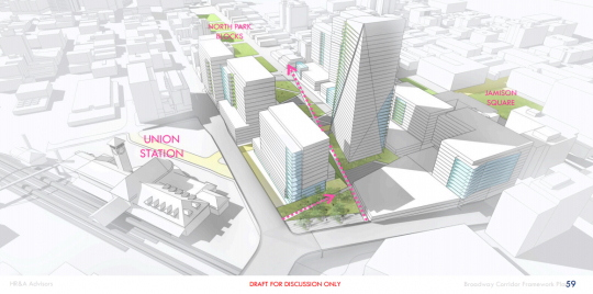
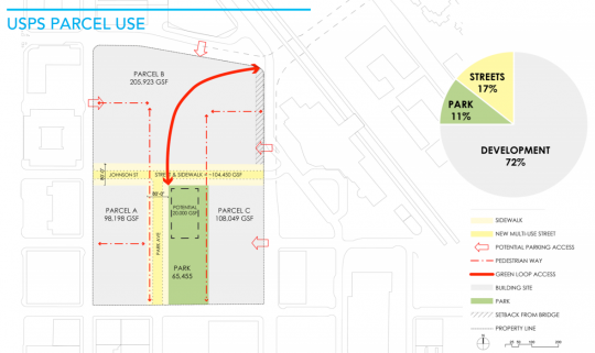
So, what exactly will the bikeways look like? Frustratingly, the numerous renderings of the preferred alternative don’t show the connection to the Park Blocks that PDC and PBOT officials say the plan will include. The closest the sketches come is this, with the pink arrows seemingly indicating possible routes for people biking and walking down to the Park Blocks:
There’s also this, which suggests that the new route down from the Broadway Bridge would land — presumably after some amount of weaving — on the west side of the Park Blocks, just east of Park Avenue.
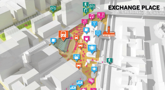
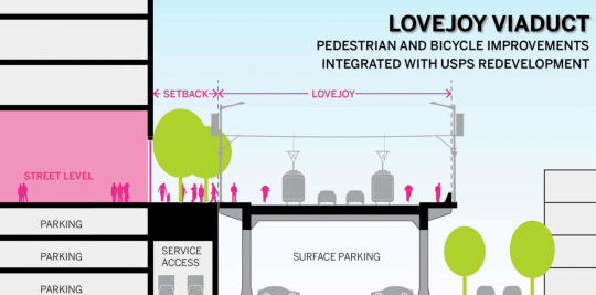
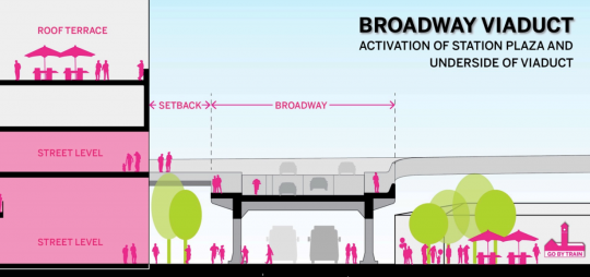
The nature of the protected bike lanes on Lovejoy and Broadway is still an open question. But Wagner highlighted the two images below. They show how the ramps down from the Broadway Bridge could be connected to create an elevated “street level” entrance to the new buildings.
It’d be possible, Wagner said, to move the bike lanes entirely off the Broadway and Lovejoy road beds and put bidirectional protected lanes on in the wide “setback” area shown here.
“We’re still discussing with PDC what these could look like,” Wagner said.
Though it’s theoretical, all of this will be influenced by, and will influence, the big downtown project the city is starting work on: its Central City Multimodal Safety Project, which is likely to give serious thought to an improved bike facility on Broadway further south in downtown. It’s also a big deal for rapidly growing Northwest Portland, which would get a lot out of a better bike connection to the Lovejoy viaduct and has been waiting for almost a decade for a comfortable bike route into downtown. The Flanders neighborhood greenway pictured here makes sense mostly if it connects to a long-discussed biking-walking bridge over Interstate 405.
All of this street work will also cost money. Presumably that’s where the developers who’d buy the site from the city are supposed to come in.

