The web-based toolkit that lets you track Portland transportation projects and related issues has been heaved into the Hales/Novick era.
When we wrote in July about the Portland Bureau of Planning and Sustainability’s Comprehensive Map App, its list of transportation projects was rooted largely in 2007, which had been the last time the city had updated its master list of transportation projects.
But as of last month, the city has a new list, and it’s now dropped that list into the Map App Explorer and the accompanying Proposed Draft Map App.
Among the changes: you won’t find $200 million for the rejected Columbia River Crossing. But you will find neighborhood greenways on Northeast 14th; upper Northeast 22nd; SE 34th; SE 14th/15th in Sellwood and Moreland; inner SE Steele; and Knott/Russell, Pacific/Oregon/Holladay and Mill/Main/Millmain in East Portland. Outer Stark Street is slated to get some sort of bike facilities eventually. There’s now a multi-use path listed alongside U.S. 26 heading west out of downtown and a “Fairmount Blvd Bikeway” in a loop directly west of Oregon Health and Science University.
All that and more, including plenty of non-bike-related projects, is now in both the Map App Explorer and the Proposed Draft Map App. (Confusingly, the two are different, but very-similar-looking, websites. You can toggle between them by clicking on the name of the opposite one at the top of the other. Give the city credit for innovation here but feel free to marvel at its ability to come up with new and creative usability problems.)
As Mayor Charlie Hales and Transportation Commissioner Steve Novick head into what’s looking like a knock-down fight with the Portland Business Alliance and the local gasoline industry over whether the city should get to spend $20 million a year on safety or only about $10 million, and whether poor people should have to help pay for it, it’s useful to know what’s at stake here.
Advertisement

The Map App Explorer offers another neat feature that hasn’t been available on the Proposed Draft Map App: you can now view demographic data and proposed zoning or transportation projects on the same map.
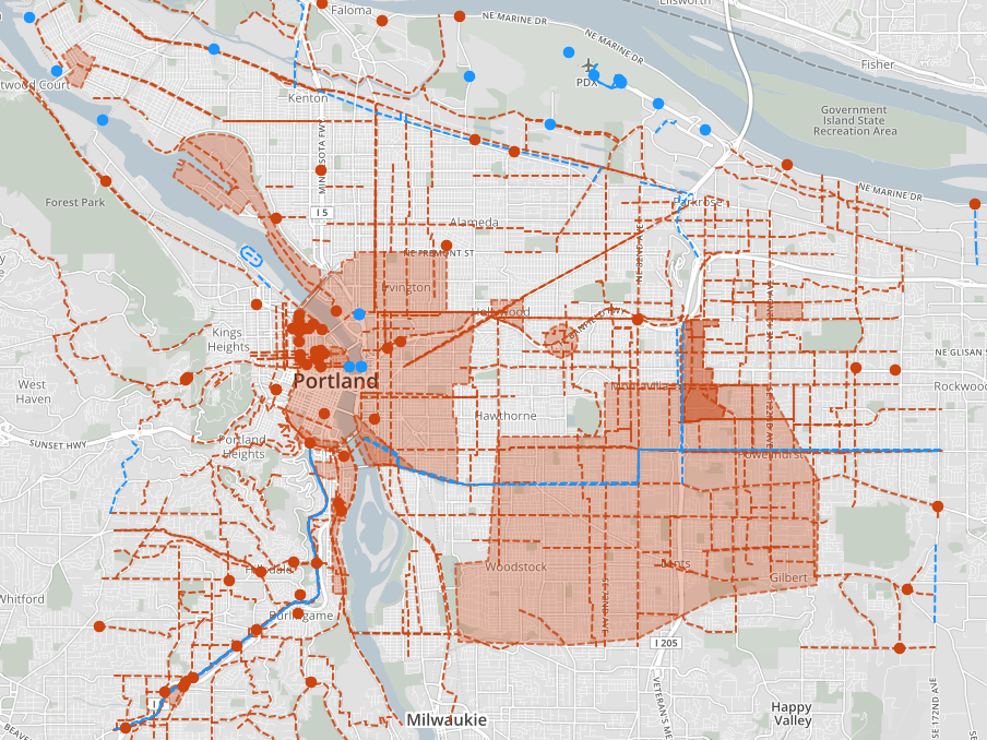
For example, here’s the map of city transportation projects (in red) overlayed on a map of areas within 1/4 mile of a frequent-service transit stop. It’s a great illustration of how important these projects will be to improving low-car life in East Portland.
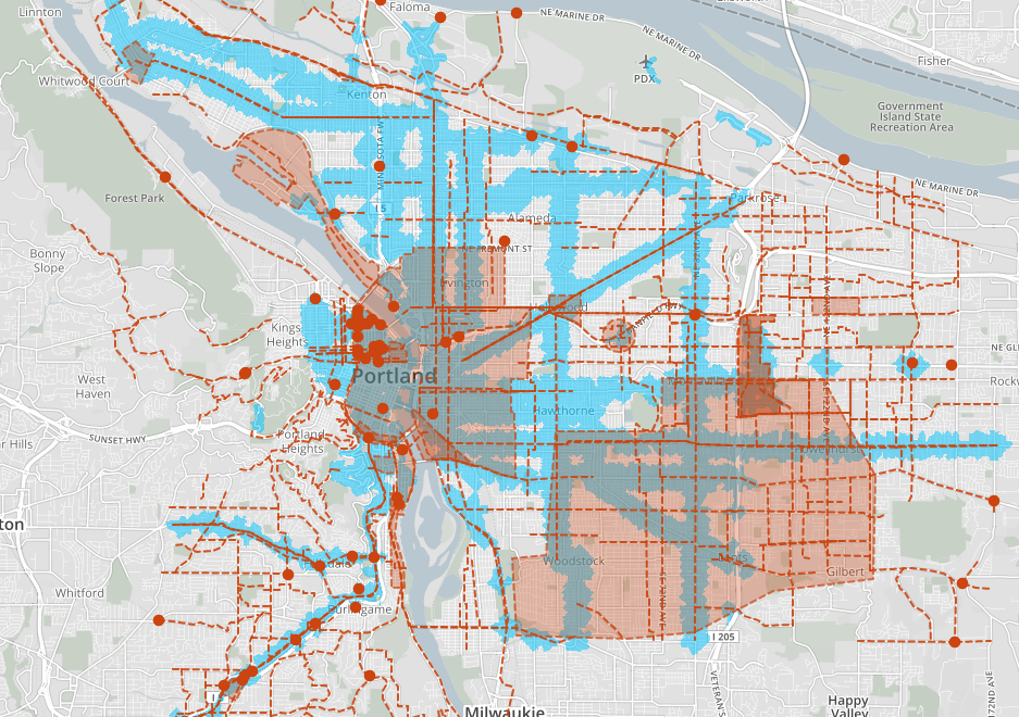
And here’s a map of the region’s population density, showing how parts of outer North, East and Southeast have more residents per square mile than many central neighborhoods:

There are lots of other useful tidbits here. Enjoy exploring.