


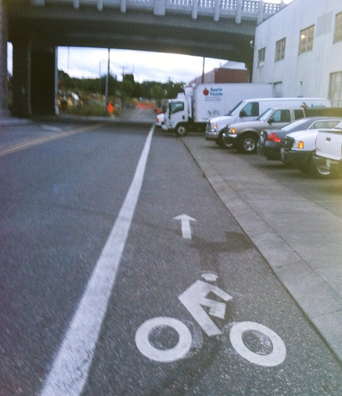
(Photo: Besty Reese)
Anyone who has ridden on SE Caruthers in the pathway gap between the southern end of the Eastbank Esplanade and the start of the Springwater Corridor trail (map) has likely experienced the problem of trucks encroaching on the bike lane. It’s common because two truck-heavy businesses — Apple Foods and McCoy Millworks — have loading docks adjacent to the street and a smooth, mountable curb is all that separates the parking zone from the bike lane.
(Photo by Betsy Reese)
Now the problem might finally get fixed thanks to an innovative design change coming from the Bureau of Transportation (PBOT). According to PBOT project manager Theresa Boyle, the city is prepping a project that will create “advisory bike lanes” on Caruthers between SE Water and SE 7th.
Advisory bike lanes are different from traditional bike lanes because people are allowed to drive in them — but only when there are no bike riders present. Sound strange? Read on…
Currently, SE Caruthers in this location is a pretty typical cross-section. It has four lanes: one standard lane and one bike-only lane in each direction. The new design will reconfigure the lanes and leave just one lane in the middle and green-colored, advisory bike lanes on each side. Here’s how it looks on Google Streetview:

And here’s how Boyle explained the new design in an email to a volunteer activist who had contacted the city about the bike lane encroachment problems on Caruthers:
“… this is a striping protocol that can be applied to streets with low volumes of vehicles, and high volumes of cyclists.
It allocates more of the paved street area to bike lanes and less overall to cars than is typical. It essentially creates a queuing street for vehicles which is why it is only suitable for low volumes.”
Boyle says the new bike lanes will be eight-feet wide (compared the existing five-foot wide lanes) and there will be one, 16-foot wide “through auto lane” in the middle. Along the southern curb (where the encroachment problems now occur), PBOT will mark an additional four-foot wide buffer zone.
We took a closer look at advisory bike lanes back in 2009 after they were included as a potential facility type in the PBOT Bike Plan for 2030.
Here’s an early draft of a PBOT graphic showing how they work/look:
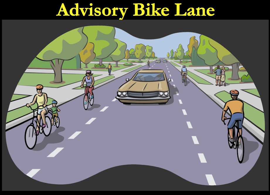
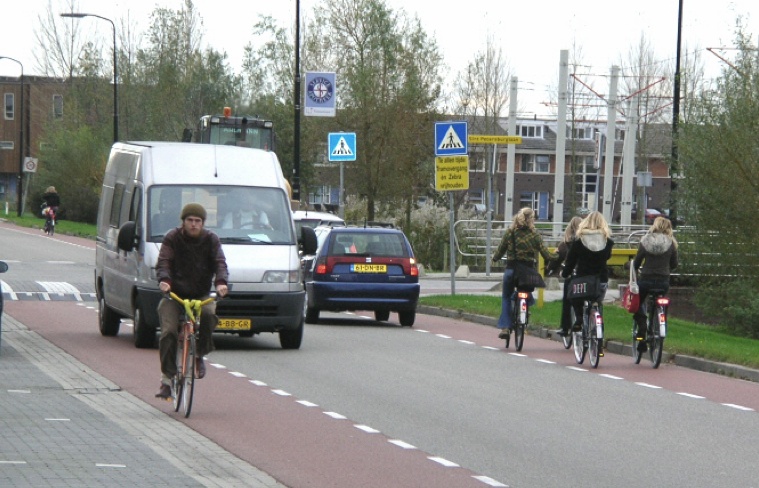
Adivsory bike lanes are not a PBOT invention. They are widely used in Europe (especially The Netherlands) and the City of Minneapolis also uses them. A presentation put together by PBOT Bike Coordinator Roger Geller (PDF here) explains that advisory bike lanes are typically used when standard bike lanes don’t fit. They’re also a good solution, he says, when there is a higher volume of auto traffic than a neighborhood street.
(Photo by Roger Geller/PBOT)
PBOT is making these changes as part of their Clinton to the River Multi-Use Path project. That project is building a 2.8 mile bike path adjacent to the new Portland-Milwaukie Light Rail line.
To help people understand the new design, PBOT will do a marketing campaign with signs and graphics similar to how they rolled-out bike boxes. If all goes according to plan (it must be dry for the striping to happen), PBOT should have the new lanes striped by the end of next month. If not, it might be next spring before we see the changes on the ground.
Stay tuned.
— For more on advisory bike lanes, see this page from the City of Minneapolis website.