
The Bureau of Planning and Sustainability has released a bold new vision for a “Green Loop” that would circumnavigate Portland’s urban core with world-class bikeways, walkways and parks. Other names suggested include “Promenade Park”, “The Park Way”, “Urban Trail”, “The Central Path”, “The Way Around”, and “Compass Park”. According to a document released last month as part of their ongoing West Quadrant Plan (PDF), the BPS study fleshes out an idea that was first introduced in the Central City 2035 Concept Plan.
existing “active transportation infrastructure”.
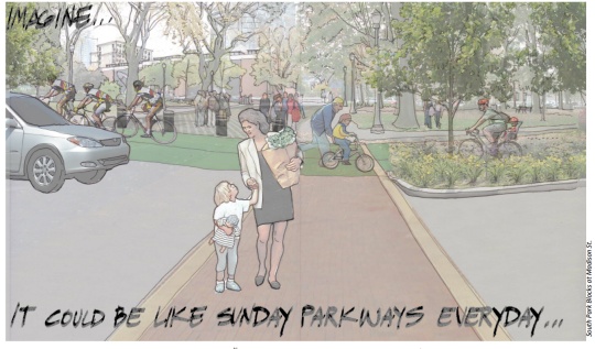
A drawing of the south park blocks on page two of the study (seen above) is accompanied by the words, “Imagine… It could be like Sunday Parkways everyday.” It depicts a public space full of people, plants, and dedicated space for bicycling and walking.
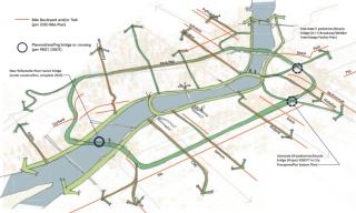
In the document, the loop concept is described as, “A 10-mile linear public open space that will strengthen the Central City’s role as the ‘Center for Innovation and Exchange’ over the next 25 years.” It’s being seen as the public space analog to the existing — and more commercially-oriented — central city streetcar loop. The route would utilize the Broadway Bridge, the north and south Park Blocks, and the Portland-Milwaukie Light Rail alignment (including the new bridge) through southwest Portland.
The six “key objectives” described in the concept plan include:
1) Improve Health
2) Connect Parks
3) Support Businesses
4) Increase Trails
5) Encourage Riding
6) Grow & Build Green
The concept document includes several tantalizing before/after images…
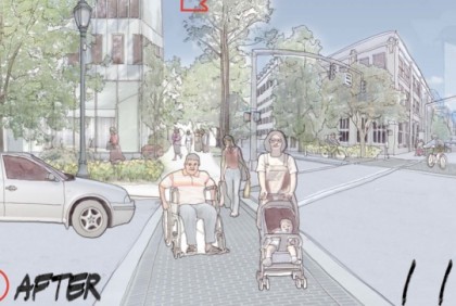
SW Salmon before (note the dedicated bicycling space in the upper right)…
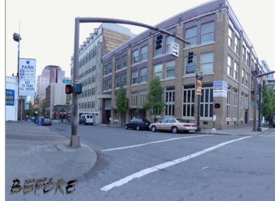
SW Salmon after…

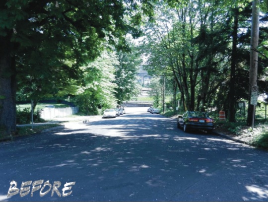
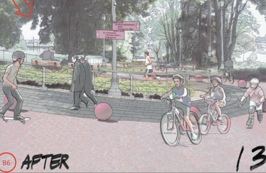
SW Caruthers (from Water to Naito) before…
SW Caruthers (from Water to Naito) after would “explore creation of Lombard like (in San Francisco) hill park…
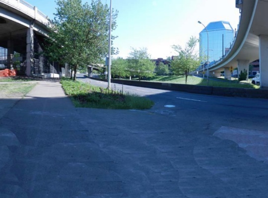
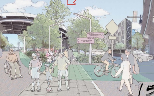
And the very annoying Naito Gap near the Steel Bridge before…
And after…
As inspiration for the idea, the BPS document includes references to the British Columbia Parkway in Canada, the Rio de Salon in Madrid, and the Indianapolis Cultural Trail.
While the vision is exciting enough on its own, it’s also important to note that it could be done on a tight budget. “The concept is a relatively low-cost opportunity in the face of dwindling resources for major infrastructure systems such as regional transit or large open space acquisition and development projects,” reads the study. One reason the cost would be low is because the loop would use facilities and right-of-way that is already publicly owned.
While this is nothing more than a concept buried inside a concept plan, it’s the type of vision for public space and transportation that Portland is sorely lacking right now. My only questions are… Where do we sign up?! And when is the big rally?!
— If you’d like to learn more about this and/or get involved in making it a reality, read up on BPS’s West Quadrant Plan. They’re entering into the development phase of the process and there’s an open house scheduled for March 10th.