
See the full animation below.
Yesterday I posted an animation showing how Portland’s network of bike-specific infrastructure had evolved since 1980. The images used in the animation were from a 2005 presentation by City of Portland bike coordinator Roger Geller.
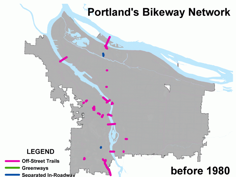
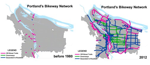
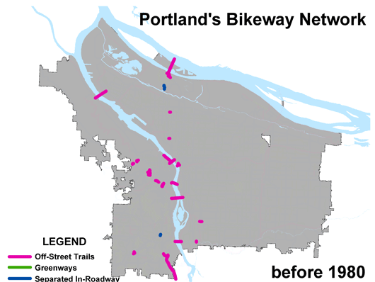
A few hours after it went up, Geller got in touch to share an updated set of images. The images not only provide more detail on what the various colors represent, but there are also many more of them. Geller has shared a year-by-year snapshot of how Portland’s bike network has evolved since “pre-1980” to all the projects currently funded past 2011.
In the new images, you’ll see three colors: Pink is for dedicated, off-street trails (also known as multi-use paths); green is for neighborhood greenways (also known as bike boulevards); and blue is for everything else (bike lanes, cycle tracks, buffered bike lanes).
Thanks to help from reader Spencer Boomhower (the same guy who did amazing animations showing an alternative vision for the Columbia River Crossing project and an explanation of the Idaho Stop Law), I can share these new images with you…
Check them out via GIF below (it starts automatically, so make sure you watch it all the way through):
And for your convenience, Spencer also uploaded it to Vimeo (it’s handy because you can stop it whenever you’d like):

Portland’s growing bike network from Spencer Boomhower on Vimeo.
A few things stand out for me while watching this:
- Our off-street path network has been stagnant for the past decade.
- From before 1980 to 1995, bikeways trickled in (about 114 total miles built*), then there was a big boom between 1996 and 2002 (when we added 139 miles during what some might consider the Mia Birk era).
- Between 2003 and 2009, we added only about 3.5 miles of new “separated in roadway” facilities (bike lanes and the like) per year.
- After 2009, the vast majority of additional bikeway miles has come in the form of neighborhood greenways.
- Despite the boom in bikeways in the 1990s, bike ridership in Portland didn’t really spike until 2005. Why? Perhaps it’s a sign that beyond just the physical infrastructure, culture plays a large role in getting people on bikes.
- *For reference, we have about 307 bikeway miles as of 2011.
For the numbers behind some of the data represented in these graphics, see this chart from PBOT: Bicycle Traffic across Four Main Portland Bicycle Bridges Juxtaposed with Bikeway Miles (JPEG opens in new window).
Geller has also shared some interested charts and stats on how bike ridership in Portland relates to U.S. Census tracts. I’ll put that together for a post soon.