

We can and should do better.
(Photo © J. Maus/BikePortland)
I won’t be satisfied with Portland’s progress as a bicycling city until our transportation system provides the same level of safety, efficiency, and respect to people on bicycles as it does to people who drive or take transit.
I can walk to my car and drive to my office downtown in a few minutes, enjoying comfort and safety on streets made just for me. Or, I can walk a few blocks to a bus or a light rail train and have a similar experience. But on my bike, my experience is vastly different.
Contrary to popular belief, bicycling in Portland isn’t all unicorns and rainbows. Cars still dominate the streetscape. In fact, there isn’t a single A-to-B route in this city that has the type of dedicated, connected, safe, easy-to-use facilities like we provide for motor vehicles and transit.
Is it really any wonder that well over 60 percent of Portlanders still drive alone to work everyday? (Or that a mayoral candidate saw fit to do it in an election ad?)
This is the place I started from when GOOD asked me to come up with an urban challenge for Portland as part of their GOOD Ideas for Cities project.
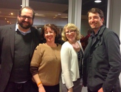
Katrina Johnston, me.
Back in February, GOOD teamed me up with the savvy trio of urban planners at THINK.Urban, a non-profit that melds academic research to urban planning. Over the course of several weeks, Jason King, Allison Duncan, Katrina Johnston, and I rolled up our sleeves and came up with a new way of thinking about our street system. (Actually, they did all the real work and I just spouted off crazy ideas at a few meetings.)
Below, I’ll share the basic points of our approach and then I’ll share some visual highlights from the presentation.
—
They key principles of re-making our system so it does a better job serving cycling is to make it connected, safe, and legible. If we do these three things we’ll get more capacity from the system for less money and we’ll reap the myriad benefits that come with more people choosing to ride bikes.
Connected
When we looked at a map of Portland, the most direct and accessible streets were all streets that either lacked quality bike access or lacked dedicated bike space completely. Streets like Sandy, Powell, Broadway, MLK, Lombard, and Burnside. For various reasons, we just assume those roads are primarily for motor vehicles and everything else should either steer clear or simply “be accommodated” only when and where it can be done without impeding motor traffic. That’s unfortunate. So, instead of a backstreet approach, we decided to do the opposite: Re-allocate space on these key main streets so they include quality access for all vehicles.
Safe

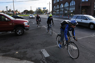
(Photo © J. Maus)
There is no mystery here. To encourage ridership and prevent collisions, we must separate motor vehicle and bicycle traffic. If we build streets for cars and trains and then try to figure out how to “accommodate” bikes, it will take us many years to see large jumps in bike usage. There are many tools engineers can use to create separation of modes. We don’t lack the knowledge to do this, we lack the political will.
Legible
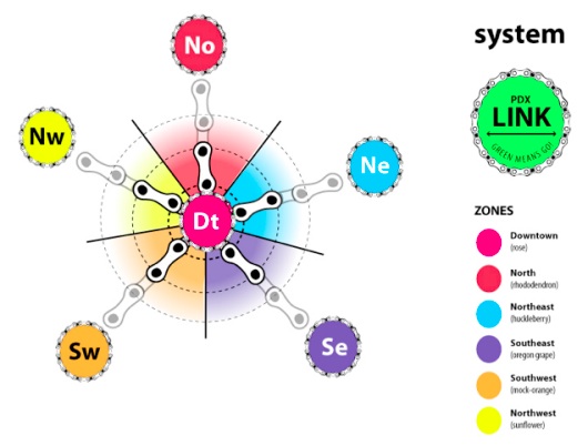
A great bicycling city shouldn’t require bike maps. People should not have to have insider knowledge just to move around the city on a bike. It should be blatantly obvious how to get somewhere safely on a bike — just like it is for driving or taking transit. That being said, it’s important to communicate at the street-level with a consistent brand. Just like it’s easy to spot a sign for a freeway on-ramp from blocks away, we should make it easy to find (and stay on) major links in the bike network. To accomplish this, Katrina Johnston developed a simple “LinkPDX” visual standard to tie the system together.
—
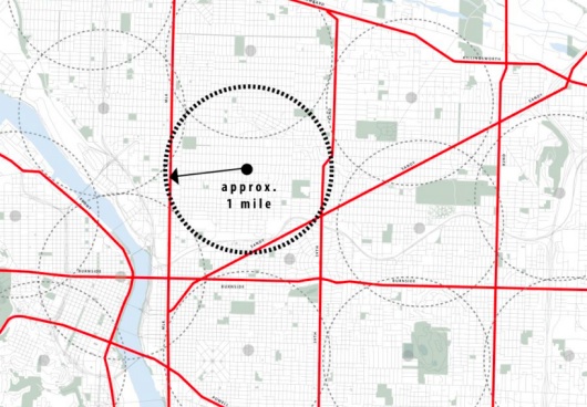
To give these ideas a whirl in real life (well, OK, this is a planning exercise, not exactly real life, but you know what I mean), we decided to develop a test route. Our route takes us from the Cully neighborhood in northeast Portland to Portland State University downtown. Not only did this route allow us to test many of our ideas, it’s also symbolic because it ties together two of Portland’s marquee — yet woefully disconnected — cycle tracks on Cully Blvd and on SW Broadway (near PSU).
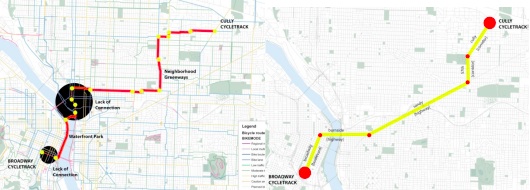
With our system you’d take only five streets to make this trip: Cully, 57th, Sandy, Burnside, and Broadway (see image above right). There are only seven turns to navigate along the entire 5.5 mile route. On the flip-side, if you took Portland’s existing bike network, you’d have to add 1.5 miles and make 33 turns! When you combine this inconvenience with risky gaps and broken connections, you start to understand why Portland still has a lot of work to do.
Below is a series of illustrations created by the THINK.Urban team that take you through the route…
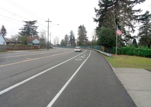
NE 57th before
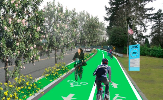
NE 57th after
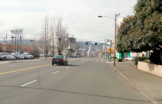
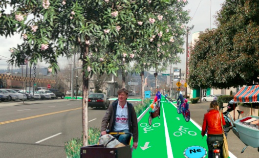
NE Sandy before
NE Sandy after
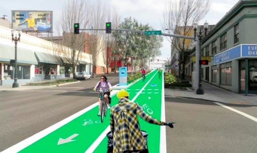
Burnside before
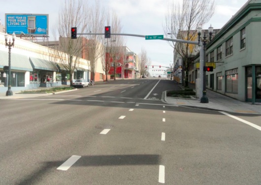
Burnside after
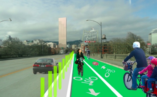
Burnside Bridge before
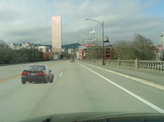
Burnside Bridge after
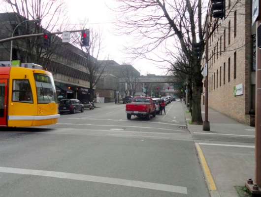
SW Broadway before
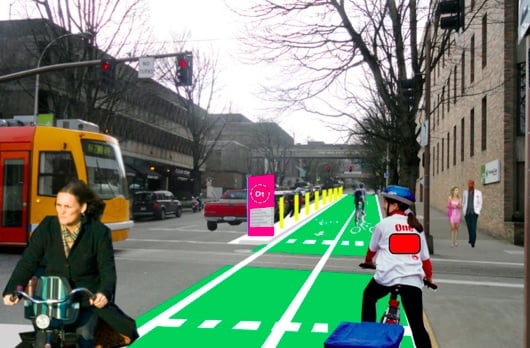
SW Broadway after
Before you nitpick these designs, understand that our team was made up of planners and dreamers, not engineers and bureaucrats. The goal is to spur conversation and show what might be possible if we think beyond the status quo. We have the backbone of a high-quality, connected bike network already in place. We simply have to use it better.
Thanks to Jason, Allison and Katrina for their excellent work in turning our ideas into a cohesive project and thanks to GOOD for the opportunity. You can view the entire presentation, including a video of Allison and Jason presenting it live back in February, at ThinkUrban.org.