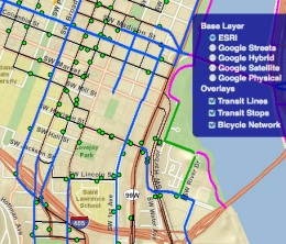
– See it here–
Our regional transit agency, TriMet, is a national leader at data-sharing and they embrace open-source tools. One such tool that they’ve recently added to their App Center is the nifty Portland Bike to Transit Map.
According to the map’s creator, Melelani Sax-Barnett, “It can display bike routes, transit stops, and transit routes at the same time, so you can find the best way to bike to your transit stop.”
Sax-Barnett created the map as part of a student project while taking a GIS course at Portland State University last summer. She used data gleaned from the Portland Civic Apps site. After winning $1,000 for “Most Original App” back in October, she told us that, “I’ve always wished that such a map existed (with bike routes and transit stops visible simultaneously), and I think I started putting it together before Google had its bike directions all set up.”
Check out the Portland Bike to Transit Map.

