
The Oregon Department of Transportation has taken a bold step into the 21st century and has published their Oregon State Bike Map online for the first time ever. The map has been available for nearly 15 years, but prior to this week it wasn’t even available as a PDF, much less publicly available on the Internet.
The map is also now GIS based and has up to date data on road conditions. The map is broken up into nine printable sections that can be downloaded from the ODOT website.
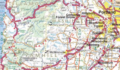
ODOT bike and ped program manager Sheila Lyons says the map is a “road map with information for bicyclists.” Instead of recommending particular roads as designated bike routes and labeling them different colors, Lyons says they decided to just provide information someone might use to decide for themselves which roads to ride on. The map labels highways with shoulder width greater than 4-feet and information on traffic volume, terrain, and elevation is also available.
At this time, the state’s official Scenic Bikeways are not on this map, but Lyons says they hope to include them on future versions once that program is more established.
The legend for the map is currently only on Tile #2 and ODOT bike and ped program manager Sheila Lyons says she’s aware of that issue and plans to put the legend up as a separate PDF soon (I also didn’t see the separate download for traffic volume information, so hopefully that gets added soon as well).
This is a great way to assess relative bike-ability of roads when planning your spring and summer adventures. For more detailed roadway information, you’re advised to complement this with city-specific maps.
As always, ODOT would love your comments and review of the map to improve future versions. If you’d rather have a hard copy of the map, you can request one for free by calling (503) 986-3556.