
(Photos © J. Maus)
Last Friday a few friends and I decided to ride our bikes down to Monmouth (about 15 miles west of Salem) for the start of the Cycle Oregon Weekend event.
When I checked the map to plan the route, I realized this was a perfect opportunity to test out the state of Oregon’s first fully signed and mapped, official State Scenic Bikeway.
The Scenic Bikeway program was first proposed back in 2004 by (coincidentally enough) Cycle Oregon, but the program is just now gaining speed.

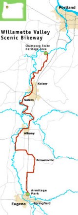
In May, the Willamette Valley Scenic Bikeway (WVSB) found a permanent online home. Now, anyone can print detailed maps of the 132-mile route that goes from Champoeg State Park to Armitage County Park in Eugene. (Hopefully someday the route will start in Portland. Federal money to start planning the new French Prarie bike/ped bridge over the Willamette should help.)
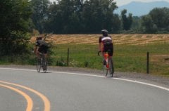
On Friday, we picked up the WVSB just south of Champoeg (the historic Butteville Store makes a great starting off point). With my map in clear view on my handlebar bag, we rolled through the farms and rural roads of the valley, with the snow-capped spire of Mt. Hood keeping watch over us.
A highlight of the first section of the route is the miles and miles of hops fields. Seeing their long vines stretch up and over the interesting cable system used by growers gave us a tangible reminder of Oregon’s flourishing beer industry.
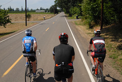
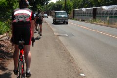
The roads were pleasant to ride on and we encountered very little motor vehicle traffic. Most of the route is on heavy farm use land and we shared the road with more than a few tractors and other farm equipment.
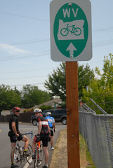
As we pedaled south, I wondered why I didn’t see any of the official Scenic Bikeway signs. Unfortunately, they didn’t show up until we got to Keizer, about 27 miles into the route. I learned later that Marion County has been slow to put up the signs, but that they should be installed in the next few weeks.
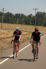
Low traffic made for pleasant riding.
|
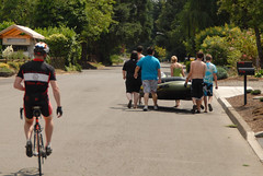
We encountered some kids portaging a huge tube for river floating.
|
Once we saw the first official sign, it was easy to follow the route, even without a map. The signs are a bit small, but they are distinct and placed at every turn. We relied on them to get around and through downtown Salem (I had forgotten to print the map for that section, so we were riding blind).
The route was well thought-out, except for one spot south of Salem where it directed us onto a sidewalk adjacent to River Road where we pedaled against traffic for about 3/4 of a mile. My only other nitpick is a lack of free, publicly available water. How about building a few water bottle re-fueling stations?
Someday, I hope Oregon State Parks realizes their vision for a statewide network of Scenic Bikeways, connecting rural towns and cities with pleasant, well-signed routes that are marketed far and wide. If the WVSB is any indication, this is a program well worth supporting.
For more information on Oregon State Parks’ bikeway program, and to find links to maps of the Willamette Valley Scenic Bikeway, visit the official website.