The Transportation Options division of PDOT has just printed up 30,000 new city bike maps (not to be confused with Metro’s “Bike There” map). I got a look at them first-hand today thanks to long-time Options staffer and mapping guru Jeff Smith.
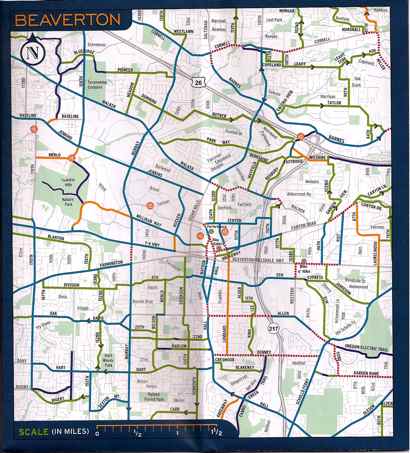
Jeff pointed out that for the first time ever, they’ve devoted a full section a small section on the back of the map to the city of Beaverton (about 8 miles west of Portland). Here’s a little sneak peak…

The other exciting thing about the map is that is substantially larger than before. A full fold bigger than the last one, it now lists more parks and background streets.
Jeff said the City received a lot of feedback about the lack of labels for background streets — side streets that aren’t officially bikeways and were not labeled on previous versions of the map.
For your copy of the new map, pick one up at a local bike event or bike shop, or visit the bike map page on PDOT’s website for downloads and information on how to request one.

