
It’s been two years since I first pointed out that Metro had made their awesome Bike There! map available for use with Google Earth.
This cool technology allowed you to get a 3-D, satellite photo view of Portland overlayed with the latest bike routes (and caution areas). You could do flyovers of your commute, explore and research new routes, and lots more!
The map was recently updated, so that meant a new file (Google Earth reads the .kmz file format) was needed to make it all work.
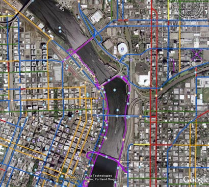
This morning, a reader (thanks Thomas!) forwarded me the new file and just a few minutes ago it popped up on Metro’s website. Below is another screenshot I snapped while playing with it this morning:

It’s easy to get this set up on your computer. Here’s how:
- Download the free Google Earth application onto your computer.
- Then download this .kmz file of Metro’s Bike There! Map.
- Open Google Earth on your computer, and then from within Google Earth, go to File > Open and open the “bike_there.kmz” file (that you just downloaded).
- Use the dashboard in Google Earth to fly over the region. Tilt, pan, zoom, play around and geek out all you want!
If anyone has questions, feel free to ask in the comments. Metro’s map guy Mark Bosworth reads the site and will likely check in and get you some answers.