

(Photo: Jonathan Maus/BikePortland)
Whether you’re just setting out and need help finding the best streets and paths to ride on, or if you’re a wily veteran who needs motivation to visit new parts of town — having a quality route vetted by a knowledgeable person is worth its weight in gold.
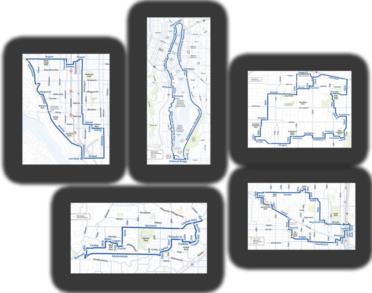
That’s why we’re so excited that the venerable Portland Bureau of Transportation has released a list of rides!
The five routes are all loops that take advantage of low-traffic streets, neighborhood greenways, off-street paths and bike lanes. They’ve posted detailed PDFs of each route. The maps are nice, but I thought a GPS link would be even better. So I went ahead and copied the PBOT routes into Ride With GPS so you can load it into your phone or device.
Here are the five routes with PBOT’s description, a link to the map, and a Ride With GPS link:
Advertisement

The Classic Waterfront Loop Ride

You’ll enjoy a scenic ride along Willamette River trails between the Sellwood and Steel bridges on this classic waterfront loop. START/END: Vera Katz Eastbank Esplanade trail behind OMSI (1945 SE Water Ave). 10.6 miles; mostly flat, paved trails.
– Map (PDF)
– GPS
The Art of Foster Ride

This ride is like a treasure hunt of more than a dozen vibrant murals and street paintings that dot the Foster-Powell area. How many can you spot? START/END: Portland Mercado (7238 SE Foster Rd). 5.6 miles; flat, some paved trails, pedestrian/bike bridge, short sections with bike lanes on busier streets.
– Map (PDF)
– GPS
Four Parks of East Portland Ride

This ride takes you on a tour of four East Portland parks and features the new HOP Greenway serving the Gateway District. START/END: Gateway Discovery Park (NE 106th Ave and NE Halsey St). 6 miles; flat, some paved trails, short sections with bike lanes on busier streets
– Map (PDF)
– GPS
North Greeley and Greenways Ride

This 8-mile North Portland ride offers a little bit of everything. Discover Neighborhood Greenways of Albina and Arbor Lodge, the Bryant St bike and pedestrian bridge, enjoy views of the river from Willamette Blvd, and squeal with joy as you ride downhill on the new protected bike lanes on lower Greeley. START/END: DeNorval Unthank Park (N Kerby Ave and N Failing St). 7.8 miles; some hills, sections with bike lanes on busier streets.
– Map (PDF)
– GPS
SW Multnomah-Vermont Ride

You’ll ride through the heart of the Hillsdale and Multnomah Village business districts, past Gabriel Park, and discover some Neighborhood Greenways in the quaint Maplewood neighborhood on this SW Portland ride. START/END: Hillsdale Library (1525 SW Sunset Blvd). 7.3 miles; some hills, gravel path, bike lanes on busier streets
– Map (PDF)
– GPS
These super fun routes have me all excited to get out and explore these places. See you out there!
— Jonathan Maus: (503) 706-8804, @jonathan_maus on Twitter and jonathan@bikeportland.org
— Get our headlines delivered to your inbox.
— Support this independent community media outlet with a one-time contribution or monthly subscription.