


An exciting evolution in the public process for the Salmonberry Corridor kicks off this week with two public open houses.

Walker Macy, the landscape architecture firm working with Oregon State Parks and the Oregon Department of Forestry to develop a master plan for the project, will unveil detailed design options under consideration for the first time. At the open house events, attendees will get to offer feedback on cross-section options, path alignment, location of trailheads, and more.
The project aims to create an off-highway path from the town of Banks in Washington County to Nehalem Bay and Tillamook on the Oregon Coast — a full 86 miles through a (mostly) abandoned railway corridor that winds through thick forests.
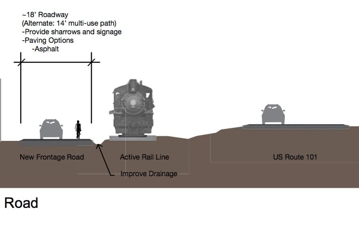
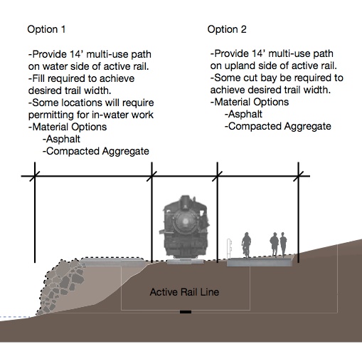
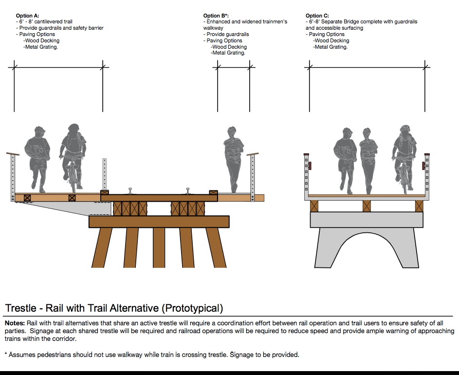
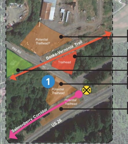
Below are more images taken from an excerpt of the “Plan Book” Walker Macy will share in its entirety at the town halls (download PDFs of Plan Book excerpts part 1 and part 2):


Advertisement


The master planning process began in mid-2013 and is expected to wrap up by November of this year. Once the master plan is complete, project backers can start looking for funds to implement it. For more information contact Oregon State Trails Coordinator Rocky Houston at (503) 986-0750 or rocky.houston@oregon.gov.
Here are the details on this weeks town hall meetings:
-
West End – Tillamook
Date: June 24, 2014
Time: 5:30 – 7:30 p.m.
Location: Port of Tillamook Bay, Officer’s Mess Hall (6018 Hangar Rd, Tillamook, OR)
East End – Banks
Date: June 25, 2014
Time: 5:30 – 7:30 p.m.
Location: Banks Fire Hall (300 Main St., Banks, OR)
— Learn more about this project in our Salmonberry Corridor archives.