

(Photos J. Maus/BikePortland)
This post is part of our special focus on east Portland this week.

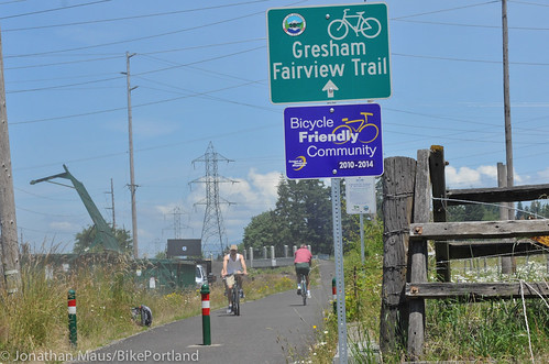
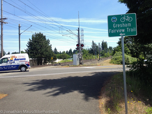
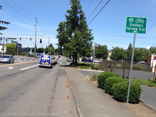
Besides the Springwater Corridor, outer east Portland’s marquee bike path is the Gresham Fairview Trail. Similar to the Springwater, the Gresham Fairview Trail was built on the bed of a former railroad line and treats riders to a (mostly) low-stress, carfree environment with views and access to natural areas.
Despite covering news of the trail for many years, I had never actually ventured out to explore it myself. With our special east Portland focus this week I figured this was the perfect chance to finally check it out.
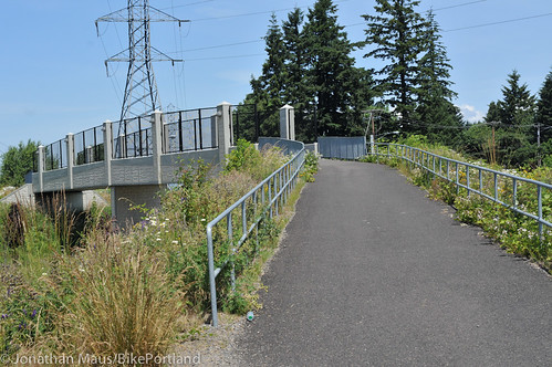
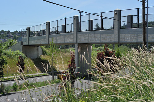
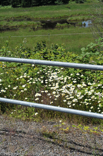
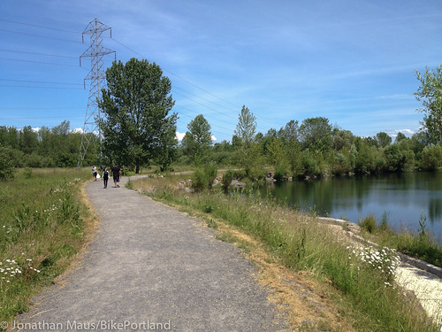
I got on the trail at its southern end, where it connects directly to the Springwater Corridor at SW 10th just south of Powell Blvd. The trail started with a flourish as I pedaled by a horse pasture and the open spaces full of wildflowers and natural ponds between Grant Butte and Southwest Park. As I pedaled north I crossed the wonderful new(ish) bridge over Powell Blvd and then stopped to fully take in the clear view of Mt. St. Helens.
Advertisement
 >
>
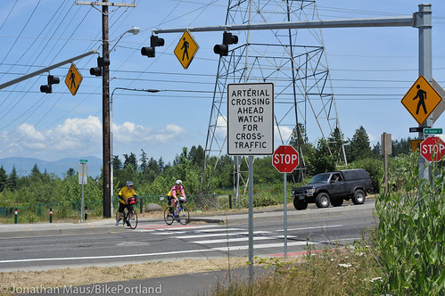
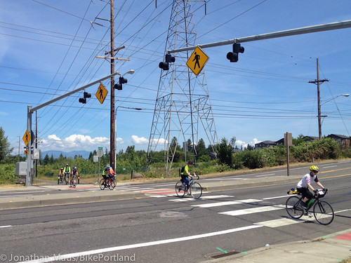
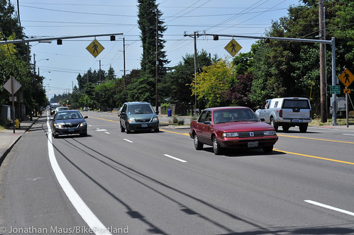
After I pedaled the winding path behind apartments and condos I came to the at-grade crossing of SE Division. As I observed traffic at this intersection for several minutes, I appreciated the bridge over Powell Blvd even more.
The first thing I noticed at Division was a huge sign that read, “ARTERIAL CROSSING AHEAD WATCH FOR CROSS TRAFFIC”. Then I heard what sounded like an angry Stormtrooper from Star Wars repeatedly imploring people over a loudspeaker to “Cross with caution, vehicles may not stop! Cross with caution, vehicles may not stop! Cross with caution, vehicles…”
The crossing itself has four caution signs warning drivers on Division about the path. There are also six sets of flashing lights activated by push-buttons. I ended up crossing with a group of several other riders and, as we listened to the loud Stormtrooper voice, one woman exclaimed, “Why would they not stop?!”
Well, as it turns out, some people simply don’t pay attention to what they’re doing. As I crossed I heard a loud bang on the street. Sure enough, someone driving on Division drove right into the back of someone else who had already stopped to let us cross.
All this stress and visual and audio clutter just to cross a street. Seems like it’d be much simpler and safer to just dig a tunnel under the road and be done with it. Sheesh!

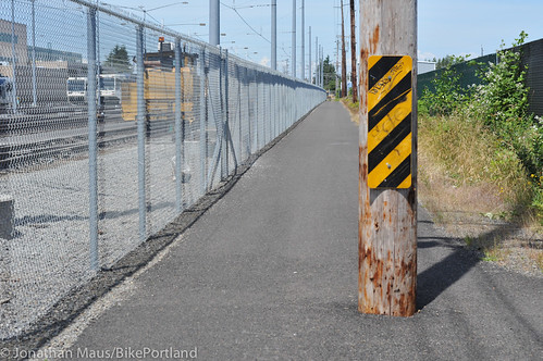
Continuing north I pedaled by TriMet’s Ruby Junction rail yard where the path butts right up against a chain-link fence. Just past the rail yard, I came to the first major gap in the path and was unceremoniously dumped onto a surface street (Birdsdale). Having never been on this path before, I wasn’t exactly sure where to go. There were signs (but no markings or facilities on the street at all) that directed me to go left on Burnside. After being on a carfree, paved path I was suddenly sharing a lane with auto drivers in the middle of traffic.
The master plan calls for, “a combination of wider sidewalk/pathway, roadway illumination, signing, bicycle loop detectors, pedestrian detectors, wide curb ramps, a high visibility ‘ladder’ cross walk and a curved path approaching the crossing.” Apparently I was supposed to use the south sidewalk of Burnside and then cross at a marked crosswalk a block or so to the west; but I just took the lane and found the trail again on my own.
 >
>

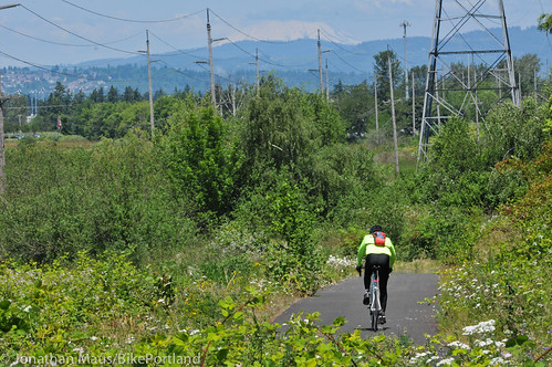
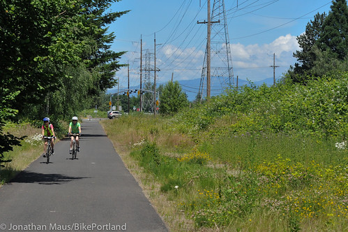
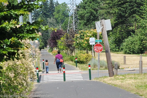
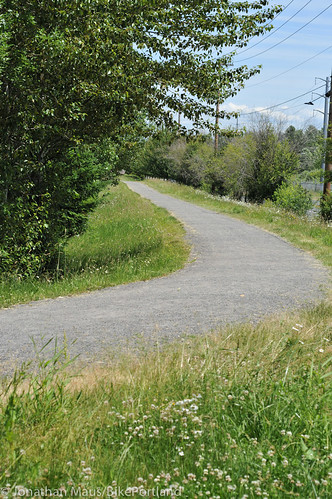
After Ruby Junction, the path heads straight north in a greenway/power-line corridor. This is a nice and quiet section with plenty of room to pull over and rest or have a picnic. The at-grade crossing of SE Stark wasn’t too bad, but a tunnel would be much better.
At Glisan I veered off the path to try and find the Salish Ponds Wetlands Park. Just a few blocks off the trail, it’s a shame there’s not a more obvious connection. There aren’t any signs (that I saw) and there’s no direct trail connection. I only knew the park existed because I saw it on Google Maps. Even the park’s listing on the Travel Oregon website makes zero mention of accessing it from the Gresham Fairview Trail.
The trail’s master plan (adopted way back in 2002) mentions that, “A trail connection could be planned through Reynolds Middle School connecting the two trails and could be constructed by the City of Fairview,” but that connection hasn’t been built yet.
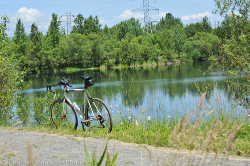
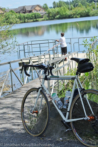
Even with lackluster access, Salish Ponds Park is well worth checking out. It’s got two large ponds and a bunch of gravel paths to explore. I saw several people enjoying the park, including teenagers fishing, walking with friends, and taking photos of wildflowers on their iPhones (a great sign of a park’s success in my opinion).

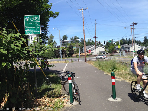
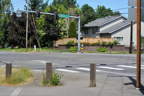
I then hopped back onto the trail and rode to its northern terminus at NE Halsey. The end of the trail was pretty disappointing. It just sort of dumped me onto Halsey (at 201st). The trail’s master plan calls for it to eventually connect to the Marine Drive Bike Path. That will be great, but today your best bet is to make a loop westward by hopping onto the bike lanes on Halsey continuing north across Halsey to the I-84 bike path, then take that east to 122nd.
The Halsey bike lanes aren’t great. Like almost all the bike lanes in east Portland, they’re just 4-5 foot curbside lanes (with nasty storm drains) next to several wide lanes of fast-moving traffic.

The Gresham Fairview Trail is a good asset in the regional bike network. It’s just too bad we don’t have more money and urgency to make it great. I realize it’s difficult to build these type of facilities because — unlike highways and transit projects — our federal government doesn’t have a dedicated funding program for them. But still, the first meeting for this trail was held in 1998. The master plan was adopted in 2002. And it’s still two miles short of its ultimate goal of reaching the Marine Drive Bike Path (not to mention the stressful crossings and the Ruby Junction gap).
Hopefully someday soon we’ll have stronger funding respect from the feds. In the meantime, stay tuned for ways to speak up and voice local support for this and other major trail projects.
— Read more of our special East Portland Week coverage here.