(All images by NACTO)
When it comes down to curbs and crosswalks, a great street is as much a product of design as a great mobile app: the process of moving safely through a city needs to be as intuitive as sharing a photo with your phone. If it isn’t, people won’t.
That’s why it’s exciting that a new urban street design guide has been getting big attention.
“The best street design also adds to the value of businesses, offices, and schools located along the roadway.”
— NACTO Urban Street Design Guide
Though it’s been harder to notice than the surge of biking and walking in U.S. cities, traffic engineering in the United States has also been changing fast, shifting away from the 1950 assumption that wide arterial streets are best used to move cars as quickly as possible and back to the traditional understanding that arterials are instead the logical places to attract lots of people and the commerce and culture people create.
The National Association of City Transportation Officials (NACTO) has been at the front of this movement by creating a series of guides that traffic professionals can consult for ideas about designing streets that are worse at moving many cars quickly, but better for people and for economic activity.
On Wednesday, NACTO announced that the Washington Department of Transportation, in addition to 23 cities including Portland and Seattle, has officially endorsed their latest product, the Urban Street Design Guide.
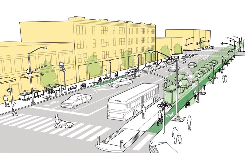
To get a sense for what these local governments and WSDOT have endorsed as good inspiration for their engineering teams, check out these neat images from the new guide.
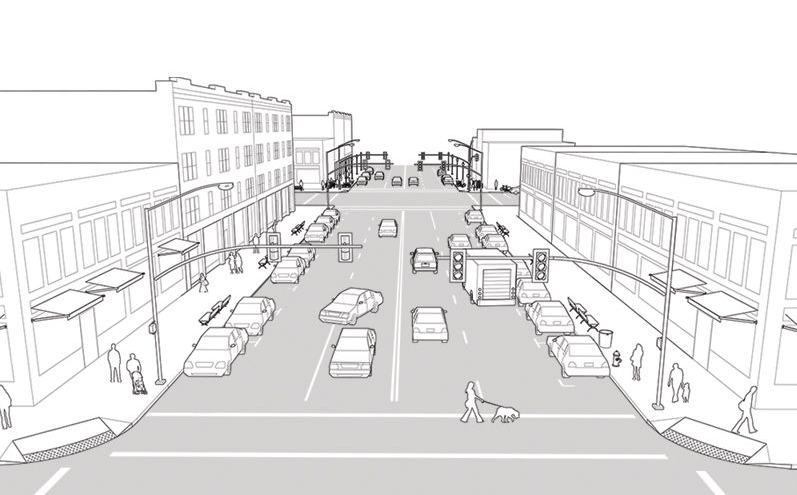
Here’s NACTO’s “before” picture of a “neighborhood main street,” which doesn’t look much different than Northeast Sandy, Southeast Foster, Southeast Grand or North Lombard:
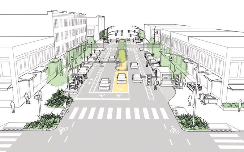
And here’s the “after” sketch. Check out the sharp corners, bump-out sidewalks, center turn lane, parklet, dedicated truck loading zone and of course the buffered bike lanes:
Here’s what the guide calls a “commercial shared street,” before changes:
…and after, with textured pervious pavement and public seating that communicate to people in cars that they should proceed with caution:
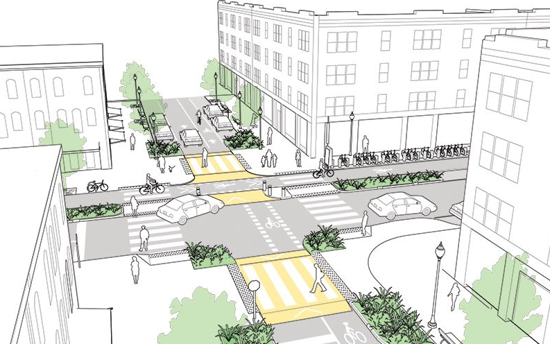
Here’s the “before” version of an intersection between a minor and major street:
And here’s the image after, with expanded sidewalks, raised crosswalks, bollards to guide turning cars, and a curb-protected bike lane:
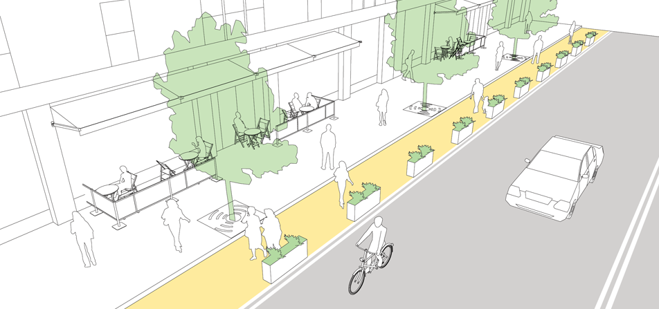
Can’t afford to move the curb between sidewalk and street? No problem, says the NACTO guide. Create an “interim sidewalk widening” by putting planters in the street:
Here’s one of my favorite insights from the guide: which of these two intersections is safer?
The intersection at the top doesn’t have trees that block lines of sight as a car approaches, so it might seem unsafe. But as the guide points out, removing them isn’t the only solution. By narrowing the intersection, as in the bottom picture, street designers are cuing drivers to slow down — something that improves their peripheral vision and makes them less likely to miss someone coming around the corner.
For people who, like me, spend most of their time on Portland’s relatively close-in east side, many of the “after” images in the NACTO guide are reassuringly familiar. The streets in Portland’s gridded neighborhoods could improve, but in many ways they’re a model for the NACTO guide’s ideas. We can be proud of that.
But it’s easy to forget that even in Portland and our neighboring cities, making more streets look like these is still highly controversial. Maybe that’s because people who use these streets understand the downside (it’ll take longer to go long distances in cars) but don’t appreciate the benefit (because pleasant streets lead to more development, you won’t need to travel a long way to get where you’re going).
Or maybe the problem is that even in relatively progressive agencies like Washington’s and Oregon’s, engineers and planners just aren’t questioning enough of their own habits and practices.
That’s why NACTO supporters are pushing to get as many states and cities as possible to follow WSDOT’s lead and officially endorse this guide.
“What is very surprising is not that they have done it but that they were the first DOT to do it,” Todd Boulanger, a local transportation consultant who often works in Washington, wrote in an email Wednesday.
The race for second place is on. Which state DOT will be next?

