
(Photos © J. Maus/BikePortland
This is part of ongoing coverage of the Green Lane Project/Bikes Belong Netherlands Study Tour.
Of all the cities I’ll visit on this trip, Rotterdam is the most comparable to a large American city. As such, the steps they’re taking to go from auto-dominated, war-torn, industrial city to a modern Dutch cycling paradise make for interesting observations.

The biggest parallel between an American city and Rotterdam is its modern urban form. Unlike every other Dutch city we’ve visited on this trip, Rotterdam is not defined by narrow, ancient alleyways, backstreets and quaint plazas. In 1940, German bombs flattened Rotterdam and destroyed all but a few of its buildings. In addition to social scars, those bombs forever changed the cityscape. Only a handful of buildings survived and the city was completely rebuilt in the 1950s.
Prior to the war the bicycle was by far the dominant form of transportation. In a presentation prior to a bike tour of the city yesterday, the City of Rotterdam’s Manager of Traffic and Transportation, Dr. Wim Hinkamp gave us a sense of how the war impacted bicycling. In 1939 the City counted traffic over just 13,900 cars and trucks and a whopping 77,900 “wielrijders” or people on bikes (not to mention 17,200 people on foot). There was so much bike traffic that the city gave wielrijders their own tube inside the tunnel to travel across the New Meuse river.
Hinkamp shared the image below of a bicycle traffic queue at the Willems Bridge before the war…

And here’s a 1942 sketch of the Maastunnel. The tube for bicycle riders is on the upper left…

But by 1947, the number of people who biked in the tunnel had dropped to just 25,000 per day (Hinkamp said many Dutch people had their bicycles forcibly taken away by the Germans). By that time the city was marching forward in a “modern” style that they thought would assure economic prosperity; and from a transportation perspective that meant the construction of massive motorways where cars would have top priority. In a presentation about the historical context of Rotterdam’s transportation system, Hinkamp shared with us that, “At the time, cars were the future.” Hinkamp called 1945-1965 the “age of explosion in cars.”
Like other Dutch cities, Rotterdam’s citizens rallied against an all-out embrace of automobiles. They also began to build cycle-tracks in the late 1960s. However Rotterdam had wide roads and a cultural connection to driving that was stronger than other Dutch cities. Because auto use remained convenient and encouraged (policy-wise), bicycle use in Rotterdam is far below its Dutch peers. Experts say their bicycle mode share is about 18%, compared with 38% or so for other Dutch cities (and about 50% in central Amsterdam).
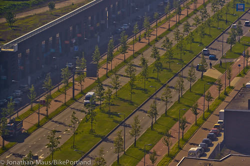
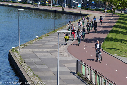
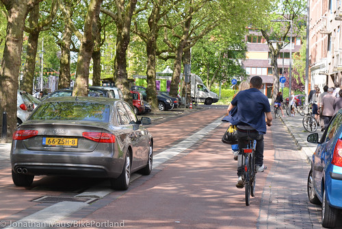
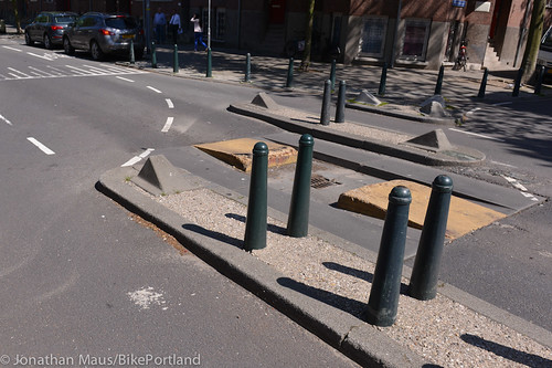
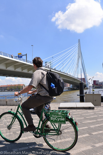
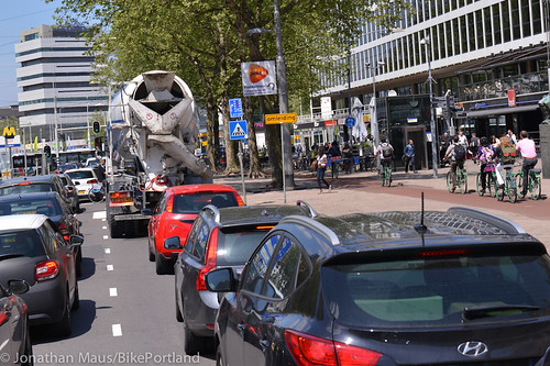
Rotterdam is also one of the largest harbor cities in the world. In the past few decades harbor-related activities have been pushed to the outskirts, leaving behind large roads that are being re-purposed into shopping and residential districts. During our visit I snapped a photo of Vierhaven, an old harbor road, from a window inside the City of Rotterdam headquarters building. It’s a gargantuan boulevard and Rotterdam city planners have designed it with two-way separated cycle tracks on both sides — that’s four lanes for bicycling! Check out the road’s massive profile…
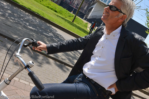
Slowly but surely Rotterdam is catching up to its neighbors with innovative bicycle projects and bold transformations of public space. The man behind many of these projects is City of Rotterdam Senior Designer Warner Beumer. Beumer, a sharp dresser with a wit to match, took us on a bike tour of several projects he designed.
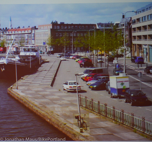
On Aelbrechtskade, a waterfront road in the New West part of town, Beumer seized an opportunity to create a waterfront cycle path where auto parking and a lane of auto travel once existed. Here’s the before shot…
And here’s how it looked when we rode across it yesterday…
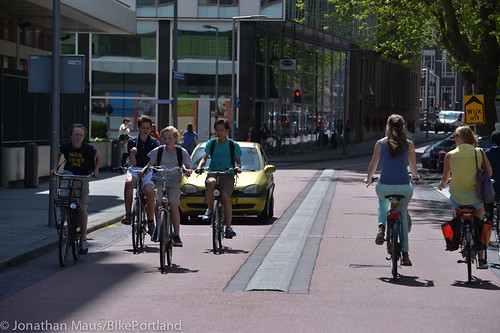
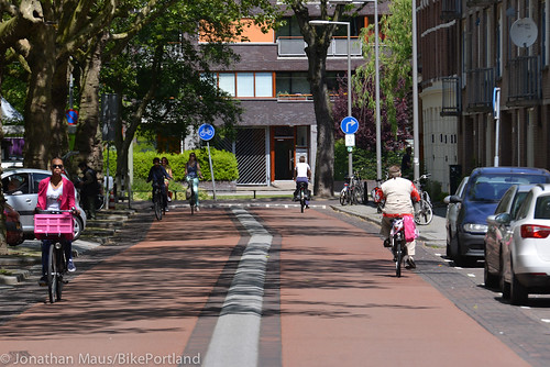
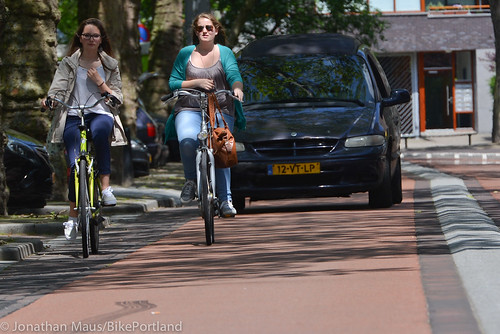
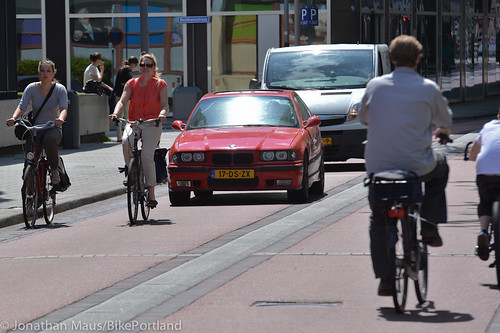
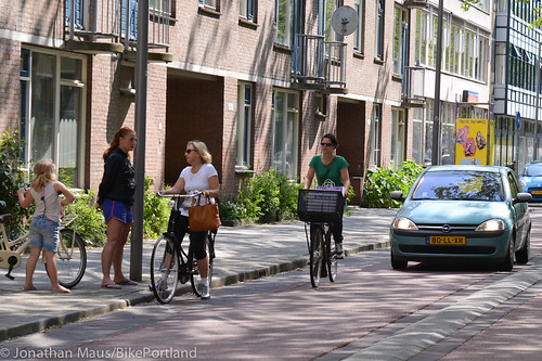
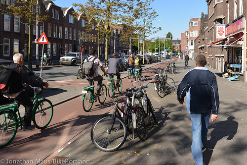
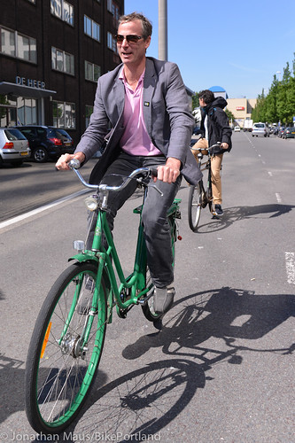
My favorite project Beumer shared was his “Bicycle Street” on Teilingerstraat. The sign at the entrance to the street says it all: “Bike Street: Cars are guests.”
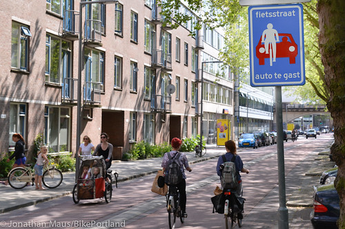
What was once a car-dominated environment, Beumer has transformed into a shared street where bicycles have priority. The profile of the street is two lanes with a median in the middle (that’s easy to roll up on). The surface of the street is red bricks (red is used for bikeways in the Netherlands) and it’s a 30 km/hr (18 mph) zone. It seemed to work very well while I observed it. People on bikes stood their ground in the lane and people would slow way when they drove up from behind. Many people simply drove slowly behind the bike riders. Others, if they wanted to pass, would just merge up and over the median, and into the adjacent lane to give the bike rider plenty of room.
Check out the photos below of the Teilingerstraat in action…

Transformations like these are partly why Rotterdam has seen bicycle use grow by 60% in the past 10 years, while auto use has remained flat. They’re not near the 77,000 daily tunnel riders they had in 1939 (current number is about 20,000); but they are moving the needle. “You have to do it slowly,” offered Beumer, “Or people won’t have time to adjust.” In the meantime, Beumer will remain in an envious position for city planners. He’s got the roadway space to, in his words, “Make it nice for everyone.”
— Read more coverage of my trip to Copenhagen and the Netherlands here.
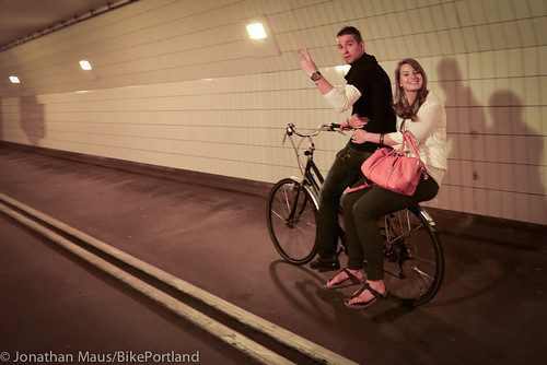
BONUS! Because it was such an interesting place, here are a few more images of our Rotterdam bike tour…


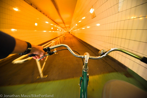
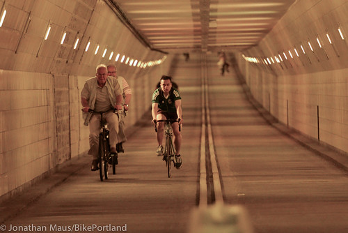
The Maastunnel was built during the Nazi occupation and it’s still a key river crossing. You take an escalator down and then pedal through a cool corridor to the other side…

More photos in the Rotterdam gallery.