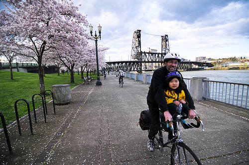

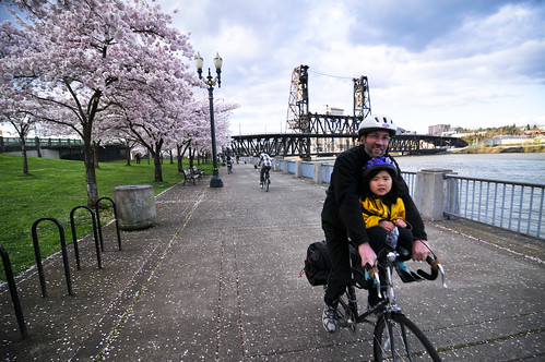
(Photo © J. Maus/BikePortland)
We’ve covered Oregon’s innovative State Scenic Bikeway program since its inception back in 2008. The program has flourished since the Willamette Valley Scenic Bikeway opened for business in 2009. With the economic boost that comes with opening up to bicycle tourism, public and private agencies across Oregon are clamoring to have a route designated in their town.
Today there are nine official State Scenic Bikeways and they are all focused on rural areas. Now a group of Portland advocates is promoting the idea of an urban route that could turn the program in a new direction.
The route, which one of its backers shared with me yesterday, would simple be the tried and true Steel Bridge to Hawthorne Bridge loop via the Eastbank Esplanade and Waterfront Park multi-use paths. Almost anyone that has ridden in Portland has been on some portion of this route.
Backers of the Portland Scenic Bikeway (not the official name) say the route is full of interesting vistas and is especially great for families and kids — something that can’t be said of many of the existing routes. “Scenery doesn’t just mean streams and trees,” is how the project backer explained it to me (he’d like to remain anonymous until an official route proposal is made).
If chosen, a State Scenic Bikeway in the heart of Portland’s bikeway system could have awesome potential. What if the route was ultimately expanded down the Springwater to Oaks Park and/or onto surface streets downtown or on the central eastside? It’s important to remember that there is no capital construction element to the Scenic Bikeway program. Beyond a few wayfinding signs, the routes are strictly honorary designations. But what it would do is provide greater marketing and promotion of the route, it would be a way to find business partners along the route that would assist in the accompanying route management plan, and it could give a small amount of leverage to advocates pushing for improvements. For example, it could give urgency to closing the “Springwater Gap” between OMSI and the Ross Island Bridge, and it might give advocates more reason to call for expansions to the existing path in waterfront park.
This route has not been officially proposed yet because Oregon State Parks (the agency that oversees the program) isn’t open to new applications at the moment. The next open call for routes is expected this spring. We’ll keep you posted as this idea progresses. In the meantime, it would be great to hear your feedback.