
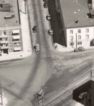
(Photo: City of Portland archives)
The notorious Broadway/Flint/Wheeler intersection has been getting a lot of attention lately. Just today I rolled up on PBOT traffic safety staff and engineers observing the new partial closure of Wheeler, while a PPB officer talked with Paramount Apartments owner Betsy Reese. In addition to the closure, the Portland Bureau of Transportation (PBOT) has followed through with promises to business owners in the Lower Albina district by removing several on-street parking spots to make it easier for large trucks to turn in the area.
But a lot of work remains to make this area hospitable to all road users. It’s a mess and the addition of the new streetcar line — set to open later this month — will only add to the traffic safety issues.
While we continue to think about this intersection, and PBOT and ODOT continue to tinker with it, I thought it’d be fun to share a historical perspective. A reader recently shared a post on the Vintage Portland blog that featured this intersection as it looked in 1940. Check it out below…
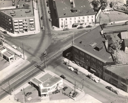
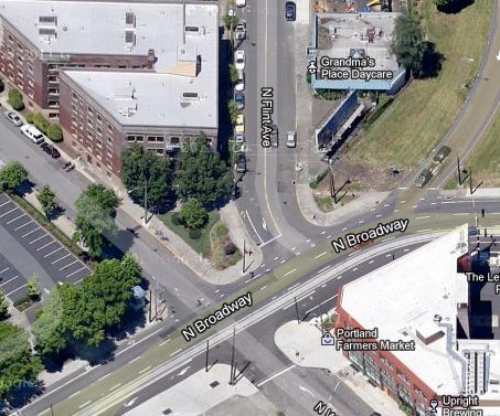
The building in the upper left is the Paramount Apartments, and of course the street in the upper middle of the image is N. Flint. Today, there’s a median island that stretches from the apartments all the way to Broadway, forming a peninsula bordered by Flint, Broadway and Wheeler. Compare the image above with the view today…
Given all the change that’s coming to this area (the streetcar opens later this month and ODOT/PBOT would like to spend $400 million to widen I-5 and make other changes), I’m sure this intersection will look a lot different in another decade or so.
Stay tuned.