

Recently in the forums the discussion turned to Westside commute routes. A user named “nborders” mentioned his daily commute up and over the Sylvan hill and down into Portland.
When someone asked him for more info, he posted a detailed description and even made a series of route maps using aerial photos of the area with hand-written notes and tips.
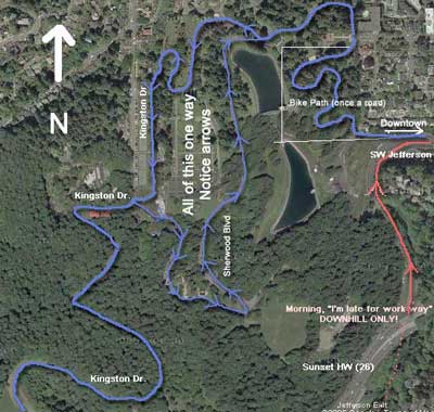
[One in a series]
Imagine what a tremendous resource it would be to have hundreds of these maps, complete with comments, recommendations and tips from riders. Online bike route planning and home made maps like these will soon be commonplace.