Download PDF (420kb)
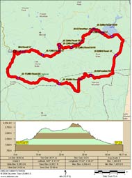
After my previous post about my ride up to Timothy Lake (SE of Estacada) I’ve had several emails from readers wanting more specific route details.
Well, it just so happens that one of the guys on the ride is a real map lover and owner of some topo mapping software. He did me a huge favor and sent me over a nice PDF of the route along with an elevation chart.
Click. Print. Ride.

