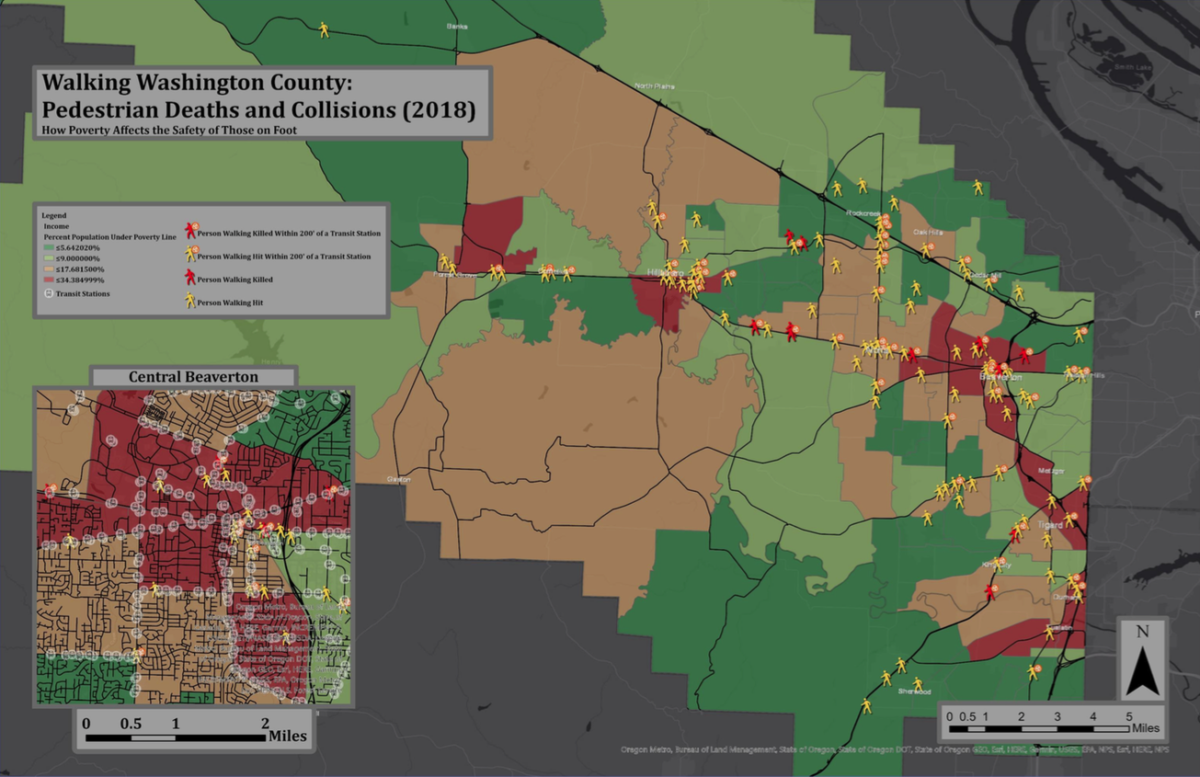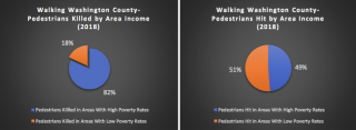
Oregon State University student and community activist Benjamin Fryback (@bfryback) has added his voice to the chorus of safety advocates who would like more complete data about pedestrian crashes. Fryback analyzed pedestrian crashes in Washington County for his “Geospatial Information and GIS” class. Using publicly available datasets on income, race, ethnicity and transit stops, his visual analysis and simple calculations suggest a correlation between poverty rate and crash severity, with pedestrian crashes in high poverty areas disproportionately resulting in fatality.

He also notes that in the urban areas of downtown Beaverton and Hillsboro more pedestrians are hit, but that relatively fewer of these crashes are fatalities. However, “It is difficult,” he writes, “to determine what this can be attributed to, as Washington County fails to maintain even the simplest of GIS databases on the roadways within their jurisdiction.” He adds that entries in the CrashData datasets are often incomplete and can be missing key information such as speed limit, lane count and conditions. Moreover, it is estimated that non-fatal crashes are only reported between 44 to 75% of the time, this underreporting confounds crash analyses. Readers might remember that Oregon Walks made several recommendations about crash reporting in their Fatal Pedestrian Crash Report which came out earlier this year.
Advertisement

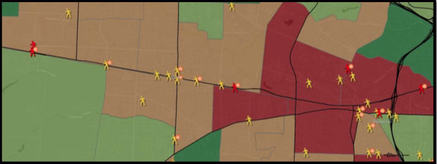
To get around some of this missing information, Fryback employed the lower-tech solution of looking at crash sites. For example, he determined that the four people killed walking on Tualatin Valley Highway were all within a block of a transit stop, and that three of them lacked nearby traffic lights.

These deaths in particular caught my attention because a couple years ago I could have easily been one of those tiny TV Hwy red people in Fryback’s graphic. I had taken the MAX to pick up my car from the body shop. Instead of following everybody else (who it turns out were taking a skewed path to the only nearby traffic light) I headed straight for TV Hwy only to arrive at the edge of the road with no place to cross, the nearest light seemed about a quarter mile away. At the time, I was recovering from a broken leg and arm. I was also 58 years old, and overweight.
Do you know I considered making a dash for it? with everything I know about pedestrian traffic deaths, and using a cane? My auto body shop was just across the street. Then a little voice whispered, “Lisa, you are about to become a statistic.” I listened to it, and instead phoned the car people, who drove over and picked me up. It’s not that hard to misjudge these streets, especially as you get older–or perhaps it’s your own abilities you misjudge.
Fryback, who grew up in Hillsboro, is a Civil Engineering major and would eventually like to work for a municipality on equitable transportation infrastructure. This summer he is getting valuable work experience as a summer intern for the Shoalwater Bay Tribe.
Thank you to Benjamin for doing this important work!
[pdf-embedder url=”https://bikeportland.org/wp-content/uploads/2021/08/Final-Writeup-BP-Final.pdf” title=”Final Writeup-BP Final”]
— Lisa Caballero, lisacaballero853@gmail.com
— Get our headlines delivered to your inbox.
— Support this independent community media outlet with a one-time contribution or monthly subscription.

