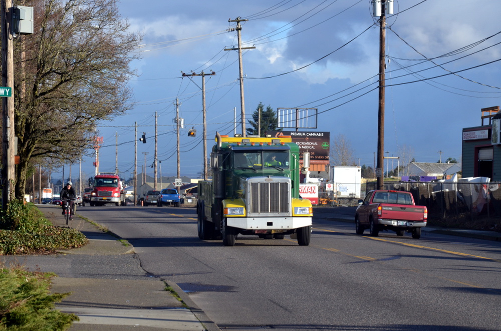
(Photo: Michael Andersen/BikePortland)
The Portland Bureau of Transportation has launched the Columbia/Lombard Mobility Corridor Plan.
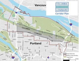
(Graphic: PBOT)
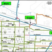
If it succeeds, the plan could hasten development of infrastructure projects that expand biking, walking and transit access to major destinations like the Portland International Airport, Oregon Humane Society, and Cully Park, as well as tens of thousands of industrial, middle-wage jobs in the corridor. The outcome of the plan will be to create a prioritized list of projects for future funding and develop a safety strategy.
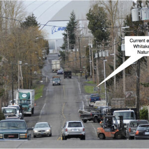
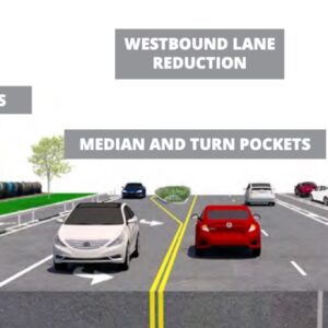
Currently, NE Columbia Blvd and NE Lombard St between I-5 and I-205 are wide, dangerous, high-speed, arterials. They are incomplete, outdated streets that serve only people using cars and trucks. With better transit service, protected bike lanes, safer crossings, and other updates, Portland could unlock massive benefits that will help us reach our safety, public health, transportation, equity, economic development and climate change goals.
According to the plan’s website, over the next 18 months PBOT and an advisory committee will, “Identify, develop, and prioritize improvements that would make multimodal transportation and freight movement safer and more efficient along the corridor.” Metro’s Regional Transportation Plan has already identified this area as a “mobility corridor,” which is supposed to “function well for all modes of transportation”. If you’ve ever tried to bike or walk in this area, you know we are nowhere close to meeting that standard.
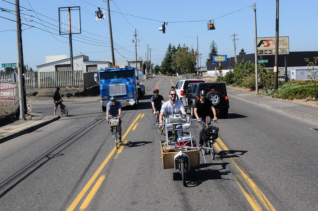
(Photo: Jonathan Maus/BikePortland)
Advertisement
The good news is PBOT seems to already have a solid handle of the problems that currently exist. Here’s what they’ve listed on the plan website:
A lack of separation between modes, outdated roadway designs, and sub-standard infrastructure have led to major safety issues on both Columbia and Lombard. Both streets are on the designated Vision Zero High Crash Network because of high crash rates, especially those involving motor vehicles.
The pedestrian and bicycle networks have major gaps and deficiencies and transit service is currently very limited, which means most commuters or visitors are reliant on personal vehicles that add to traffic congestion and increase cost of living.
Residents of nearby neighborhoods in Northeast Portland have difficulty accessing jobs, parks, and services in the area due to widely spaced and difficult connections across the corridor.
Proposed TriMet bus service on Columbia Blvd would be difficult to access because the street currently lacks adequate pedestrian facilities, crossings, and connections to employers.
At-grade railroad crossings, sub-standard over-crossings, missing connections and signals, and traffic bottlenecks have led to growing concerns about freight mobility and access in the corridor.
The lack of traffic management systems means that freight operators and personal drivers alike do not have adequate information to respond to congestion issues and choose the most optimal routes.
The corridor does not currently have a clear system of mode-specific treatments that would prioritize freight and transit over single-occupancy vehicles.
While the dire need for safe active transportation infrastructure is obvious, this plan will also be pulled in the direction of improving freight movement. The Columbia Corridor Association (CCA), a 501(c)6 nonprofit business association, is a major power-broker that will be paying very close attention to the outcomes. This plan is a good chance for us to show it’s possible for freight and active transportation to co-exist — and even flourish — together.
The CCA’s boundary includes what they claim to be 2,500 businesses and 65,000 jobs. With around 40 percent of those employees living five miles or less from their jobs, there’s massive potential to reduce single-occupancy driving.
During our “Gap Week” coverage in 2016 we identified several gaps in this area and reported how, if closed, more people from the Cully area could access jobs, Marine Drive, ride to the Portland Airport, and more. We also lamented the lack of safe bicycle access around Cully Park (which is sandwiched between Lombard and Columbia) when it opened in summer of 2017.
Imagine a bicycle highway on NE Lombard between Martin Luther King Jr. Blvd and the I-205. Hopefully this planning process won’t be afraid to think outside the box.
For more information, check out the plan on PBOT’s website.
— Jonathan Maus: (503) 706-8804, @jonathan_maus on Twitter and jonathan@bikeportland.org
Never miss a story. Sign-up for the daily BP Headlines email.
BikePortland needs your support.

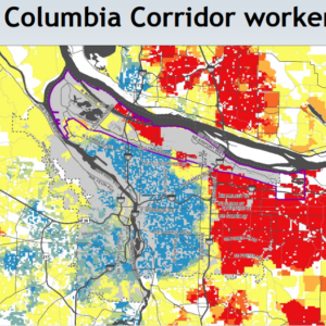
…The Columbia Corridor is the single largest industrial area in the state of Oregon.-It covers 22,600 acres or 28 square miles. The Corridor stretches over 18 miles along the Columbia River from the Rivergate Industrial District on the Willamette River to the Troutdale Industrial District on the Sandy River and north of Columbia Boulevard/Sandy Boulevard and I-84. And a slough runs through it…
This study will be a great start to connecting people and jobs to the Columbia River Corridor complex. I’d like to see the study cover the entire corridor within the city limits and even partner with Gresham, Troutdale and Fairview to expand it further while promoting active transportation options.
IMO the City of Portland is being short sighted with this project and should start working from the eastern city limits toward the western edge of the corridor. The eastern portion of the corridor has the fewest North/South active transportation options than the western portions and subsequently could decrease auto dependency if safer options were available.
I believe Gresham is also doing a plan looking at north/south from Clackamas Co. to Columbia Corridor. There is also a couple of transit connectors in the works to help connect people to jobs in the corridor. Lots of opportunities!
https://bikeportland.org/2016/01/29/gap-week-cully-columbia-and-alderwood-to-portland-airport-173594
As noted in a previous posting, the highest percentage of workers in the corridor live in East Portland. Yes, transit options are on the table, but active transportation infrastructure would certainly be a plus.
When we were working on the EPIM in 2012, the Planning Bureau had a report about where city residents in different parts of the city worked. Basically, if you lived west of I-205, there was an extreme probability you worked in or around downtown (pill hill etc). If you lived to the east, then there was a very high probability you worked along a sliding scale of: the Columbia Corridor, Swan Island, Gresham, Clark County, Clackamas County. Only about 6% of EP residents worked downtown. Trimet’s passenger numbers reflected this reality, and it still does. They get it. So does the various business associations that serve the industrial corridors.
Some of the city planners were (and probably still are) very resistant to the idea that anyone wouldn’t commute to work downtown – they didn’t believe their own data. And of course PBOT was in full denial mode – the idea that a cyclist might want to ride directly from East Portland to a job on Columbia Blvd without first riding all the way downtown was unfathomable to both the staff at PBOT and most of the representatives on the Bicycle Advisory Committee, not to mention most readers of this blog.
From the photo it looks like the trucker driver honking at the cyclists was hauling gas to keep the petro jalopies chugging along on their mission to wreck the climate and spread mayhem on the streets. I think karma will have something to say about this one day.
I really don’t think that is their mission. It might be an externality, but that is not why they were created.
The plan should include the whole of Columbia Blvd and Lombard to St. Johns. The fact that Lombard from I-5 to St Johns is a “state highway” is a dangerous joke and needs a comprehensive approach to resolving the traffic flow and facilitating the long term vision for mass transit.
An actual sidewalk would be a good start on Columbia.
the few existing stretches of sidewalk are mostly non-compliant, including the one in front of my shop. Our landlord fears doing anything that would trigger sidewalk improvements partly because he fears ( and he may be right) that it would force very expensive stormwater management improvements that he would be forced to pay. I would love to see enforcement of and improvements removing obstacles to use where the paltry sidewalks do exist.. such as forcing Davey Tree Service at 58th or so to cut the English ivy that covers most of the sidewalk.. and mailboxes with mounts that jut back to catch unsuspecting sidewalk users with angle iron at chest level. Pedestrians and cyclists are the last considered on this stretch.
I sure hope this includes fixing pedestrian access between Kenton and Woodlawn along Lombard.
The I-5 exit and on ramps along Lombard are just accidents waiting to happen.
Accidents might be an externality, but waiting on accidents is not why they were created.
Any update on the improvements planned for NE 47th between Columbia and Cornfoot [to the North]? Heard about the plans for sidewalks and bike lanes a couple of years ago, and with the new Post Office going in, I was hoping this was ‘coming soon’.
I use this portion of 47th often, and it is quite dangerous for peds and cyclists … and motorists! And workers near the street – especially the pallet folks.
Yes! I have been wondering the same thing. According to PBOT’s web page the project has been pushed out to this spring/summer. I use this to get to my office on Airtrans way.
I avoid this area at all costs on a bike. It’s also a defacto North Portland Highway to get from I-5 to I-205.
A safe way for VRUs (particularly children) to get from the fairly dense neighborhoods off Cully Blvd. to the new Cully Park would be great. If you’re in the area of Killingsworth and Cully around the time the school buses are getting out you’d be amazed by the sheer number of school age kids living in the area. The new park is fantastic and it should be a priority to ensure that people in this community can safely access it.