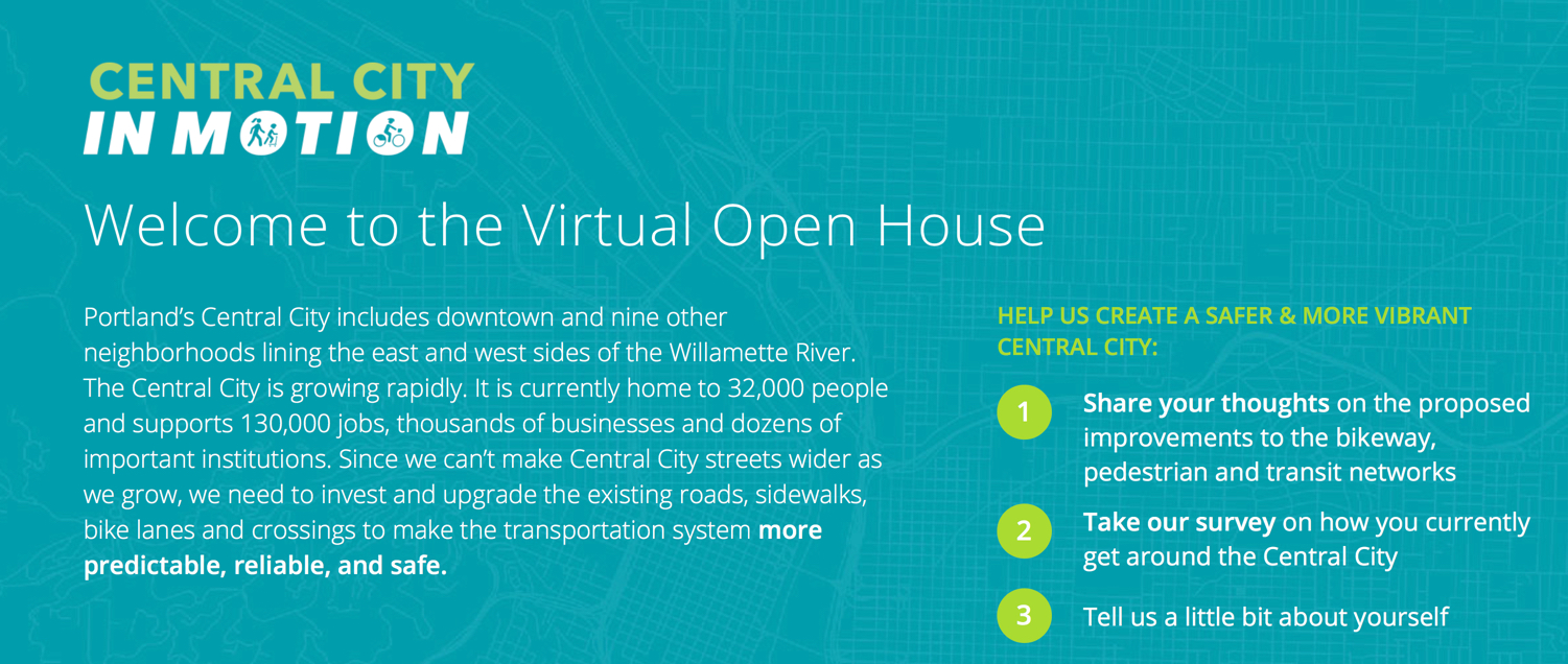
After years of planning and plotting and delays, the Portland Bureau of Transportation is ready for public feedback on their $8.4 million project to update central city streets. Today they launched a virtual open house for their Central City in Motion project.
What began as an effort to create a network of protected bikeways downtown and in the nine other neighborhoods that straddle both sides of the Willamette River, the planning has expanded to include a more holistic approach that will aim to make streets safer and more efficient for bike riders, walkers, truck drivers and transit users. “Since we can’t make Central City streets wider as we grow,” reads a statement posted on the virtual open house site, “we need to invest and upgrade the existing roads, sidewalks, bike lanes and crossings to make the transportation system more predictable, reliable, and safe.”
And if you think this is just another planning process that won’t result in anything being built (a very reasonable perspective, given Portland’s history), the CCIM is already funded and PBOT is ready to implement whatever projects come out the other side. As for what projects make the cut…
The city knows not everyone will be happy with the changes required to significantly change how we use our roads. They’ve framed the project in terms of tradeoffs required to make it happen:
“By 2035, the Central City’s population is projected to triple and the number of jobs will increase by 40 percent. Adding lanes to Central City streets would require removing parking or acquiring new right-of-way. Acquiring right-of-way in the constrained, developed Central City isn’t feasible, and removing parking for travel lanes is not consistent with City policy or priorities. Because we need to move more people in the same amount of space, Central City in Motion is focused on improving conditions for people walking, taking transit and biking.”
That line about how removing parking isn’t consistent with city policy is a bit strange. Hope that doesn’t mean parking removal is off the table. We’ve asked for a clarification and will update this story when we hear back. (UPDATE, 8:20 pm: Project Manager Gabe Graff said that line is a mistake: “Yes, sorry for the confusion. This is supposed to say that removing parking for the sake of additional *single occupancy vehicle* travel lanes isn’t supported by Central City policy.”)
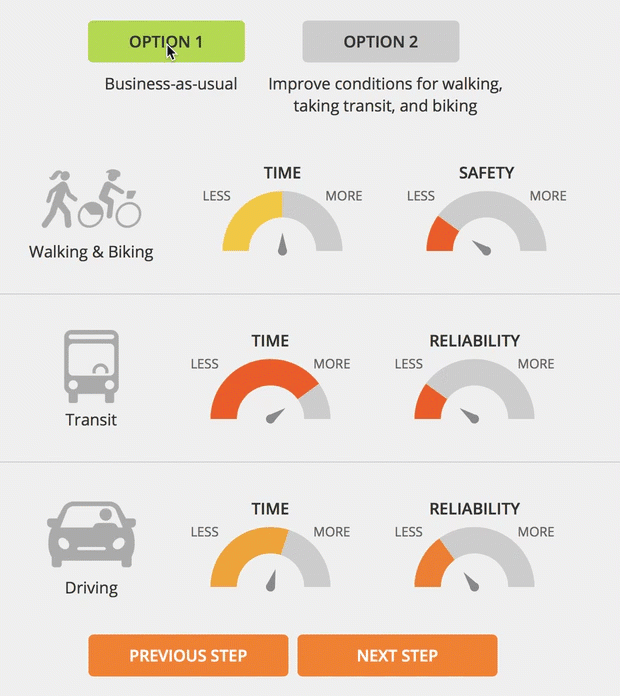
There’s also a nifty dial graphic that shows how each type of travel method will be impacted once the streets are redesigned.
Advertisement
The open house then allows people to dive deeper into how the project will impact biking, walking and transit.
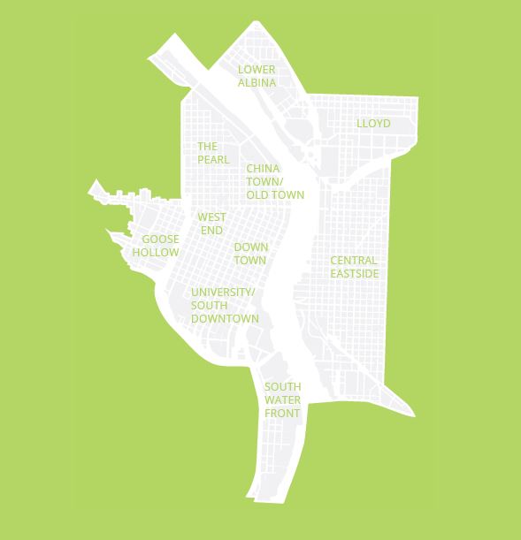
On the biking end of things, PBOT’s goal is to identify a network of streets that will, “provide a functional bikeway system that is cohesive, direct, safe, comfortable, and implementable within 5 years.” The open house has a great map tool that allows you to see where existing bikeways are and where they’re being considered.

(Source: PBOT)
For walking, the project promises to, “make streets in the Central City safer for walking and rolling by making crossings safer and improving access for people using mobility devices.”
(Source: PBOT)
And for transit users, the city says we can expect the project to, “Identify locations in the Central City where our busiest buses get stuck in traffic and then identify investments that can make taking the bus faster or more reliable.”
(Source: PBOT)
There’s also a survey that asks questions about how you use the Central City.
Check it out at CentralCityinMotion.com.
— Jonathan Maus: (503) 706-8804, @jonathan_maus on Twitter and jonathan@bikeportland.org
Never miss a story. Sign-up for the daily BP Headlines email.
BikePortland needs your support.


“removing parking for travel lanes is not consistent with City policy or priorities”
Really? That’s a blanket statement?
yes that stood out to me as well. looking into it.
It may relate to the original CEID plan from the previous century.
(UPDATE: Project Manager Gabe Graff said that line was a mistake: “Yes, sorry for the confusion. This is supposed to say that removing parking for the sake of additional *single occupancy vehicle* travel lanes isn’t supported by Central City policy.”)
The map seems to be saying that the streets highlighted in red are OK and no changes are being considered. Most of those streets are acceptable, but Ankeny, an unprotected greenway with an unprotected crossing of a major arterial (Sandy) is included. Disappointing.
Quite a few people have already commented on exactly this issue.
It does say “existing and funded” so I think this includes cases in which it’s not built yet, but it’s funded to be fixed. I don’t know if that’s true for this specific case but it’s a possible interpretation.
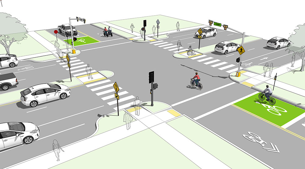
Why does the image “Safer Crossing Example” have a Prius parked squarely on top of a bike lane, on the lower left?
Yikes! Because that is what will happen?!
Plus a door zone bike lane on either side of the intersection. I guess relative to the door zone, the intersection is relatively safe.
Because it is a Prius?
Progressive Privilege 🙂
must be an Uber/Lyft
With all due respect to the staff working on this, it’s not at all clear to me what this open house is designed to achieve. After 8 years of work council is almost set to adopt the Central City 2035 Plan and the associated amendments to the Transportation Systems Plan. That plan lays out all the transportation projects that the city hopes to achieve in the next 20 years:
https://www.portlandmaps.com/bps/mapapp/maps.html#mapTheme=cc2035TSP
The CCIM open house seems to invite people to add more projects by giving them the opportunity to draw new routes on the map. When people add in new projects that aren’t in the TSP is the city really going to consider scoping new projects and amending the TSP again? Or are they just going to ignore those comments?
I think this is a shame, because the CCIM project has a lot of big decisions to make by the summer. If the goal is to develop a set of project that can implemented in the near term, why not let the public know what the trade offs are, and then let them weigh in? Back in December the project had already identified families of choices:
https://www.portlandoregon.gov/transportation/article/666579
As an example, the TSP has bikeways on both Salmon/Taylor and Jefferson/Columbia, connecting Goose Hollow to the waterfront and the Hawthorne bridge. Knowing that it’s unlikely that both projects will be built in the near term, why not let people weigh on which would be most useful if only one is built?
How should we deal with bus / bike conflicts on streets that are used by both (left side bike lanes? floating bus stops? or—shudder—combined bike / bus lanes?)? Should the city lay out an entire network as soon as possible, using paint and plastic wands, or should it build higher quality facilities more gradually? Where we’re adding bike lanes does it make more sense to remove parking or vehicular lanes?
Looking at the project website it looks like the two committees are already dealing with these questions. It’s too bad the extremely knowledgeable population of Portland wasn’t asked to weigh in on these in a meaningful way.
This seems to be setup similarly to what Southwest in Motion (SWIM) has been doing, though it doesn’t really apply as much to downtown. Unlike southwest, there are plenty of connected streets downtown with a simple topography and fairly consistent widths. PBOT should take an idea from Calgary, do some movable implementations of a key network of bikeways in the next 5 *months* with movable curbs and barriers, adjust as necessary, and then pour concrete based on what works.
PBOT already has data on where people on bicycles use streets most. Physically separate these as in the comment above as an interim trial and pour concrete when it works.
Portland does NOT need more planning as Mac above suggested. We have years of precedent on what people want. Pland needs protected bike lanes, not more redundancy on where they should go. PBOT and the city can reference the TSP. Instead of providing comments on where bike/transit lanes should go, please tell them to act.
I think the issue is that $8 million or whatever it is isn’t enough to build the whole shebang so they’re trying to get feedback on what to build first.
Well said! 100% agree with this comment! I had a fair amount of confusion about the virtual open house when I looked at it today. It seems to be a map that just shows streets (blue lines) that could potentially be improved and some streets that will see some improvement (red lines). Everything is all very vague, general, and has no clear definition or committment.
It’s strange that after 2 years of public outreach, we are still bring presented something that basically says “we hypothetically can do something to these streets (the blue lines), but we don’t say what it will be or how much of any given street will be improved”.
thanks for the comment iain. flagging this for comment of the week.
Yet another survey that assumes you use only one mode “primarily”. I use a lot of different modes, depending upon the length of trip, how I’m feeling, convenience, weather, etc. Apparently PBOT pollsters are not human. Which explains a lot about PBOT, of course.
I thought the same and sent an email directly to Dylan Rivera. The survey also asked me why I travel to the central district or whatever they called it. “I live there” wasn’t an option. Surveys in general make me bonkers because they are so often terrible. This one didn’t break that mold.
It feels like the city after years of invitation-only, public-not-invited meetings has decided what it will do, and is now just going through the formality of pretending to hold an open house.
Not even a real open house, merely a “virtual open house” aka inviting the public to view some pictures on a website and fill out a survey. The project can check the “public input” box and move on.
This is very disappointing. Tens of thousands of Portlanders will be riding and walking on these streets in the coming years. Only a few dozen Portlanders will have had any real chance to influence staff in the planning process, and only a handful of them will be among those who actually depend on pedal and foot to get around.
It seems like any time there’s something that may be controversial, or something that’s already really been decided, the City (or County, or whomever) holds an open house rather than a meeting. That way, the City can present its views to people, and people attending have no way to hear other viewpoints (and those with other viewpoints have no way of communicating to others).
I don’t know how many times I’ve gone to an open house, heard the spiel by the staff person standing at their foamcore board chart, then told them why everything they said is wrong, and had them agree with me, only to then stand back and watch them tell person after person following me the same spiel that they’d just admitted was wrong.
How dare they try to collect public feedback!
Will you please reconsider, JM?
Not to worry, people!
The house is “virtually” open.
And Leah is having more “courageous conversations.”
Yawn… Another feel-good public information campaign masquerading as a survey.
I have about ZERO faith anything will come of this but more rationale for their preselected favorite outcomes.
If anyone was listening to the public, we would have never ended up with the mess of N. Williams/Vancouver, Tillicum Crossing, I-5 widening through the Rose Quarter, the Sellwood freeway- oops Sellwood Bridge, and almost: CRC… among others. All were necessary and noble projects that became highly unpopular in the final form but built anyway in the face of withering public protest.
All were blatant abuses of the public’s trust in public engagement. Anyone participating at this point is just wasting their time for the benefit of PBoT public relations interns running this survey.
Just stop with the sham of a public process and just do what’s needed and is scientifically proven to work rather than pretend anything we say matters. The added benefit, of course, being they would not have to pretend to serve all masters.
People hate the Tilikum Crossing?? This is news to me.
I don’t use it myself, but it’s not unusual to hear complaints that the east end (on land) is overblown, and the high cost. I think at least some people also view it as an expensive monument to misplaced priorities whose budget could have paid for other, more needed projects.
imo, from an active transportation point of view, it ranges from OK to terrible. certainly not world class.
Installation of new RRFB’s have been suspended by the Feds. What now?
http://www.tooledesign.com/resources/news/information-fhwa-rescission-interim-approval-rrfbs
Untrue.
Use of a specific manufacturer’s product has been suspended due to a policy of not recommending patented items (the patent claim is sketchy).
The easy work around is to use a different shape (not rectangular) and a random flash pattern, and many jurisdictions have already done this.
A better fix would be to install red-amber-green 2-way signals, like in front of fire stations, at such crossings so that cars would be legally required to stop, at a slightly higher cost. The RFBs are not legal stops.
Install facilities that aren’t useless?
Why does it take 7-12 (or more) years to build cycling infrastructure when other road fixes can literally be implemented in weeks to months?