(Photos: J. Maus/BikePortland)
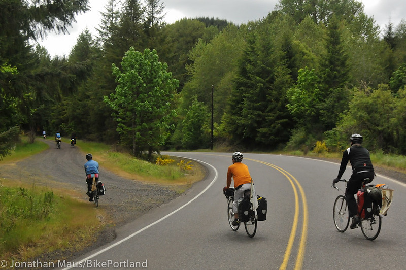
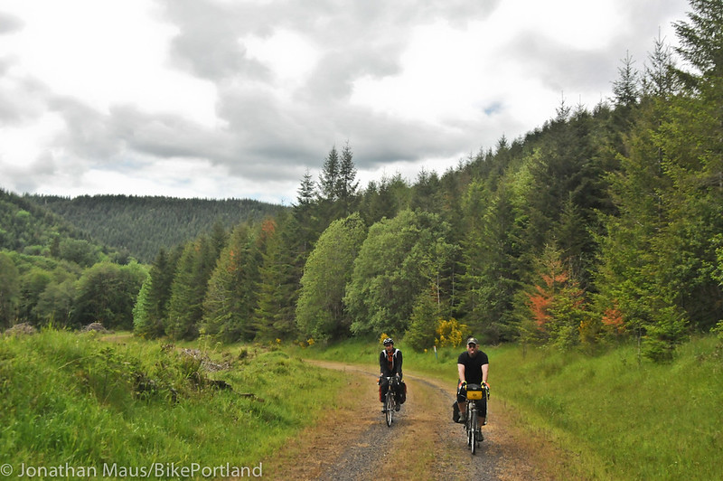
Great news for those who like to take the road less traveled: The Crown Zellerbach Trail, a former logging road that gives riders an off-highway option between Scappoose and Vernonia, has just won a $150,000 matching grant from Oregon Parks and Recreation.
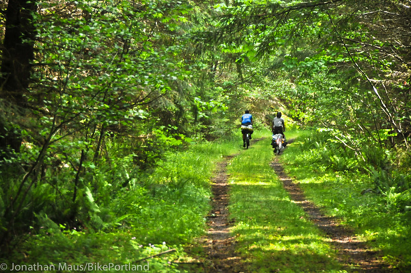
(Photo: Dale Latham)
The funding will pay for access and safety improvements along the 23-mile trail that will include kiosks, maps, signage, safer highway crossings and other amenities.
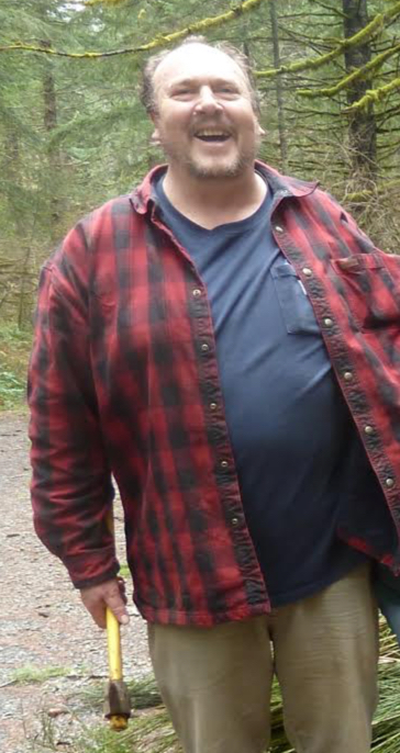
What’s amazing about this grant is that it started from a humble desire to memorialize a man who loved to hike and bike on “the CZ”. Dedicated advocate (and personal friend and supporter of mine) Wayne Naillon chose to end his life on this trail in May of 2016. Friends and partners quickly joined together to remember him by raising money to improve the CZ. That initial, relatively meager sum of $6,000 is what led to this much more substantial grant.
Here’s more from a statement released today by Columbia County:
“”Wayne loved the CZ Trail and wanted more people to know about it, so we thought that promoting use of the trail would be a good way to memorize him,” said Dale Latham, Naillon’s friend and co-manager of the Wayne Naillon Memorial Trail Fund.
Latham and family member Marcus Iverson approached the county with the idea of using the $6,000 to improve access to the trail. That’s when Casey Garrett, the county’s General Services Manager, suggested the county apply for a grant from OPRD, which they did in May 2017. By December, the initial donation of $6,000 had turned into an approved $150,000 matching grant, with promises from the county, Oregon Equestrian Trails, and cartographer Jeff Smith partnering to provide labor and pro bono personal services. Smith was a good friend of Naillon’s and is an active advocate for biking trails in Oregon.”
Advertisement
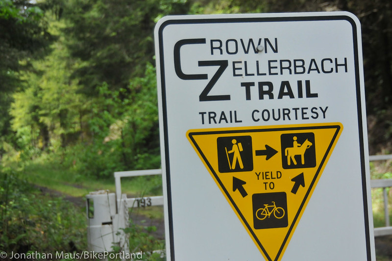
The County says many of the improvements will take place at the Chapman trailhead about 8.5 miles from Scappoose. They’ll include a covered picnic area, bicycle rack, bicycle repair station, signage, an ADA horse mount assist and an ADA-approved vault toilet.
Five other trailheads will get new kiosks with maps. There will be a new flashing crossing beacon installed at the intersection of Scappoose-Vernonia Highway and Cater Rd. Caution signs will also go up at several other intersections to help make crossings safer.
Columbia County commissioners hope these improvements will raise the profile of the CZ trail and create more urgency for progress on other trails like the Salmonberry Trail, which will eventually run from Banks (easily accessible via the Banks-Vernonia Trail) to the Oregon Coast. (One missing link that remains is the gap from where the CZ trail ends at Pittsburgh and where the Banks-Vernonia begins.)
“The CZ Trail is a jewel, and we’re thrilled to be able to make it safer and more accessible, and to spread the word about this beautiful place,” County Commissioner Margaret Magruder said in the statement. “I thank the friends of Wayne Naillon for starting us on this incredible journey.”
A better CZ Trail will also be a key piece of the already growing interest in cycling we’ve seen in Columbia County.
Work on the trail will begin this spring and is expected to last up to two years. If you haven’t ridden on it yet, I highly recommend it. Check out just a few of the adventures I’ve had on it over the years here and here.
— Jonathan Maus: (503) 706-8804, @jonathan_maus on Twitter and jonathan@bikeportland.org
Never miss a story. Sign-up for the daily BP Headlines email.
BikePortland needs your support.


Great news! (I loved cycling along this trail.) Thanks for all of those who worked on this application (and donated the initial funds too)!!
Wow, it seems like there are a ton of trails I didn’t know even existed. Is there a website that summarize them all with maps, etc…
RH, best info. I’ve found is on the Oregon Hikers website, which is a fantastic resource in its own right:
http://www.oregonhikers.org/field_guide/Crown_Zellerbach_Traverse_Hike
It’s got a lot of interesting history & description (thanks, bobcat!) but still a bit challenged in the map department. But the trail pretty much parallels the Scappoose-Vernonia Rd., with the exception of the last 4 miles or so at the west end before joining Hwy. 202 – there it plunges up into the hills southwest toward Vernonia, and is presumeably not the rail grade any more (?) because it gets pretty dang steep.
From the Scappoose end it’s very easy to find – there’s a trailhead right off Hwy 30. A really nice ride, up (and over) the crest. The 10 or so miles spanning the crest are especially enjoyable, IMO. There’s a trailhead about 6 miles east of the crest, IIRC, so it’s easy to hop on there, too.
Surfacing varies quite a bit, but I’d say it’s very rideable on 35c tires for the moderately skilled (me), and I’ll guess that a lot of cyclocross folks would find it to be just fine on 28c. On a Mt. Bike, no probs.
I agree with Jeff’s comments regarding ridability and for those interested in riding it one way, mostly downhill, starting outside of Vernonia: the trailhead is at the far end of Knott street, which abuts Hwy 47 on the north side of town. Park your car at the dead end of Knott street, walk (or ride!) your bike around the gate and up the steep, rough Jeep road about 1/4 mile, keeping right if the trail route seems unclear. Once you cross the berm, you are on the official CZ Trail and the route is obvious except for a T intersection in the first mile or so where you turn left. When we rode it last September, we only saw one person-a hunter- until we reached the summit. You should ride this now and enjoy the serenity before it really gets discovered.
Right on! I’ve ridden this a whole mess of times as a loop through Banks/Vernonia & Stub Stewart (read about the idea here!). It’s always been somewhat of a mystery, with no official website or any real info on the who/what/etc. It’s great to know the backstory and see some nice upgrades for this hidden gem.
I am working with Columbia County, as part of this grant, to update their website and provide information so bikers can find their way through the unclear part of the trail, which is only about 1/4 miles long. It goes across private land, the route is unclear, that part of the trail is very rough, and is unofficial. Until we do, it would be great if bikeportland can help get the word out.
on the trail the largest most dangerous form of transportation has the right-of-way at all times…
You strike me as a super fun guy.
Just like trains. They both built this country.
Brendt, your link did not come through. Can you resend it?
I hope CZ doesn’t get too much more attention or travel. Part of the joy is that you seldom see others.
Until you have a mechanical 10 miles out of cell phone range.
In Oregon, are many thousands of acres of commercial forest land in the Coast Range with logging roads carved into them. This one trail is just a glimpse of the huge potential for off-road biking recreation on those lands. From wikipedia about the coast range:
“The Oregon Coast Range, often called simply the Coast Range and sometimes the Pacific Coast Range, is a mountain range, in the Pacific Coast Ranges physiographic region, in the U.S. state of Oregon along the Pacific Ocean. This north-south running range extends over 200 miles (320 km) from the Columbia River in the north on the border of Oregon and Washington, south to the middle fork of the Coquille River. It is 30 to 60 miles (48 to 97 km) wide and averages around 1,500 feet (460 m) in elevation above sea level. The coast range has three main sections, a Northern, Central, and Southern. …”
https://en.wikipedia.org/wiki/Oregon_Coast_Range
from where the CZ ends, find Pebble Mountain Road to get to the BV.