(Photos: J. Maus/BikePortland)
Multnomah County opened a new connection from the west side of the river to the southern sidewalk on the new Sellwood Bridge about a month ago. I finally took a closer look at it on Friday.
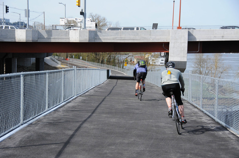
The new bridge was closed when we last checked in on this project back in December. The gates have come down and you can now enjoy a wide and smooth ramp from the Willamette Greenway path that winds up to the sidewalk and bike lane on the bridge.
Here are a few more photos…
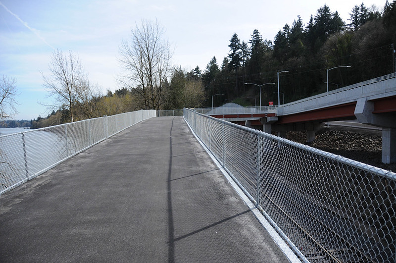
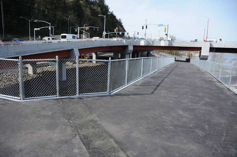
Looking east toward Sellwood from Highway 43:
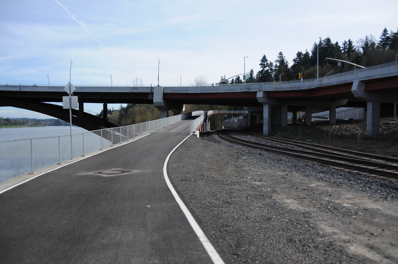
Looking south up the ramp:
Advertisement
The path feels roomy at 14-feet wide:
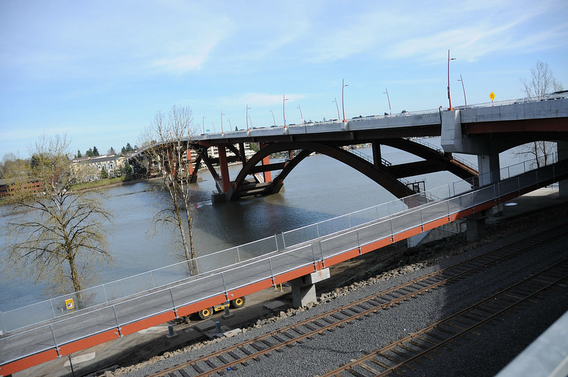
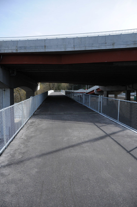
Here are three views from the new bridge path looking back north:
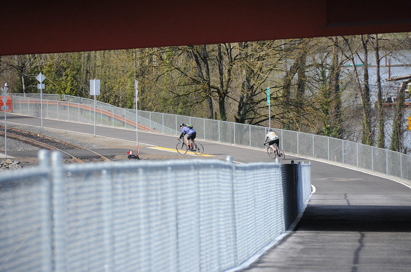
Looking northeast east as the path becomes the southern sidewalk of the bridge:

Have you ridden this yet? What do you think?
— Jonathan Maus: (503) 706-8804, @jonathan_maus on Twitter and jonathan@bikeportland.org
BikePortland is supported by the community (that means you!). Please become a subscriber or make a donation today.


excellent! I can’t wait. I live at the top of Barbur and only yesterday biked up through the cemetery to Terwilligar for the first time. Not the shortest route home, but this time of year I’m always looking for ways to make my ride longer. Plus it’s so pretty! Tho I suppose this bike ramp actually goes in the opposite direction. Oh well, it’ll be great for adding in a Sellwood/Tilikum loop when I have time
That south ramp is awesome! Much better than the tight switchbacks on the north ramp.
14′ sidewalk is wide enough to ride on if you want to take pictures, have kids or cargo, or just feel like going slow. There’s also **unofficially** 2-way bike traffic on the sidewalk but as the weather improves more people will start using the bridge so GO SLOW AND BE CHILL. This isn’t the Hawthorne & if we’re in a hurry we can use the bike lane.
This south ramp makes it so much easier to head north after coming through the cemetery! Plus, it should eliminate some of the 2-way bike traffic on the north ramp.
NIce. Way to go MC! Looks like rails and trails can co-exist, with another potential national example!!
But how do the striping / signing plans look? Has anyone checked them out…esp. given the sweeping downhill turns…so as to keep “gawking” peds safe from “Strada type” cyclists and visa versa. 😉
The exit speed heading north from the south ramp is lovely. Great to have this option vs. the Z ramp on the north side of the bridge.
I think the north side is actually more likely to have issues as the visibility at the upper switchback is marginal. But given the location of the Sellwood, it’s likely never to be as nuts with congestion as the Hawthorne or Tillikum.
All in all, my hats off to MultCo for the design. Now if only half of the west side trail wasn’t under water…
Do we know if there are any plans to extend the trail south to Lake Oswego?
That would pretty much require the existing rail line to be converted to trail. Since they still run a seasonal trolley from Lake O, I think it’s doubtful. Adding a trail to the side of the rail right of way would be tricky / impossible as .25 mile of the line goes through a tunnel.
Not sure. I think one or two on LO city council might support it. There are giant sewer / road / bridge projects that have been in construction on nearby roads like Terwilliger by the state park and Boones Ferry will have road-closing construction from 2018 through 2020. New bike lanes in Lake Grove.
A waterfront paved trail to Lake Oswego would be an reformation of the existing space. I hope it happens during my lifetime.
You must mean “43/Macadam”. And yes, taking out the sidewalk was done intentionally because they wanted people to use the new trail. The trail would be most people’s choice most of the time, but you’re right, the County made the decision that it’s the only option you ever get.
Oops–this is supposed to be a reply to Doug Klotz’s comment right below this.
Meanwhile, it looks like there are no plans ever to make it possible to walk south along OR 43. Why else would the sidewalk on that south ramp come down from the Bridge, only far enough to meet up with the ramp to the Willamette Greenway, and then abruptly stop in midair? You’d think a “sidewalk” like this, on a bridge, would at least extend down to ground level, that is, to the east shoulder of Hwy 43.
That, and the removal of existing sidewalks on 43/Mcloughlin north of the bridge seems to indicate that the County had decided that, with the Greenway path there, they don’t need to provide any other facilitation for non-MV movement in the vicinity. “We know where you want to go”.
It’s sort of like ODOT mandating that bike lanes be removed from SE 26th near Powell, if they were to approve the 28th crossing. “We’re providing this facility, so we’re going to make it difficult to use any other route”
https://goo.gl/maps/D1drnVruf7w
Its quite nice! I took this home one day as I live in Sellwood and it does feel very wide. When going up it can feel like it takes a while to get to the top, probably because they didn’t want to make it too steep.
How can you get to the Springwater trail from the south side of the bridge? I’ve been taking the north side because it seems better, maybe I’ll try the south next time.
As you get to the traffic signal on the east end of the bridge, make a right (onto 6th), then another right onto Umatilla, and then a right onto the Springwater.
That’s what I thought, thanks.
This is a very nice facility. I do wonder if we’ll ever get a sidewalk on 43 south of the Sellwood bridge. The ramp to the south has a sidewalk that serves Greenway path users, but stops in midair, and doesnt continue south to ground level, so you wouldnt even be able to get down to the hwy 43 shoulder. I would have thought at least they’d get folks down to grade on this 100-year facility, to allow for an upgrade in the (far?) future. Likewise about the sidewalk
To the north along 43/Macadam, where existing sidewalk was removed(!) But, yes, for the path of travel that was chosen, the facilities are very good.
West Linn wants it. Maybe more frequent car gridlock will convince LO. http://westlinnoregon.gov/planning/highway-43-conceptual-design-plan
That West Linn project just got funded through Regional Flexible Funds Allocation.
The could fund it with a local improvement district. They definitely have the money…
It’s also a much better walking experience than the north side, with it’s looong switchback, tight turns and then a long walk fully exposed to highway traffic while surrounded by acres of concrete.
I think the westside of the Sellwood bridge area still looks like a bigger freeway than before the project got started.
Yes, it’s ridiculous, and I think with time it’s going to be seen as a hugely unfortunate. There used to be a pretty smooth transition in character along 43 from the in-City SW Macadam portion north of the bridge, to the wooded, more scenic stretch from the bridge to LO. Now, it’s a jarring concrete wasteland, and the way its designed, without much in the way of trees or other plantings, it won’t soften with time.
Because there were no groups with huge personal stakes in the west end design, and because the bridge’s neighboring residents, businesses and user groups were concentrating on defending their own interests during the design process (and therefore had little time or energy left to look at aspects of the design that didn’t immediately impact them) I think the west end at the bridge suffered from lack of public oversight.
So it was left to traffic and civil engineers to design based on their limited interests–vehicle flow and structure–and it looks like it. And a lot of that was due to a desire by the project and ODOT to maintain certain vehicle speeds through there. If the speed limit could have been reduced, ramp radii and sightline distances could have been reduced, etc. meaning the roadway could have been shrunk, meaning less intrusion into the hillside, meaning lower retaining walls…
And they probably could have value-engineered about $100 million out of the project by simplifying the west end interchange and forcing the Clackamas county commuters to deal with a few more closures during construction.
Yes. As another example, the project’s ideas for the trail section north from the bridge to Willamette Park were substantially more expensive than what was built. The reason the expensive options didn’t get built was that the public opposed them. And the expensive ones would have been nowhere near as good as what was built.
And another: Late in the design, the project’s consultants and County management proposed several “value engineering” changes to reduce costs. Fortunately, the County commissioners rejected them, noting a) the late changes were contrary to what citizen reviewers had already been promised, b) the changes were compromises in design and function, and most importantly, c) the costs of delaying construction while the plans and permits were revised to include the “cost-saving ideas” would eat up the entire projected cost savings (!). Luckily the commissioners caught that one.
My recollection is that the US DOT demanded that the the Westside interchange be built to its present scale and capacity in exchange for the Federal contribution to the new bridge. I also recall that the Westside interchange accounted for half the cost of the project.
If that’s true, then the project could have been better off skipping the federal money.
It sounds like something the County might say whether it was true or not, to deflect criticism away from itself and ODOT.
I really enjoyed the challenge of the old dirt “path” underneath the bridge to get to the cemetery. And the old switch back system to head east from the North was good practice too. I suppose all this new infrastructure is a new challenge as well in terms of getting used to it along with all the funky signals upon the bridge deck heading west.
Ah. Heavenly. Just awesome 🙂
But is the Willamette Greenway still flooded at SW Pendleton St, between South Waterfront and the Sellwood Bridge?
Not to belabor a point that I have made in the past, but . . . the Sellwood Bridge’s cycling infrastructure is pretty massively overbuilt. The Sellwood Bridge may be wonderful for people commuting for free by SOV from Clackamas to OHSU, but it is also of very limited utility for cyclists. Put simply, the West side leads either to 1) a long, steep climb (which is great for recreational riding and useful for the small number of people who commute to Lewis and Clark, but which simply does not see a great deal of cycling traffic) or, 2) an inferior MUP heading toward downtown. People quickly discern this fact and, as a result, there exists a vast disparity between the very large number of cyclists who ride from Sellwood toward downtown on the Springwater and the comparatively tiny number of people who cross the bridge to take the windy ands slow Westside MUP or to ride West through the cemetery.
The Westside interchange only needed a single connection to the Westside MUP, and I lament that the funds to pay for the elaborate south side connection weren’t fungible and thus could not have been repurposed to provide better north-south connections east of 205, a non-motorized bridge over I-84 at NE 7th Ave., or–my desire–a HAWK signal/set of right-turn-only signs for cars at NE Fremont and NE Alameda.
I agree–the project never acknowledged the advantages the eastside trail has for getting downtown.
I AM glad for the new south connection, but mainly because I don’t like the design of the north one–long climb, fairly tight turns, and a long stretch along the highway. The old connection for all its problems brought you right up to the bridge in a short distance, without having to walk or ride along the highway once you were near the bridge.
For my own needs (may not be true for others) I wouldn’t have minded the project skipping the south connection if the north connection had been better.