
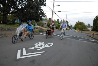
Portland’s premier neighborhood greenway is about to get a makeover.
Next week, the Portland Bureau of Transportation will implement a “fog seal” treatment on N Going Street from Vancouver to Cesar Chavez Blvd. The work will begin on September 8th and will last for five days. In order to minimize disruptions to what PBOT refers to as “one of the most popular bike routes in the city,” city maintenance crews will work on three to four block sections at a time.
During the project, the section being worked on will be closed to all uses for the entire day in order to give the sealant material time to dry. It’s also extremely important that you don’t walk or ride on the sealant while it’s wet. You will muck up your bike and shoes and you will damage the sealing process.
Some people might choose to ride up on the sidewalk; but if you’d rather not mix among walkers, joggers, and residential driveways, PBOT will have a signed detour in place (see map above).
(Photo by J. Maus/BikePortland)
As for what exactly PBOT is doing to the street, it’s not exactly a repaving project. Unlike a full “grind and pave” where the existing surface is taken up and a layer of brand new pavement is put down in its place, a fog seal is a coating that’s applied to the existing pavement similar to sealing a wooden deck. The sealant is a mix of asphalt, recycled tire rubber and grit. It doesn’t last as long as a full repave, but it’s much cheaper.
According to the city’s own estimates, one lane mile of fog seal costs $8,500 versus $150-200,000 per lane mile for a grind and pave (full reconstruction can cost over $1 million per lane mile).
Since Mayor Hales made it his campaign promise to “get back to basics” and speed up road maintenance, PBOT has been fog sealing roads at a much higher rate than ever before. In a statement about the project on Going, PBOT said this “Back to Basics” initiative prioritizes maintenance on neighborhood greenways.


Oh man, if this is the same stuff they recently put down on Skidmore in the same general area, it is deadly when it’s icy out. Last winter I came very, very close to biffing it when I turned from my street (Grand) onto the newly treated Skidmore. It was like the street just turned to oiled glass. I saw 2-3 other cyclists who were not so lucky and just went sprawling across the street.
To be clear, this was not an ice-storm day, just one of those frigid days when there are spots of black ice and frost on the street.
They recently fog sealed Bryant St between Greeley and Interstate. Completely ignoring the junk show of pavement between Greeley and Willamette. Was concerned about the texture different when it gets wet, good too hear it’s not entirely just in my head.
Does fogsealing Going St count as repaving, according the 4 part prioritization below? The flasher sign that has been up for a while says the project encompasses 39th to Vancouver. Some of the worst potholes are between 40th and 42nd.
http://bikeportland.org/2013/05/28/help-is-on-the-way-maintenance-and-paving-coming-to-neighborhood-greenways-87372
Priority 1: Local Street on a Neighborhood Greenway* and within 1/4 Mile of a Public School
Priority 2: Local Street on a Neighborhood Greenway, more than 1/4 Mile from a Public School
Priority 3: Local Street Not on a Neighborhood Greenway, within 1/4 Mile of a Public School
Priority 4: Local street Not on a Neighborhood Greenway and more than 1/4 mile from a public school
I’m not sure if they officially count fog sealing as repaving miles, but when I recently put in a request to have the notoriously bad section of NE 37th Avenue between NE Bryce Street and NE Shaver Street redone (see Street View here: http://bit.ly/1nyzur4) since lately they seem interested in redoing the pavement along many major roads rather than doing specific projects that would help only active transportation users, I felt like this would be a semi-easy request since that segment of local roadway is “Priority 1” as it is within a 1/4 mile of a public school AND is a neighborhood greenway. Not the case, as they said funding wasn’t available for fixing neighborhood greenways, and won’t be until future funding streams were available, at which point they tried to sell me on supporting the street fee in order to get my request through the system. See the full text regarding this statement below:
“At present, PBOT lacks the funding needed to initiate the requested repairs along NE 37th, much like we lack adequate funding to initiate or complete street repairs or improvements at other equally deserving locations and neighborhoods throughout the city. That being said PBOT continues to investigate all funding options and alternatives. For example, if the OurStreets* funding initiative currently under consideration passes, funds would be allocated toward improving our Neighborhood Greenways. This would, in turn, allow PBOT staff to add your request to an expanding list of suggested public right-of-way improvements. In the meantime, and with our apologies, no unfunded (re)paving improvements are possible at this time.”
Heck yes they do! That’s the whole point. And that’s why I’ve heard from some critics who are skeptical that the fog-seal treatment is a good investment because it doesn’t last nearly as long as a full grind and pave… But PBOT/Mayor Hales is doing a lot of it simply because it’s cheaper and it allows them to tout their “100 miles of street maintenance and paving” promise which was central to the mayor’s election campaign.
Yeah, I was under the impression that this was the case, but didn’t want to falsely claim such without knowing for sure. Thanks for the clarification, as unfortunate as it is more about politics than the actual significant improvements promised during Hales’ campaign.
Fog seal is WAY cheaper than grind and pave. If you have unlimited money, you can do it all. 🙂
To be fair, with some prodding they mentioned that they will send a team out to that section of 37th Avenue to see if they can do any spot fixes to reduce the number of potholes. Not a full reconstruction of the roadway surface, but if they do attempt any fixes it’ll likely be much better than it is today.
Therefore, I’d suggest reporting the potholes that you know about along Going Street, rather than waiting for the city to obtain the funds to fix the entire roadway surface – as that could be a year away at the earliest.
I’d say a little more than “some prodding” was required. “Hounding” might be a better description. Which is sad–PBOT has avenues open for citizens to show where fixes are needed, then do their best to brush the suggestions aside if it doesn’t fit what they’ve already identified as priorities.
And yet earlier this year they ground and repaved SE 26th from Division to Harrison, and SE Harrison from 26th to Ladd’s Circle; compared to some of these other locations, SE 26th and Harrison were in what I would have considered good to excellent condition prior to the repaving.
I hope PBOT will take this opportunity to fix the convoluted west end of this popular greenway! At 6th, the greenway should jog south to Skidmore, and continue on Skidmore to Concord. This is MUCH more straightforward and easy to follow, and all of the crossing infrastructure is in place. This just needs a tiny bit of traffic control, maybe lose a couple of parking spaces…
Seriously, this route will eventually connect to the NP Greeenway at the bottom of Going Street, this west end is important to create a practical, easy to use piece of the transportation system.
maybe lose a couple of parking spaces…
DOA.
War on cars!!
Skidmore west of MLK is a Neighborhood Collector and Major Response Route.
A connection for the west end of Going at Vancouver with a contra-flow bike path to Blandena has been floating around for a few years. That path would get you to Michigan where the bike lanes start on Skidmore west of Michigan.
The on-street parking is very underutilized on Skidmore between MLK and Mississippi. I think large, buffered bike lanes would be great here. A clear, easy to follow bike route between Lining the NP Greenway, Concord and Michigan Greenways, and the Vncouver/Williams couplet is already needed (and the NP Greenway is a ways off!) and will will be increasingly more valuable as the Williams and INterstate corridors densify. I would love to see PBOT be more proactive adn secure this route while it is relatively easy.
The proposed route using so signals to cross MLK or Williams, and contra-flow lanes will never be as good, easy to follow or as safe as some well-designed infrastructure on Skidmore would be.
We had a great time talking with biking and walking on Going yesterday talking about the project.
A big favor: PLEASE DON’T BIKE THROUGH A CONED OFF AREA. It’s really bad for your bike and for the street. Thanks.
Oops, I meant to write: “We had a great time talking *with people* biking and walking on Going yesterday about the project.”
I bet if the City had better construction mitigation for bikes in general (e.g. providing reasonably clear, safe, and sensible bike detours, like the City generally does for driving) then people biking would be more likely to abide by construction signage and indications. As it is, if people on bikes follow (car-centric) construction signage and detours, we are often routed onto streets that most people don’t feel safe or comfortable biking on (e.g. Powell). This trains bikers to ignore construction signage and cones and “DIY” a route through, even in situations like the one you note, where that “DIY” behavior is not necessary, appropriate, or helpful.
A better solution would be to treat bikes differently than cars in most construction areas and provide bike-specific detours and signage. This would probably make everyone’s life easier for a pretty low cost. We’d probably need more orange signs, cones, etc., and a relatively few more hours of planning and sign-moving per project. I’d hope more bikers would heed orange cones if the City did a better job of having them often be relevant and helpful for bikers!
use the sidewalk, it’s legal on the east side
🙂
I wonder how this will effect auto volumes. I think a big reason cars stay away is the surface quality. Also, I second the blocks from 40-42nd as being the worst (aside from maybe 16-17th). I wonder how the fog seal will do on that old concrete.
This is better than nothing, and if we can get more car traffic off the street, it will last even longer.
This is also an opportunity to discuss the design and use of Neighborhood Greenways – making them safer and making our investment go further. I believe these bikeways are the perfect place to advocate for CAR FREE active transpo thoroughfares (local access only at major crossings, like 15th and 33rd, or bus routes like 30th). They’re already traffic calmed, they’re already highly utilized… what if we eliminated the deadly cross traffic and established parking permits (grandfathered in) for residents on the street?
A separated network that actually makes our city accessible for 8-80, reduces collisions and injury for all road users, requires minimal cost for conversion, and saves money on maintenance by reducing surface damage (oh, and increased property value for people along the street – an added bonus for residents).
Sunday Parkways everyday via Neighborhood & Commercial Parkways – it could completely change biking in our city…
It will look nice, but I think it will not really do much to improve the surface quality for people in autos and will likely only be a marginal improvement for people on bikes. It is basically a thin veneer and will probably only mask some of the harsher transition points created by the difference surfaces on that street.
Does anyone know where the first fog seal projects were done last year? How do they look today, which would be about 1 year later?
They did Klickitat in NE last year, and it still looks pretty good today. I’m interested to see what this does to the portions of Going that are bumpy concrete. From my observations on Klickitat, this treatment doesn’t do much to even out the bumps.
they just did N Flint both N and S of the I-5 crossing, if you want to see what this stuff looks like when it’s relatively fresh.
Has anyone commented about how ridiculous their Wygant detour is? That is the silliest thing I’ve seen all day.
Hey, not everyone has brand new gravel-specific racing bikes yet. I mean, ya, a few people can ride on those unpaved streets, but for everyone else, that’s crazy!
I don’t care for the fog seal at all. It seems to hide the bumps and dips in the road surface more so than just bare pavement. The city coated my route to work last year and into this year. I’d prefer that they didn’t put this stuff down on the bike routes.
Hey PBOT, can you please, please, please this time around make a sharrow-shaped mask to put down before you do your thing? Last time around, on Taylor (and probably a bunch of other streets) this handy little trick was omitted. Talk about a waste of resources.
http://bikeportland.org/2013/09/06/fog-seal-treatment-has-covered-up-about-100-sharrows-but-theyll-return-93544
No mask, please. I’d rather have the whole roadway freshly fog sealed with new sharrows painted on, than a patchwork of fresh fog seal and faded old sharrows on old pavement.
At $250 a piece to repaint them? I thought PBOT was out of money.
There were 100 sharrows that got fog sealed in SE last Fall. That’s $25,000 flushed down the toilet. I’m pretty sure you’d be able to handle the results of a piece of plywood-shaped-like-a-sharrow if it translated into that kind of savings. If we keep at it, perhaps we don’t need a Street Fee after all?
Thermoplastic sharrows are $250. I think the replacements on fog seal are something else, but still $50-$100 each.
If I correctly remember my conversation with city spokeswoman Diane Dulken a few months ago, the replacements are also due to be thermoplastic.
So I take it that means no mask? I’d be curious for an explanation from PBOT.
What’s up with the crazy zig-zaggy “recommended” detour along Wygant between 26th and 33rd? It literally adds 5 1/2 blocks distance and 12 turns to one’s route. Crazy.
It would be better to just go two blocks to the south and use Skidmore instead for that stretch. Or the more brave can just take the lane on Prescott only one block to the south.
Skidmore used to be my “bike boulevard” in that hood when I lived there before there was a bike boulevard on Going. But after a while, the stop signs every other block got to me and I started taking the lane on Prescott (it’s pretty narrow eastbound in that stretch). Prescott was an awesome thoroughfare with only traffic control at 7th and 15th for the whole distance between MLK and 33rd – and it’s not rough, broken concrete like Going.
I agree, Skidmore is much saner than that proposed Wygant zigzag. From my experience, Skidmore is also much safer than the existing Going route west of 6th: there are good signals at MLK, Williams and Vancouver, a 4-way stop at Mississippi, and good infrastructure from Michigan to Interstate. I recommend trying Skidmore during the repave, and if you like it, lobby PBOT for more permanent bike facilities here.
Vancouver re-paved several streets around my neighborhood this summer. The main drag was ground and paved with hot, rolled asphalt. The side streets had badly alligatored and pot-holed sections removed and hot patched, then the whole roadway was chip-sealed, and finally fog-seal emulsion was sprayed over the chip-seal. The fresh asphalt gives the smoothest ride, obviously, but the sealed side-streets are *way* better than plain chip-seal and also much better than where the old surface was breaking up or previously patched, which was more or less everywhere. This winter I’ll see how it does on sub-zero-C mornings, as fredlf mentioned, and time will tell how it holds up, but for now I’ll give the city the benefit of the doubt as far as cost/benefit goes and just be happy to have local streets in good repair.
One effect I’ve noticed is that cars are quieter on the new surface so they get closer before I know they’re there.
PBOT’s _Bicycle Plan for 2030_ states:
“When construction activities in the roadway affect bikeways, safe and convenient detour routes through or around the construction zone should be established.”
p. 87 http://www.portlandoregon.gov/transportation/44597?a=379134
Looking at the NE Bike/Walk map, it appears that NE Skidmore is an optimal detour route for the Going St. reconstruction. It’s a designated bikeway from Garfield (NE 3rd) all the way to 42nd, with a well-signed jog at 29th down to Mason to cross 33rd. & it’s a fine bike route, if unmarked, from Garfield over to Vancouver.
http://www.portlandoregon.gov/transportation/article/322254
While I understand that Wygant offers access to Going and Alberta destinations without needing to cross Prescott, I think many bicyclists would prefer a simple, well marked detour on Skidmore all the way from Vancouver to Cesar Chavez.
I biked the Skidmore corridor last night, I’d forgotten how nice of a route it was. I used to take it before Going was improved. Skidmore has a nice feel — better views, more variable grades, a narrower street, slightly fancier houses. And it crosses MLK and 33rd at traffic signals.
I recommend it.
Ted Buehler