

(Photo by J. Maus/BikePortland)
Reacting (in part) to the desires of more than 2,200 survey respondents, the Oregon Department of Transportation (ODOT) is poised to implement several projects in the Mt. Hood area that will improve bicycling access.
As we reported back in August, wider shoulders on Highway 26 and Highway 35 were among a list of projects being considered as part of ODOT’s Mt. Hood Multimodal Transportation Plan. Last month, that plan’s Project Leadership Group (made up of ODOT, County, and federal “decision makers”) released their project recommendations (PDF). On that list are several projects in “Group A” that will impact bicycle access.
Here they are:
- Mt. Hood Highway bike/pedestrian intersection improvements ‐‐ depending on where transit stops are located for enhanced transit service on US 26 and OR 35, there may be a lack of pedestrian or bike crossing facilities at those locations. This project would, in coordination with the community and the Oregon Department of Transportation, design safe and convenient pedestrian and bicycle crossings across US 26. The project would encourage the development of enhanced pedestrian traffic control (example could be crosswalks or signals) to facilitate movement across US 26 (Rhododendron has been identified as one likely place for an enhanced crossing).
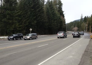
- Mt. Hood Highway shoulder widening for bicyclist use ‐‐ There are many stretches of US 26 and OR 35 where shoulders are very narrow or nonexistent. Bicyclists rely on shoulders for travel through this area. This project would create a plan prioritizing shoulder widening locations in along US 26 and OR 35 . Shoulder widening would be targeted to areas based on need and cost.
- Bike/pedestrian info along Mt. Hood Highway with maps to mountain biking, alternate routes to US 26/OR 35, hiking trails, etc. Wayfinding would be a key element. (This project is slated for completion in the “mid-term” or 3-7 years.)
- Bike intersection improvements at OR 35 and OR 282 intersection ‐‐ The bike shoulders on southbound OR 35 end through this intersection, so bicyclists have to merge into high‐speed traffic at this location. In addition, bike lanes are not striped on OR 282 as it nears OR 35, so bicyclists have to enter the lane at the intersection. This project would stipe a bike lane on OR 282 approaching OR 35 and would look for ways to widen available space on OR 35 to allow for a bike lane on OR 35 south to the west of the dedicated right‐turn lane.
- Bike intersection improvements at OR 35 and Historic Columbia River Highway (HCRH) (E. State St.) in Hood River ‐‐ This intersection lacks striping for bicyclists headed east on HCRH to OR 35 north (or across the highway to the HCRH multi‐use path). The project would add bike lane striping (green striping potentially) for bicyclists headed east from the bike lane on HCRH to the OR 35 crossing.
There are other bicycle-related projects on the list, but the ones above are in “Project Group A” which have first priority for implementation and are expected to completed in 0 – 5 years.
If you’d like to learn more and/or weigh in on these projects, the Project Leadership Group is set to meet in Portland on Thursday, December 19th from 3:00 to 4:30 pm at ODOT Region 1 headquarters (123 NW Flanders, Conference Room A/B). The public is welcome.
— Read more about the Mt. Hood Multimodal Transportation Plan in our archives.