

series of stencils on the pavement to help
riders find their way onto and over
the I-5 bridge.
(Photo: Beck)
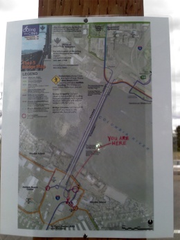
A laminated map and stencil markings have mysteriously appeared on the shared-use paths leading up to the I-5 bridge. We haven’t figured out who’s behind them, but several people say the signs are a big help.
To ride a bike over the I-5 bridge from Portland to Vancouver is an exercise in frustration. Before even getting on the deck of the bridge (which is narrow and a bit frightening to many riders), people on bikes are forced through a series of awkward crossings and sidewalk riding. And that’s only if you can figure out where you’re supposed to ride to begin with.
The City of Vancouver has tried to improve signage (but was shot down by ODOT) and Metro’s solution was to put out a how-to video.
Now, someone has taken the matter into their own hands…
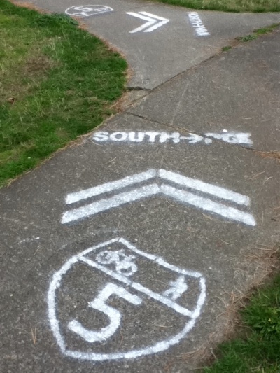
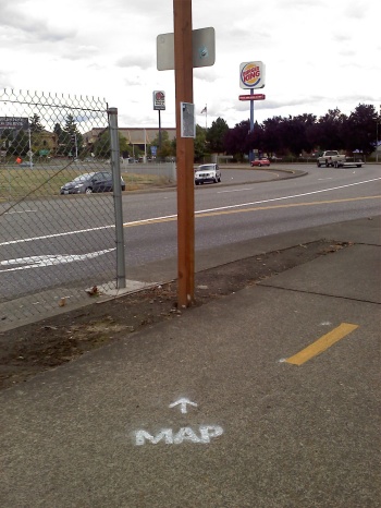
A reader named Beck sent in photos of the signage a few weeks ago. He says there are two laminated maps (both near the bridge on the Oregon side) along with “probably six to eight stencils indicating routes on Jantzen Beach and on the Vancouver side leading to the bridge.”
Vancouver resident (and former City of Vancouver Transportation Planning employee) Todd Boulanger says, “They are the 3rd generation of this grass roots effort – and much more refined than before.”
I’m glad someone stepped up and did this, yet it’s too bad that an official and more permanent solution has not yet come to pass.
So… the question remains: Whodunnit?